The landscapes of Syria
Coastal mountains, the pines above Kessab, the Ghouta orchards, the Badia steppe and snow on Hermon. What is where, in which month, and what walking is really like.
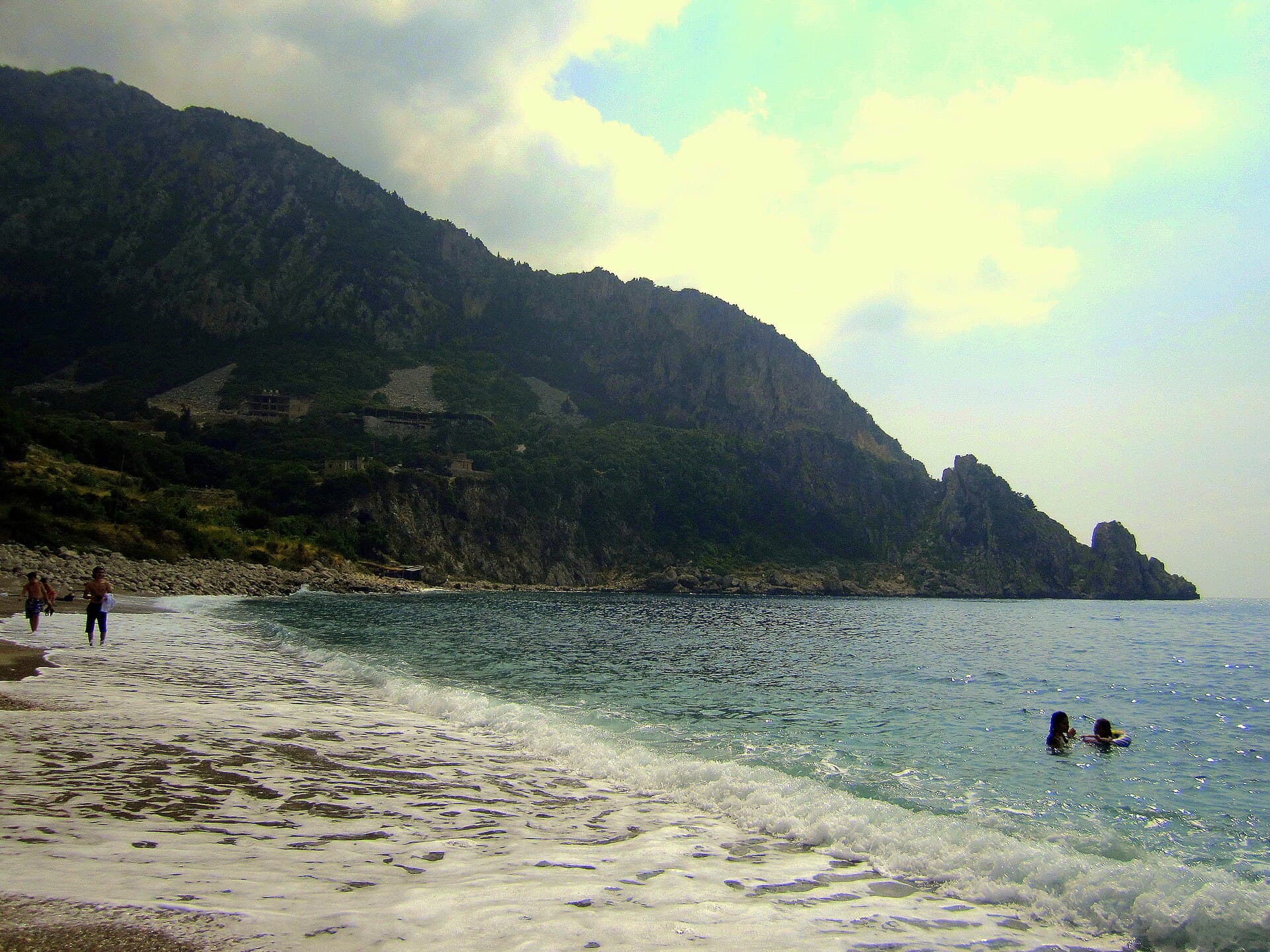
For most travellers Syria means desert and stone cities. Both are true and neither leads the list. The same country has pine forest, a ridge that holds snow, waterwheels on a river and a plain that flowers in spring. This page puts the landscape in order: what you see in which region, in which month, on which road.
Four climates in one country
The rainfall map cuts the country in two. In the mountains above Latakia annual rainfall passes 1500 millimetres; out in the Badia it stays under 200. The distance between the two is less than two hundred kilometres as the crow flies.
The result is that green thins out fast as you go east. Bay and olive on the coast, pine and oak in the mountains, wheat and cotton on the inland plain, steppe beyond. A single day’s drive can cross the whole gradient, and that gradient is the real story of the landscape.
The Coastal Mountains and the Ghab
The range that runs parallel to the sea is the Coastal Mountain Range, older name Jabal al-Ansariyah. It averages about thirty kilometres across; the high point is Nabi Yunis east of Latakia, at 1562 metres. The western slope catches the moisture coming off the sea, which makes it far greener and far more populated than the eastern one.
Along the eastern foot lies the Ghab plain: a trench 64 kilometres long with the Orontes running north through it. South of Masyaf the range breaks and the Homs Gap opens. Krak des Chevaliers sits on the ridge that watches exactly that gap, which is not a coincidence.
Kessab and the northern forest
The densest forest is in the north-western corner. Kessab lies 59 kilometres north of Latakia, seven kilometres inland from the sea, at between six hundred fifty and eight hundred fifty metres, ringed by Turkish pine, juniper and oak. People come up here from the interior in summer, for the temperature as much as the view.
The forest is Mediterranean in character: Turkish pine, Cilician fir, cedar of Lebanon, cypress and kermes oak. The country holds over three thousand plant species, and about three hundred of them grow only in Syria and Lebanon. The forest cover itself is small, a few per cent of the land at most.
That cover is under pressure. Roughly 19 per cent of it has been lost since 2011, and in the summer of 2025 a large fire ran through the Latakia countryside, with firefighting held up in places by unexploded ordnance. The fire reached the edge of the Frunloq reserve on 9 July 2025; in August 2025 the reserve’s management said the damage stayed in the southern part and that the core zone and the picnic area were intact. If you plan to walk in the woods, check the local warning first.
The Mediterranean coast
The coastline runs about two hundred kilometres. At Ras al-Basit the sand is black, from the ophiolite rock behind it rather than from any pollution. South of Jableh the shore flattens out, at Tartus it runs along the corniche, and Arwad Island sits offshore.
The swimming season is June to October. Winter on the coast is wet and windy, with most of the rain falling between December and February. For walking near the sea the best months are April to June and September to November.
The Ghouta, the Orontes and the Euphrates
The gardens around Damascus are the Ghouta, an oasis made by the Barada and its branches east of Mount Qasioun: apricot, walnut, mulberry and vegetable plots. Historically it reached ten kilometres beyond the old city. It has shrunk since, to roads, housing and industry. Even so, a morning drive out of Damascus towards the Ghouta still finds orchards.
The Orontes runs north from Homs, turns the waterwheels at Hama and enters the Ghab. The Euphrates comes in from the north and forms Lake Assad behind the Tabqa Dam: a body of water 80 kilometres long and about eight kilometres wide. Qalaat Jaabar stands on an island in that lake, and the view alone earns the drive.
The Badia is steppe, not sand
More than half the country is Badia. The word is usually translated as desert, but what you see is not sand: stony, gravelly flats cut by dry watercourses, with seasonal salt pans between them. After the spring rain the surface greens for a few weeks, then turns yellow again.
The vegetation is low and hard-wearing: wormwood, camel thorn, salt-tolerant shrubs. The road to Palmyra runs straight through this landscape and most drivers do not stop, although the light here is at its best at sunrise and sunset. Qasr al-Hayr al-Sharqi and Halabiye belong to the same frame.
Hermon and snow
The highest point in the country is in the south-west: Mount Hermon, 2814 metres. Its summit carries snow for most of the year and the meltwater feeds the springs at its base. On a clear day you can see it looking south from Damascus.
Snow is not confined to it. The high ridges of the Coastal Mountains and the country around Zabadani and Qalamoun hold snow in winter, and the apple orchards of Zabadani turn white in January. Winter visitors tend not to allow for this and can meet a closed road.
Walking and protected areas
The honest answer is that there is no network of marked trails. Walking is done on village roads, forest tracks and shepherds’ paths, and the map and the guide are usually found locally. There is a particular reason not to leave the path here: unexploded ordnance remains a problem in some districts.
As for protected areas, two are documented. Talila, 27 kilometres south-east of Palmyra, was declared on 22 July 1991 as the first nature reserve in the country; it covers 22 thousand hectares and includes a fenced enclosure for gazelle. Sabkhat al-Jabbul, 40 kilometres south-east of Aleppo, is the country’s Ramsar-listed wetland: a salt lake, salt works and a refuge for migratory birds. For both, ask locally about the state of access; the gate and the road are not always open.
Tips
- Rainfall falls from 1500 millimetres in the west to under 200 in the east; green goes with it
- The Badia is stony steppe, not sand; the light is best at sunrise and sunset
- Check the local warning before walking in forest — unexploded ordnance persists in places
- There is no network of marked trails; paths and guides are found locally
- Talila and Sabkhat al-Jabbul are the documented reserves; ask locally about access
Transparency
- How this was chosen
- This page carries the fastest-ageing information on the site: visa rules, exchange rates, border crossings and SIM prices change several times a year. The verification date above says when the facts were last put through their sources; for anything later, check your own foreign ministry travel advice and a Syrian consulate. No figure that is not known for certain is written here.
- Facts checked
- September 2026
- Last updated
- September 15, 2026