The tells of Syria: cities under the soil
A mudbrick city falls and is rebuilt on itself, and the mound rises. What was found at each tell, which can be visited, what to look for and what not to expect.
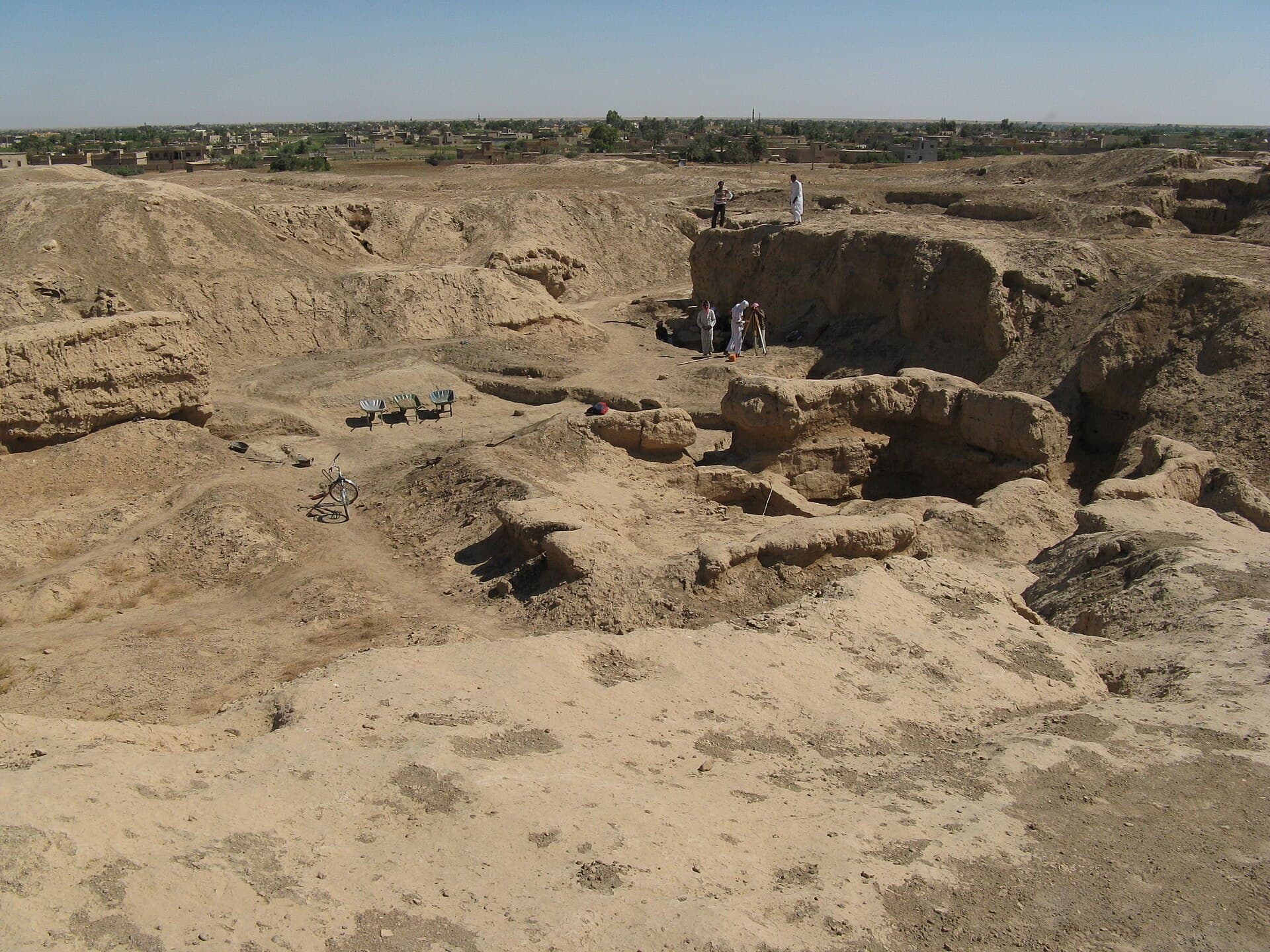
A tell is not a hill but the sum of cities stacked on one another. When a mudbrick building reaches the end of its life it is knocked down and levelled, and the next one goes up on top. Do that for a few thousand years and an artificial hill stands in a flat plain. Syria is full of them, because farming started early here and people sat at the same water source for hundreds of generations. Looking for standing walls on a tell is the wrong expectation: what you get is a section, a plan and earth.
How to read one
Three things. First the section. On the cut face opened by excavation the layers show one above the other, and sometimes an event can be read directly: the section at Tell Leilan carries a band of soil with no trace of settlement in it. Second the shape. Tell Beydar looks like a target from the air, because it is the type archaeologists call Kranzhügel: a walled circular mound inside a walled circular lower town, the inner wall 300 metres across and the outer one 600. Third the height: the plan does not appear until you climb, and at Tell Arbid the mound rises thirty metres above the plain.
What was found where
What made Ebla famous is not its architecture but an archive a palace preserved while burning: thousands of cuneiform tablets from the 3rd millennium BC. Mari is an archive too — some 25,000 tablets came out of Tell Hariri, and much of the political map of the 2nd millennium BC is known from them. The tablets found at Ugarit in 1929 carried a writing system of about thirty signs; one of the earliest known examples of an alphabet came off that mound. Tell Brak is one of the places where urban life began, and it did so independently of Uruk in the south. Tell Mozan is Urkesh, the holy city of the Hurrians, while Tell Halaf both gave its name to an entire prehistoric culture and holds the Aramaean city of Guzana.
Western and central Syria
There are tells outside the Jazira as well. Qatna lies 18 kilometres north-east of Homs and covered 110 hectares in the Middle Bronze Age; a royal tomb never opened until modern times was found under its palace. Tell Nebi Mend is south-west of Homs on the Orontes: this is Kadesh, where Egypt and the Hittites met in the 13th century BC, and that meeting ended in the first written peace treaty known. Ugarit is on the coast, 11 kilometres north of Latakia; the foundations of the royal palace are standing and the plan can be read on the ground.
What not to expect
Two things. First the finds: most of the tablets and sculpture are in museums rather than on the mound. The museums of Aleppo, Idlib, Deir ez-Zor and Damascus carry material from these tells, and the sculpture from Tell Halaf was shattered in a fire in Berlin and then rebuilt from the fragments. Second the site itself: some tells have a modern village sitting on top. The village of Ashara stands on Terqa, and there is a village on the summit of Tell Leilan. There is no enclosed site to walk in those places, and you look at the section from the riverbank or the roadside.
Practicalities
Most tells have no signage and no public transport; a car with a driver is in practice the only way, and the driver has to know the place. There is no shade either: a summer noon is not spent on these mounds, and morning or late afternoon is what works. Where there is a dig house, ask whether the site is open before you go. One tell does not fill a day; in the Jazira three or four can be strung together, because the distances between them are short.
Tips
- Do not look for standing walls; the section, the plan and the height are the point
- Climb the mound — the plan appears from above, not from below
- The finds are in museums; put Aleppo, Idlib, Deir ez-Zor and Damascus on the route
- The driver has to know the place; most tells have no sign
- There is no shade; choose morning or late afternoon over a summer noon
Transparency
- How this was chosen
- This page carries the fastest-ageing information on the site: visa rules, exchange rates, border crossings and SIM prices change several times a year. The verification date above says when the facts were last put through their sources; for anything later, check your own foreign ministry travel advice and a Syrian consulate. No figure that is not known for certain is written here.
- Facts checked
- September 2026
- Last updated
- September 15, 2026