The Balikh River, Syria
The Balikh, the Euphrates’ second-largest tributary in Syria, runs from the Ain al-Arous spring to Raqqa: its tributaries, mounds, excavations and where to see it.
- Opening hours
- Open ground, no time restrictions
- Entry
- Free
- Duration
- 60 minutes
- Best time
- Spring; the valley is green and the mounds stand out from the fields
- Period
- Natural; settlement along its banks from the Late Neolithic to the Abbasid period
- Address
- Between Ain al-Arous (near Tell Abyad) and Raqqa; joins the Euphrates at Raqqa
The Balikh is the second-largest tributary of the Euphrates in Syria. It rises at the Ain al-Arous spring near Tell Abyad, just south of the Turkish border, flows south across the flat steppe and joins the Euphrates at Raqqa. The valley is narrow but dense: along both banks lie mounds going back to the 6th millennium BC, and at its mouth stand the Bronze Age city of Tuttul and Abbasid al-Rafiqa. This page ties together the river, its source and the sites along it.
Where it rises and where it flows
Most of the water comes from Ain al-Arous — a karst spring just south of the border and the village named after it. After the Khabur, the Balikh is the largest tributary of the Euphrates in Syria and flows all year round; in recent years much of its bed has been channelled into canals.
Most of its tributaries are seasonal. The Jullab rises from springs north of Urfa but dries up by the time it reaches Harran. The Wadi Qaramogh and the Wadi al-Khidr can carry large limestone blocks after a downpour. The Wadi al-Khidr is fed by the Wadi Burj and the Wadi Hamar, and the Wadi Hamar in turn by the Wadi Huwayra.
Who lived in the valley
Mounds dating back to the Late Neolithic, the 6th millennium BC, line both banks of the Balikh. In the Bronze Age Tuttul stood at the mouth and Tell Chuera to the north. In the classical period the valley belonged to the kingdom of Osrhoene, whose capital was Edessa (today’s Urfa), and to Harran, which the Romans called Carrhae. After the Islamic conquest the region took the name Diyar Mudar. In 772 the caliph al-Mansur founded al-Rafiqa at the river’s mouth.
In the upper valley lay Hisn Maslama (Madinat al-Far), the estate of the Umayyad commander Maslama ibn Abd al-Malik. In the Abbasid period it grew into a walled town of 330 by 330 metres, drawing its water from the Balikh through a canal.
Which mounds have been excavated
Max Mallowan spent six weeks in the valley in 1938 and surveyed five mounds. At Tell Hammam et-Turkman, van Loon dug first (1981-1986, Amsterdam), followed by Meijer (1988-2001, Leiden); Peter Akkermans worked at Tell Sabi Abyad. Other excavated sites in the valley are Tell Aswad, Tell Bi’a, Tell Balabra, Tell Chuera, Tell Jidle, Tell Sahlan, Tell es-Seman and Tell Zeidan.
Where to see it
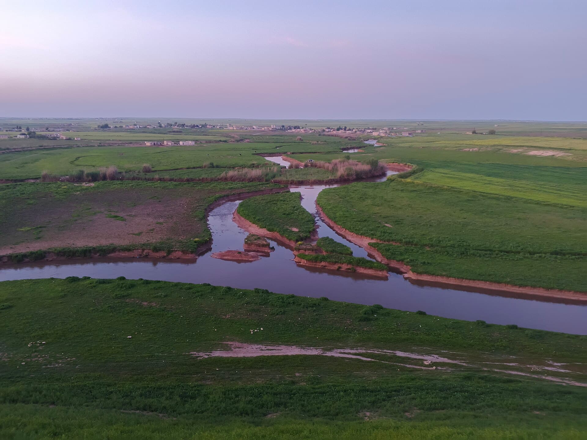
The easiest place to see the river is near its mouth. North-east of Raqqa, the mounds of Tuttul (Tell Bi’a) and Tell Zeidan sit on the plain where the Balikh approaches the Euphrates. Further north, around Tell Sahlan, the river winds between green fields; the cover of this page was taken there in April 2026.
The source area around Tell Abyad was under separate control from 2019. Access after the changes of 2026 could not be confirmed, so ask locally before heading north.
When to go
Spring. In March and April the valley is green and the mounds stand out from the fields. In summer there is no shade on the steppe, and the afternoon heat wears you down.
What not to miss
Look south towards the Euphrates from the top of Tuttul. The plain where the two rivers meet shows at a glance why the Bronze Age city named in the Mari tablets was founded exactly here.
Tips
- See the river near its mouth close to Raqqa, on the same day as Tuttul and Tell Zeidan
- Ask locally about current access before heading to the source area near Tell Abyad
- Farm tracks turn to mud after rain; do not take a low car onto them
- Keep away from the edges of looters' pits on the mounds; they are undercut and deep
Transparency
- How this was chosen
- Written by hand; opening hours, entry fee and coordinates are kept as data. A field that is not known for certain is marked as variable rather than guessed.
- Facts checked
- September 2026
- Last updated
- September 15, 2026