Euphrates Lake (Lake Assad)
Euphrates Lake, once Lake Assad, is Syria’s largest lake, behind the Tabqa Dam: how it formed, which ancient mounds it drowned, and where to see its shore.
- Opening hours
- Shores are open ground; the dam area is restricted
- Entry
- Free (shores)
- Duration
- 120 minutes
- Best time
- Spring and autumn; winter for birdwatching, when migratory birds winter on the lake
- Period
- Modern — dam 1968-1973, lake since 1974
- Address
- Behind the Tabqa Dam, 40 km upstream of Raqqa; Qal'at Ja'bar on its shore
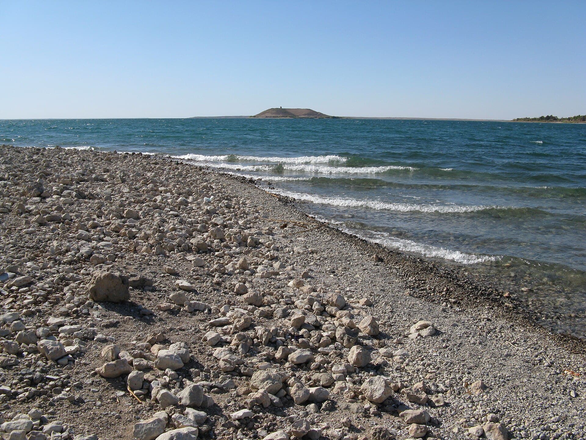
Euphrates Lake is the largest lake in Syria: a reservoir about 80 kilometres long that has built up behind the Tabqa Dam, 40 kilometres upstream of Raqqa. Under the Baath government it was called Lake Assad, and most people still search for it by that name. Its shores shift between reed beds, pebble beaches and planted slopes. Qal’at Ja’bar also stands on this lake, at the end of a causeway running into the water.
How the lake formed
The dam was built between 1968 and 1973 with Soviet help: 60 metres high and 4500 metres long, the largest dam in Syria. The lake began filling in 1974. The idea is much older. The first plan was drawn up in 1927, and agreements followed with the Soviet Union in 1957, with West Germany in 1960 and with the Soviet Union again in 1965. Under the Baath government it was known as al-Thawra (Revolution) Dam; today the names are Euphrates Dam and Euphrates Lake.
How big it is
At its maximum level the lake covers 610 square kilometres; the surface it actually holds is 447 square kilometres. It sends 80 million cubic metres of drinking water a year to Aleppo by pipeline, and there is fishing along its shores.
The main goal, though, was irrigation. The plan was 640000 hectares; by 1984 the figure had reached 60000, and by 2000 it was 124000 hectares — 19 per cent of the target. The causes were salt building up in gypsum-rich soils and irrigation canals collapsing. In 1975 Iraq claimed the flow had dropped and threatened to bomb the dam; Saudi Arabia and the Soviet Union mediated a settlement.
What lies under the water
Before the lake filled, rescue excavations were carried out in the valley between 1963 and 1974: Abu Hureyra, Emar, Habuba Kabira, Mureybet, Tell es-Sweyhat, Tell Frey and Dibsi Faraj. A protective embankment was built around the hill of Qal’at Ja’bar to keep the water off it. The minarets of Mureybet and Meskene were taken down and moved elsewhere.
What the shores are like
The western shore is a wide reed bed. The south-eastern shore was planted with Aleppo pine and Euphrates poplar. The lake is an important wintering ground for migratory birds, and before 2004 some shore roads were deliberately broken up to keep hunters away. Jazirat al-Thawra, an island in the lake, is a nature reserve.
The lake today
During the war years the water level fell sharply. In May 2026 the lake reached 97 per cent of capacity, a level not seen for decades, and caused flooding downstream in Raqqa and Deir ez-Zor. The town of Tabqa, the dam and the airport came under government control on 18 January 2026.
Where to see it
The easiest way to see the lake is to visit Qal’at Ja’bar: the causeway to the castle runs through the water, with the lake on both sides. The cover of this page was taken on that shore. The waterfront of Tabqa town also opens onto the lake. The dam, however, is a military and strategic installation. Rules on approaching it and taking photographs change from time to time, so check on the spot.
What not to miss
Omar Amiralay’s 1970 short documentary “Film Essay on the Euphrates Dam”. It follows the building of the dam in the valley before the lake filled, and watching it before you reach the shore lets you picture the landscape that is now under water.
Tips
- Ask on the spot before photographing the dam or its installations; it is a military and strategic site
- See the lake from the causeway to Qal'at Ja'bar, with water on both sides
- Choose winter for birdwatching; the reed beds on the western shore are at their liveliest then
- Ask locally before going into the water; the level rose fast in 2026 and the shoreline moved
Transparency
- How this was chosen
- Written by hand; opening hours, entry fee and coordinates are kept as data. A field that is not known for certain is marked as variable rather than guessed.
- Facts checked
- September 2026
- Last updated
- September 15, 2026