Nahr al-Kabir al-Shamali River, Latakia
One of the longest rivers on the Syrian coast, reaching the sea south of Latakia. Ugarit knew it as Rahbanu; steep in its upper valley, a plain river below.
- Opening hours
- Open natural area; access to the valley not verified
- Entry
- Not applicable — open natural area
- Duration
- 180 minutes
- Best time
- Spring and autumn; flood risk in winter
- Period
- Rahbanu at Ugarit (Bronze Age); modern dams
- Address
- From the northern mountains of Latakia province to the coast south of Latakia
One of the longest and largest rivers on the Syrian coast. It rises in the coastal mountains to the north and flows into the Mediterranean south of Latakia. In its upper reaches it drops fast through forested valleys; lower down it opens onto the plain and slows. Behind the 16 Tishreen Dam on its course lies Lake 16 Tishreen, which has its own page on this site. The name is old: in the Bronze Age the texts of Ugarit call the river Rahbanu. The Arabic name means the Great Northern River.
How long is it?
The sources do not settle on one figure. English Wikipedia gives 56 km, Arabic Wikipedia about 60 km within Syrian territory. According to the English source, its basin covers a little over 1100 km². The river rises at about 1100 m, and its peak flow is 40 cubic metres per second.
What feeds it?
Arabic Wikipedia lists its sources: rainfall of about 1000 mm a year over the basin, the Saqiyat al-Murra and Saqiyat al-Qubarsiyah tributaries, the Nahr al-Qash, surface and underground springs, and water seeping from irrigation channels.
How does the valley change?
In its upper course the river falls quickly. Below the site of the Baradun Dam the gradient eases and it becomes a lowland river. Baradun is about 26 km upstream of Lake 16 Tishreen. English Wikipedia says its construction halted during the war; its current state has not been verified. The lower 16 Tishreen Dam is near the village of Qasmin. Further north the river separates Jabal al-Akrad from Jabal al-Turkman, and its tributaries cut deep valleys into the chalk.
Why northern?
The word northern in its name sets it apart from the Nahr al-Kabir al-Janoubi, the southern river of the same name on the Lebanese border. The two share a name but are separate waterways, and they are easy to mix up on maps and in searches.
When to go and what to watch for
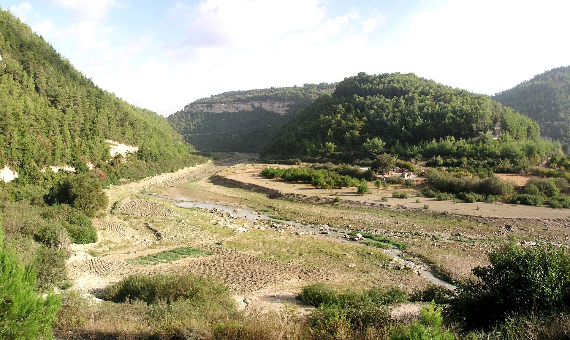
Because rain feeds it, the river changes a great deal with the seasons. Photographs taken in October show a wide, stony bed with water running in a thin channel. In winter the valleys fill fast: according to Civil Defence, two children were swept away in a valley in Jabal al-Turkman during the floods of February 2026. Keep out of the valley bed after heavy rain. No current source on access to the valley could be found; in the countryside, stay on asphalt and marked roads.
Don’t miss
The valley above the lake. Most visitors only see the river as Lake 16 Tishreen, but the forested upper valley above the dam is the stretch that shows the river’s own character.
Tips
- Keep out of the valley bed after heavy rain; two children were swept away in a valley during the February 2026 floods
- For the lake, see the Lake 16 Tishreen page; this one covers the river itself
- In the countryside, do not leave asphalt or marked roads
- Water drops in the dry months; choose spring to see the river flowing
Transparency
- How this was chosen
- Written by hand; opening hours, entry fee and coordinates are kept as data. A field that is not known for certain is marked as variable rather than guessed.
- Facts checked
- September 2026
- Last updated
- September 15, 2026