Ras al-Bassit
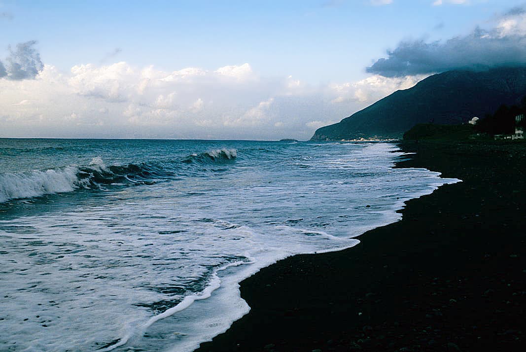
The dark-sand beach 53 kilometres north of Latakia. No other stretch of the Syrian coast has this colour, and here the forest runs right down to the water.
- Opening hours
- Open shore, all day
- Entry
- Free on the open strip; serviced beach sections may charge separately
- Duration
- 180 minutes
- Best time
- June to September, when the sea is warm and the forest road is clear
- Period
- —
- Address
- Qastal Maaf, 53 kilometres north of Latakia
A cape at the northern end of the Syrian coast, 53 kilometres north of Latakia, with a bay tucked in below it. What sets Ras al-Bassit apart from other shores is the colour of the sand: dark, close to black. The mountains come down to the sea, and the forest begins where the sand ends.
Getting there
The coast road north out of Latakia turns inland at some point, and the last stretch is a winding forest road. Reckon on about two hours by car; the distance is short and the road is slow. Mount Aqra stands 10 kilometres to the north, so the border runs close by. Ask whether the road is open before continuing that way.
What the beach is like
The bay is wide and curved. The sea is usually calm and the bottom shelves gently. Chalets and serviced beach sections line the shore, and between them lies a long open strip that anyone can walk on to; that part is free. Behind you the pine and oak forest starts. Some 3000 hectares around the bay were placed under protection in 1999, which is why there is no wall of concrete along the shore.
Why the sand is dark
The colour comes from the rock of the surrounding mountains. The hills here are made of dark stone, and the streams have ground it down and carried it to the sea over centuries. The rest of the Syrian coast is pale sand and shingle, while this beach turns fully black when it is wet — the thing that looks exaggerated in photographs is real on the ground.
What most visitors miss
Look at the excavation ground beside the marina. This was a harbour known in classical times as Posidium, and before that an outpost of Ugarit trading with Cyprus. The digs were carried out but the site was left open, so ancient walls and the present-day boat jetty stand side by side. Stones from the Greek colony founded in the 7th century BC lie somewhere in that jumble too.
Tips
- The road winds and the last stretch crosses the mountains; come ready for travel sickness
- Wet dark sand holds the heat; walking it barefoot at midday is hard going
- The excavation ground beside the marina is unfenced, so walk round the stones, not over them
- The border lies close to the north; ask about road conditions before heading that way
Transparency
- How this was chosen
- Written by hand; opening hours, entry fee and coordinates are kept as data. A field that is not known for certain is marked as variable rather than guessed.
- Facts checked
- August 2026
- Last updated
- September 15, 2026