Homs Old City churches walk: from the National Evangelical Church to Sibat al-Qadi
Five stops in Old Homs: a rebuilt Evangelical church, Father Frans van der Lugt’s grave, Our Lady of Peace, Umm al-Zunnar and the Sibat al-Qadi passage.
- Duration
- 3 hours
- Distance
- 0.9 km
- Difficulty
- Easy
- Best season
- March–May, October–November
- stops
- 5
- City
- Homs
Bustan al-Diwan, the Christian quarter in the eastern half of Old Homs, has churches a few hundred metres apart. This walk follows that line. It starts at the National Evangelical Church and passes Father Frans van der Lugt’s grave at the Jesuit monastery. Then come the Cathedral of Our Lady of Peace and the Church of Umm al-Zunnar. It ends at Sibat al-Qadi in the Bab al-Dreib quarter. The route is under a kilometre. With the stops, allow about three hours. It has two threads: churches repaired after the war, and the sibats, rooms that Homs built over its lanes.
The route
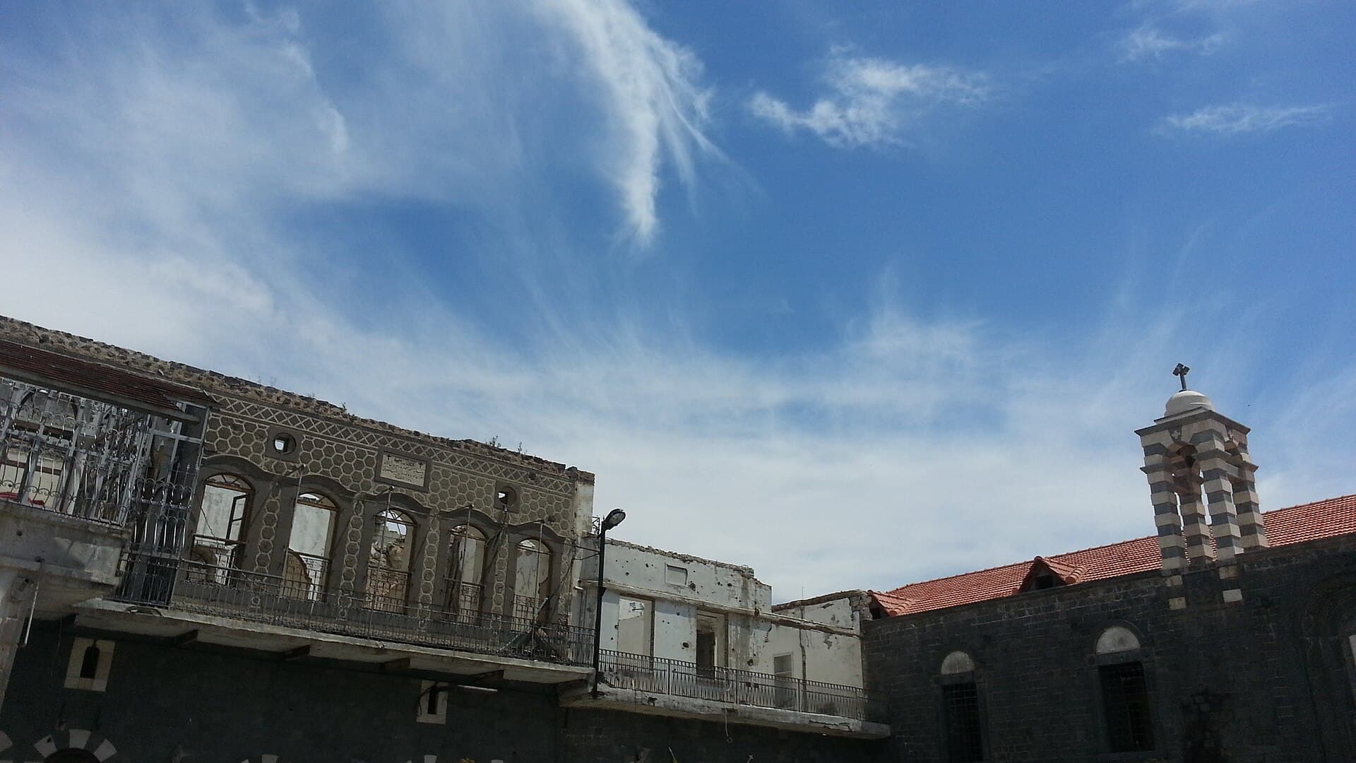
The National Evangelical Church is on al-Abrar Street, directly opposite the Jamal al-Din Mosque. Look for the bell tower. Its black and white stones, at the south-east corner, are what mark the plain building out. A rocket brought down the roof on 26 February 2012; the church was repaired and held its first service again on 25 December 2015. A walk of less than 100 metres to the north-east takes you to the Jesuit Fathers’ monastery. The Dutch priest Frans van der Lugt refused to leave during the siege, was killed in the monastery garden on 7 April 2014 and is buried here. It is not a museum. A community lives here, so ask at the door to visit the grave.
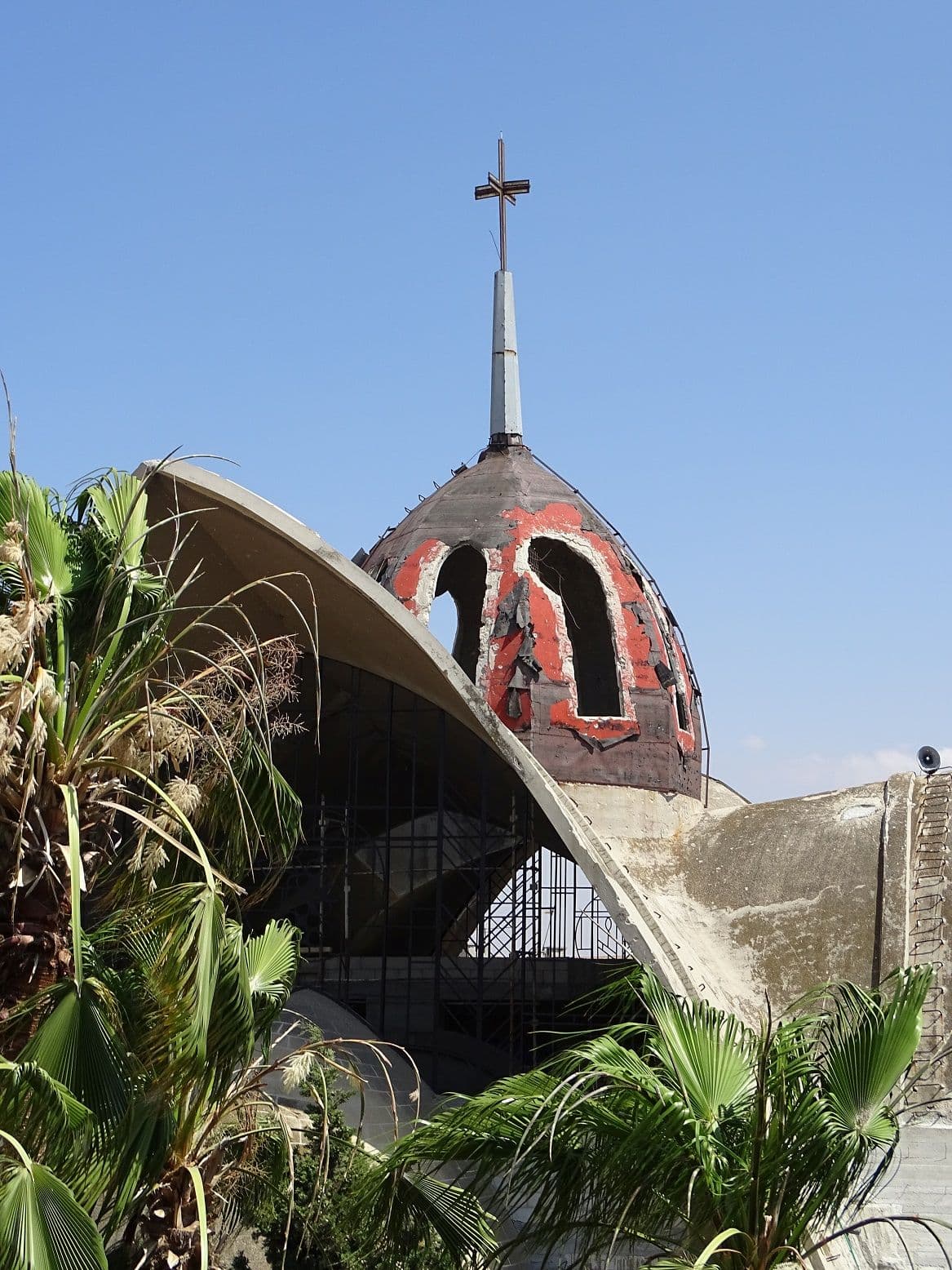
The Cathedral of Our Lady of Peace is a few minutes further along the same line, on Escada Street. It was built in 1970, and its roof sets it apart from the stone churches around it. From April 2011 to May 2014 it served as the headquarters of an armed group; on 8 May 2014 a 200 kg explosive placed in the pulpit caused further damage to the foundations. Repairs backed by Aid to the Church in Need (ACN) were largely finished between 2016 and 2019. Step back a few paces to see the three-armed cross on top of the dome.
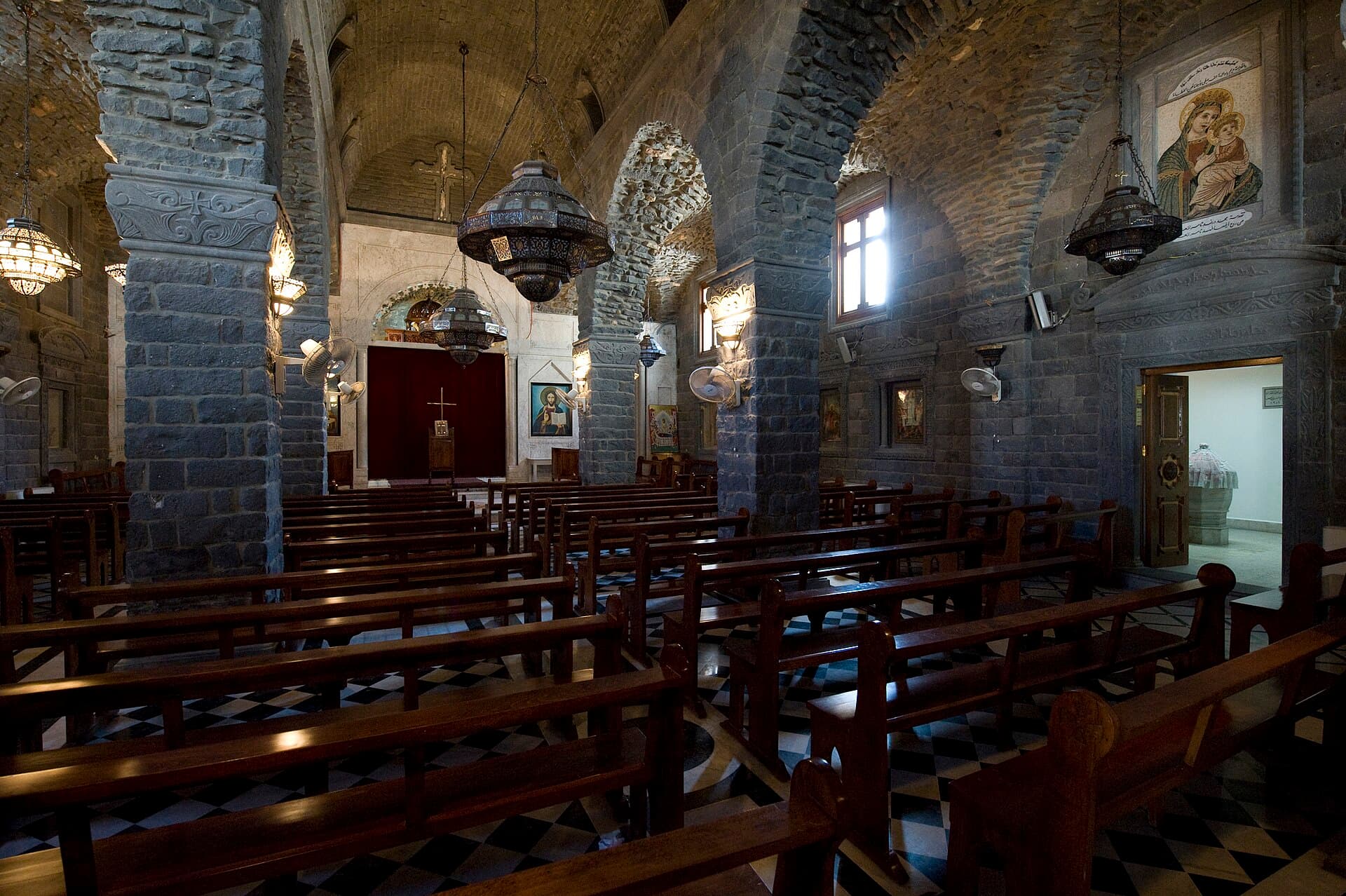
About 300 metres north-east of the cathedral is the Church of Umm al-Zunnar, the Church of the Holy Belt. A belt believed to have belonged to the Virgin Mary was found beneath the altar in 1953. The part to see is one floor down: a low vaulted chamber where you have to stoop to enter. From there walk east to the Bab al-Dreib quarter, on the eastern side of the old walls. Sibat al-Qadi is a vaulted, cross-shaped passage where four lanes meet; at more than 20 metres long, sources call it the longest sibat in Syria. Look for the lantern niches in its walls. Right beside it is a shrine attributed to Wahshi and Thawban.
Timing
Church doors are most often open on Sunday. Services pause visits. On a weekday, be outside the Evangelical Church at 10:00; twenty-five minutes is enough for the facade and bell tower. Ask at the monastery door at 10:30 and move on to the cathedral at 11:00. Reach Umm al-Zunnar around 11:45 and give the lower chamber forty-five minutes. By 12:45 you are at Sibat al-Qadi, where the niches inside the passage show in the midday light. On a Sunday, wait for the services to end and start the walk in the afternoon.
Take care
Four of the five stops are working churches or a monastery: cover shoulders and knees, and ask before taking photographs during services. The Evangelical Church and Umm al-Zunnar are free; visiting arrangements at the monastery and the cathedral vary, so check at the door. Doors may be shut. The facade and courtyard are still part of the route. There is no confirmed source on the state of Sibat al-Qadi since the war; the most recent description we have dates from 2008. Find it by asking locals for the shrine of Wahshi and Thawban, and ask before photographing homes or people. The old city was badly damaged in the war, and repaired lanes may sit next to ones that are still closed.
The route on a map
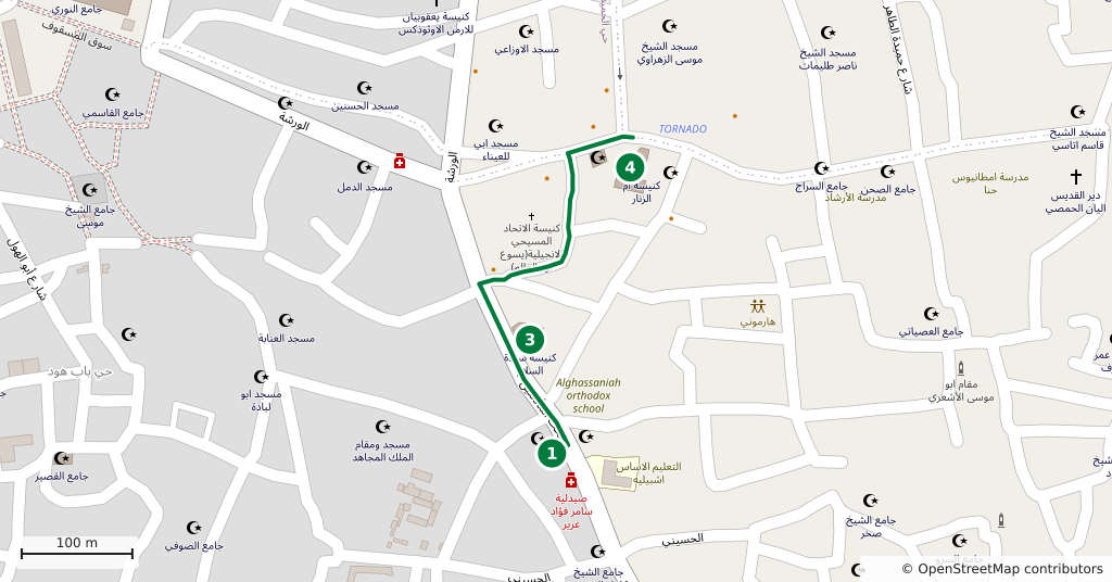
Stops along the route
- 01
- 02
- 03
- 04
- 05
Transparency
- How this was chosen
- The stops and their order were set by hand. The line on the map is real road geometry, not a straight hop between pins; distance and duration belong to that itinerary.
- Facts checked
- September 2026
- Last updated
- September 15, 2026