The Afrin River
A 131 km tributary of the Orontes that rises in Turkey and splits Afrin town in two. Assyrians called it Apre, Romans Ufrenus; Ain Dara and Jindires line its banks.
- Opening hours
- Open ground
- Entry
- Free
- Duration
- 120 minutes
- Best time
- Outside the olive pressing season, when the water can turn dark
- Period
- Natural; ancient names Apre, Oinoparas, Ufrenus
- Address
- Afrin District; runs through the middle of Afrin town
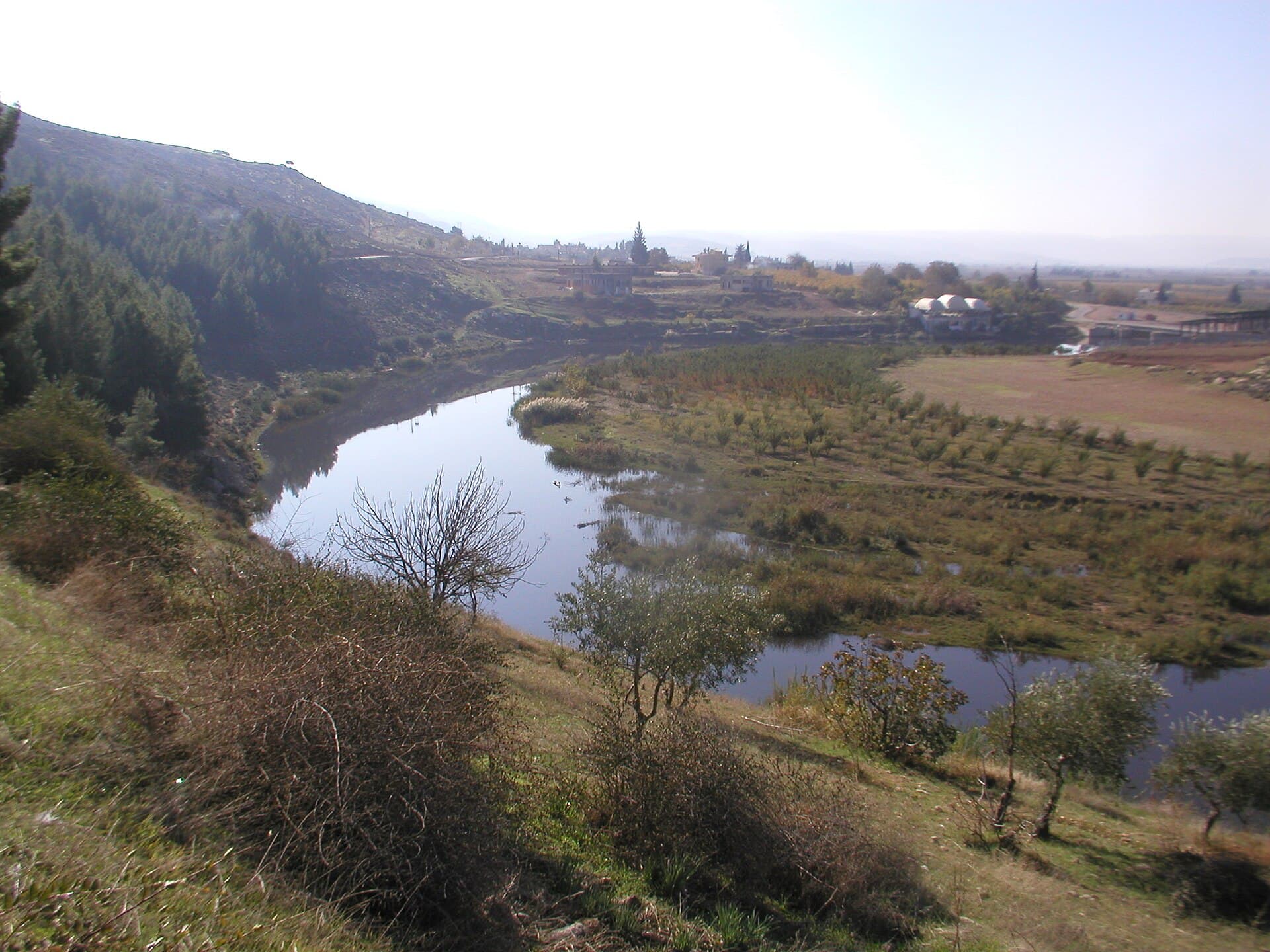
The Afrin River is a tributary of the Orontes. It rises in Turkey, flows south into Syria, cuts the town of Afrin in two and crosses back into Turkey. It is 131 km long in all, 54 km of it in Syria; Arabic Wikipedia gives 139 and 55 km. Along its valley lie the Ain Dara Temple, the mound of Gindaros at Jindires, and the bridges of Nabi Huri.
Where it rises and where it flows
Its source is in Turkey, south of the Kartal mountains. Turkish Wikipedia says it comes off Külecik Dağı and is formed where two streams, the Karaafrin and the Bozafrin, meet. Inside Syria it is held back north of Afrin in the lake of the 17 April (Maydanki) Dam, then runs through the town. It re-enters Turkey and joins the Karasu where Lake Amik used to be; its water reaches the Orontes through a canal.
Where the water comes from
Of the yearly flow, about 250 million cubic metres come from Turkey and about 60 million cubic metres from Syria. In the Syrian stretch the springs of Qatma and Basuta feed the river.
The river’s old names
The river has been on record for at least three thousand years. An Assyrian text of 876 BC calls it ‘Apre’ and describes it as the river watering Batan, today’s Jumeh plain. Strabo writes ‘Oinoparas’; in the Roman period it was ‘Ufrenus’. Abu al-Fida calls it ‘Nahr Ifrin’.
The oldest record of the name in Islamic sources dates from 1086 (478 AH). It also appears in Yaqut al-Hamawi’s dictionary of places, and in al-Qalqashandi and Ibn al-Shihna. Some researchers identify the Afrin with the ‘Chalus’, the river Xenophon describes in the Anabasis in 401 BC, whose fish the local people held sacred; that identification is disputed.
What to see along its banks
There is no single place to visit the river itself; you see it together with the sites on its banks. The Iron Age temple at Ain Dara, the mound of Gindaros at Jindires, and Nabi Huri, the ruins of ancient Cyrrhus, are all in this valley. North of the town is the dam lake.
Why the water turns dark in olive season
Afrin is olive country, and when wastewater from the olive presses gets into the river, the water darkens. The caption of a photograph taken south of Basuta in 2006 puts the dark colour down to this waste, released into the river during the pressing season. The same bank looks quite different at other times of year.
Before you go
Parts of the river run along the international border. Keep away from the border zone and from the stretch that crosses into Turkey. No access information from the past year specific to the riverbanks could be found; ask in Afrin about the current situation.
Tips
- Line up Ain Dara, Tell Jindires and Nabi Huri along the river in one day
- Keep away from the stretches near the border and the bank that crosses into Turkey
- Add the dam lake 12 km north of Afrin
Transparency
- How this was chosen
- Written by hand; opening hours, entry fee and coordinates are kept as data. A field that is not known for certain is marked as variable rather than guessed.
- Facts checked
- September 2026
- Last updated
- September 15, 2026