Bourzey Castle
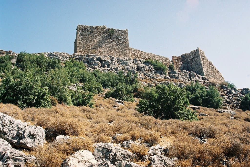
A steep Crusader castle on the eastern flank of the coastal range, above the Ghab plain. Saladin took it in 1188 in three days; towers and cisterns remain.
- Opening hours
- Open ruin, all day
- Entry
- Variable — check on arrival
- Duration
- 90 minutes
- Best time
- Spring, while the plain is green and the climb is still cool
- Period
- Byzantine — Crusader — Ayyubid
- Address
- Western edge of the Ghab plain, Shat'ha, Hama
The castle sits on a rocky ridge at the eastern edge of the coastal mountains, 450 metres above the Ghab plain. Seen from the plain, castle and rock do not separate; you work out where one ends only once you are up there. The sources call it both Bourzey and Mirza.
Getting there
About 25 kilometres south of Jisr al-Shughur. The vehicle track ends on the western slope, because the southern and eastern faces drop straight into deep gorges and no approach is possible from there. The last 100 metres are on foot, up a stony and steep path.
What to see
The plan is a triangle. The west front runs 175 metres, the east front 50; the castle took the shape of the rock rather than imposing its own geometry. Along the ridge 21 towers are counted, with a small church among them. Inside there are underground rooms and water cisterns — at this height a siege turns on water, and the castle was built to say so.
What happened in 1188
The Byzantines built the castle, the Seljuks and the emirs of Aleppo held it in turn, and early in the 12th century the Crusaders of Antioch took it and named it Rochefort. Saladin took it in August 1188 after a three-day siege, during his northern campaign following Hattin. The wife of the castle’s lord was the sister of the wife of Bohemond, prince of Antioch, and for that reason the lord and his household were allowed to withdraw to Antioch. Ibn al-Athir writes that she had also been passing information to Saladin, and puts the family’s reprieve down to that.
What most visitors miss
Look out over the plain from the ruined tower at the east end. The Ghab is the flood plain of the Orontes: marsh and channel below, flat ground opposite. One look explains why the castle stands exactly here. The road between Latakia and Apamea ran through this gap, and this ridge watches the road.
Tips
- The last 100 metres are on foot; the vehicle track ends on the western slope
- The south and east faces drop straight into the gorge, so keep back from the edge
- Wear shoes that grip; the path is covered in loose stone
- Carry water with you; there is no shade and no tap at the top
Transparency
- How this was chosen
- Written by hand; opening hours, entry fee and coordinates are kept as data. A field that is not known for certain is marked as variable rather than guessed.
- Facts checked
- August 2026
- Last updated
- September 15, 2026