Homs Citadel
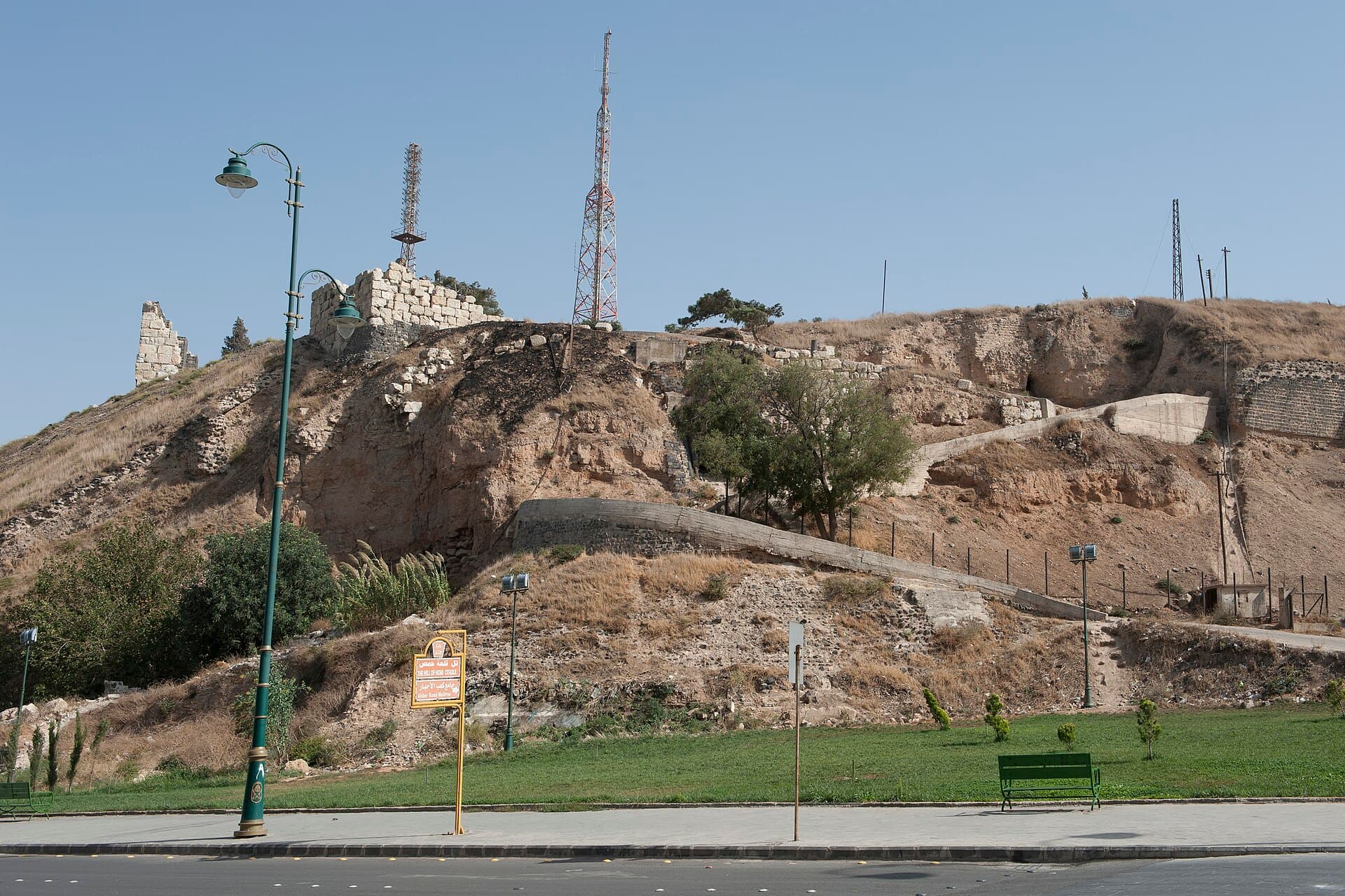
An artificial mound southwest of the old city, rising 32 metres above the plain. No castle stands; what is here is stone-clad slope, wall stubs and deep layers.
- Opening hours
- Daylight hours — open ground, conditions change
- Entry
- Varies — confirm at the gate
- Duration
- 45 minutes
- Best time
- Late afternoon, when raking light picks out the stone facing
- Period
- Ayyubid to Ottoman, mound from the 3rd millennium BC
- Address
- Southwest of the old city, Homs
Come without expecting a standing castle. The Homs Citadel today is largely a mound: an artificial hill southwest of the old city, rising 32 metres above the plain around it and close to 275 metres across at the base. The walls on top are mostly down. But the mound itself is the oldest thing in Homs — the layers beneath it reach back to the 3rd millennium BC, and the city grew up exactly at its foot.
Getting there
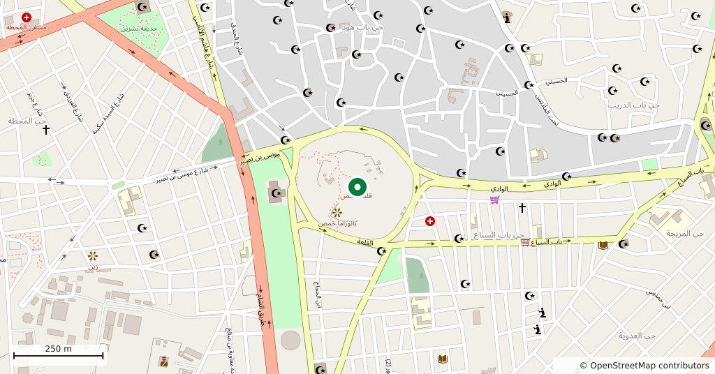
Inside the city, southwest of the old quarter. The Khalid ibn al-Walid Mosque is north of the centre; the mound is the other way, across the middle of town. A boulevard and a park run around it and the hill is visible from every direction, so it is not a place you can miss.
How long it takes
Forty-five minutes. That covers walking the foot of the mound, climbing the slope and looking out over the city from the top. There are no rooms or halls to tour inside; what there is to see is seen from outside.
What you see
The whole slope is sheathed in flat stone slabs — a facing that braced the mound and made it unclimbable at the same time. Fragments of wall and tower stand at the summit. The core of what survives is Ayyubid, from the dynasty Saladin founded: the building inscription on the north tower names Asad al-Din Shirkuh, and the rest is Mamluk and Ottoman repair. Locally the place is called the Citadel of Usama, after Usama ibn Munqidh.
Why nothing stands
One decision did it. In 1832 the Egyptian army pulled most of the fortress down so that Ibrahim Pasha could build barracks and ammunition stores. After that the hill served as a military position — first under the French Mandate, then for the Syrian army — and it was only handed to the Directorate-General of Antiquities in the late 1980s. Excavation on the mound began in the 1990s.
Don’t miss
The stone facing on the slope. From a distance it reads as bare earth; up close you see cut slabs laid course on course, and only then does it become clear that the mound was built by hand.
Tips
- Walk the foot of the mound: the flat stone facing reads best in side light
- The masts on top are antennas, not castle remains; the stone pieces are the walls
- The slope is unshaded and slippery; grippy shoes and water help
- It fits into the same half day as the Khalid ibn al-Walid Mosque — the mosque north, the mound southwest
Transparency
- How this was chosen
- Written by hand; opening hours, entry fee and coordinates are kept as data. A field that is not known for certain is marked as variable rather than guessed.
- Facts checked
- August 2026
- Last updated
- September 15, 2026