Jebel Aqra, Mount Kasios
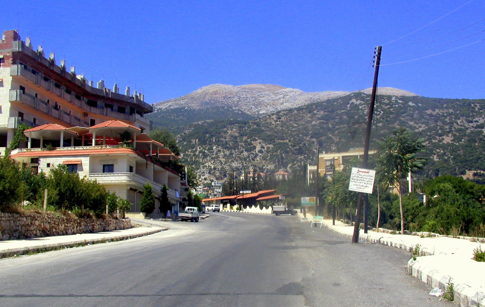
The bare-topped limestone mountain rising behind Kessab. In the Ugarit texts the storm god’s palace stood on its peak; the summit is now on the Turkish side.
- Opening hours
- No access to the summit; visible from around Kessab at any time
- Entry
- Free
- Duration
- 60 minutes
- Best time
- Morning; on most days the summit goes into cloud in the afternoon
- Period
- Cult site from the Bronze Age to Rome
- Address
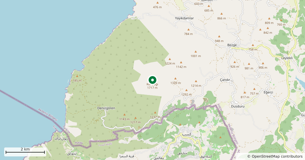
- North of Kessab, on the Syrian-Turkish border
A limestone mountain on the Syrian-Turkish border, beside the mouth of the Orontes. Its top is bare of trees, which is why Arabic calls it Aqra and Turkish Kel Dağı, the bald mountain. For sailors it has been a landmark for centuries, and it gathers cloud on itself: storms come in and sit on it.
Why it is here
This is the longest-lived sacred peak in the eastern Mediterranean. The Hurrians called it Hazzi and held it to be the home of the storm god Teshub; in the tablets of Ugarit the same summit carries the lapis and silver palace of Baal and his sister Anat. Ugarit lies 30 kilometres to the south. It appears in the Hebrew scriptures as Zaphon, and that word later came to mean the direction north in Hebrew. In Greek and Roman times the god became Zeus Kasios; Hadrian climbed at night in 130 to watch the sun rise, and the emperor Julian made the same climb in the spring of 363.
Where to see it from
On the Syrian side the viewpoint is Kessab and the country around it. From the northern edge of the town, on the ridges facing the border, the bare summit stands clear. The second point is the northern stretch of the road to Ras al-Bassit: from the shore you can see how abruptly the mountain rises out of a narrow coastal plain.
Where things stand
You cannot go up. The summit lies on the Turkish side of the border and is a military zone, which is also why the excavation was broken off. The diggers opened only the upper layers of the great mound of ash that is what remains of the sanctuary, and stopped at the Hellenistic strata. After a military base was built on the summit in 2012 the remaining traces are presumed gone.
How long it takes
An hour, as a viewpoint. If you are already stopping in Kessab it does not need a day of its own: drive up to the ridge road, look, and come back.
What most people miss
The way the weather behaves over the mountain alone. The sky can be clear along the coast while the summit goes into cloud most afternoons; the reason the ancient texts put the storm god on this particular peak is up there, not in the books. Waiting an hour and watching the cloud settle explains more than anything you can read about it.
Tips
- Do not aim for the summit — it is across the border and inside a military zone
- Stop on the northern ridges of Kessab; that is where the full silhouette is
- Keep off tracks that run towards the border line and respect the signs
- Add Ras al-Bassit to the same day; that is where you see the mountain from the sea
Transparency
- How this was chosen
- Written by hand; opening hours, entry fee and coordinates are kept as data. A field that is not known for certain is marked as variable rather than guessed.
- Facts checked
- September 2026
- Last updated
- September 15, 2026