The Orontes River
The 571-kilometre river that rises in Lebanon and runs north past Lake Homs, the norias of Hama and the Ghab Plain before reaching the sea near Samandağ.
- Opening hours
- The banks at any hour
- Entry
- Free
- Duration
- 60 minutes
- Best time
- Spring, when the river runs full and the bank gardens are green
- Period
- From the Bronze Age to today
- Address
- The stretch through central Hama; the river crosses Syria from Rablah to Darkush
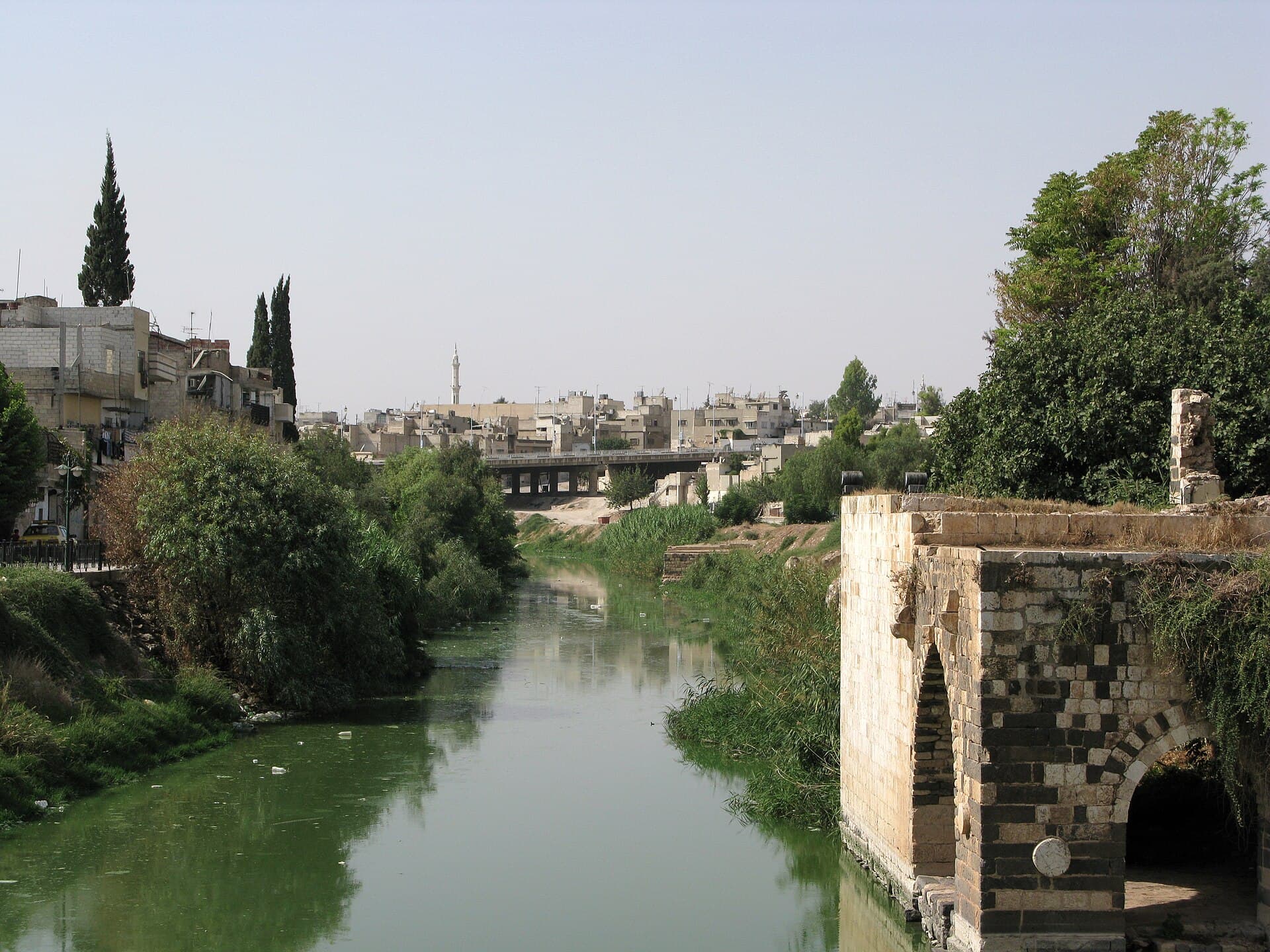
The Orontes rises in the north of Lebanon’s Bekaa Valley, flows north through the whole length of Syria and reaches the Mediterranean near Samandağ in Turkey. It is 571 kilometres long and drains a basin of 23000 square kilometres. Homs and Hama grew up on its banks, and it is the water that turns the norias, the giant wooden water wheels of Hama.
Where the name comes from
The Assyrians called the river Arantu and the Egyptians Araunti; in Greek the name became Orontes. Macedonian settlers at Apamea gave it the name of a river back home, the Axius. The Arabic name, al-Asi, is thought to come from Axius. In Arabic the word happens to mean “the rebel”. People link that to the way the river runs from south to north, against the other rivers of the region.
Its course from south to north
After entering Syria it runs about 20 kilometres to Lake Homs. Its stretch in Syria and Turkey is 525 kilometres, and in Lebanon it runs 46 kilometres. From south to north:
- Rablah: where the river enters Syria, at the Tahunat al-Umariya mill
- Tell Nebi Mend: the mound of ancient Kadesh
- Lake Qattinah: a lake enlarged by a Roman-era dam that was raised in 1938
- Al-Rastan: a dam holding 225 million cubic metres
- Hama: the norias and the Muhammadiyah noria
- Muhardeh and Shaizar Castle: the bend north-west of Hama
- Tell Acharneh and the Ghab Plain: a weir that splits the water into four canals
- Qastun and Tell Qarqur: the northern half of the Ghab
- Jisr al-Shughur and Darkush: the last stretch before the river crosses into Turkey
Battles on its banks
The Battle of Kadesh, between the Egyptian pharaoh Ramesses II and the Hittite king Muwatalli II, was fought on this river in the 13th century BC, at today’s Tell Nebi Mend. In 853 BC the Assyrian king Shalmaneser III met an army of 12 kings led by Hadadezer of Damascus at Qarqar. In the Crusader period the river was the border between the Principality of Antioch and Aleppo.
Where to see it in Hama
The easiest place is the line of norias: the river runs through the middle of the city and you can walk along the bank. From the middle of the Kilaniyya Bridge you look straight at the wheels. From the citadel mound you can see how the river splits the city in two.
The river today
The Orontes changes a great deal from year to year. In summer 2025 rainfall dropped sharply, the bed dried out in parts of north-western Syria and thousands of fish died. In winter 2026 heavy rain pushed the water back up, and floods reached homes around Darkush. How the water should be shared between Lebanon, Syria and Turkey is still disputed.
Tips
- In Hama the easiest way to see the river is the line of norias, right in the city centre
- In dry years parts of the bed dry out in summer; come in spring to see the river full
- North-west of Hama, Muhardeh, Shaizar and Apamea fit into one day
- The Ghab stretch is hard to make out from the ground; climb a height on its edge such as Abu Qubays
Transparency
- How this was chosen
- Written by hand; opening hours, entry fee and coordinates are kept as data. A field that is not known for certain is marked as variable rather than guessed.
- Facts checked
- September 2026
- Last updated
- September 15, 2026