Tell Qarqur, the Likely Site of Ancient Qarqar
A double mound in the Ghab plain, 7 km south of Jisr al-Shughur: ten thousand years of settlement and the likely site of the Battle of Qarqar in 853 BC.
- Opening hours
- Open archaeological site; daylight hours
- Entry
- Variable — confirm on site
- Duration
- 45 minutes
- Best time
- Spring, when the Ghab is green and the air is cool
- Period
- Neolithic — Bronze and Iron Ages — Mamluk
- Address
- 1 km west of Qarqur village, al-Suqaylabiyah district, Hama
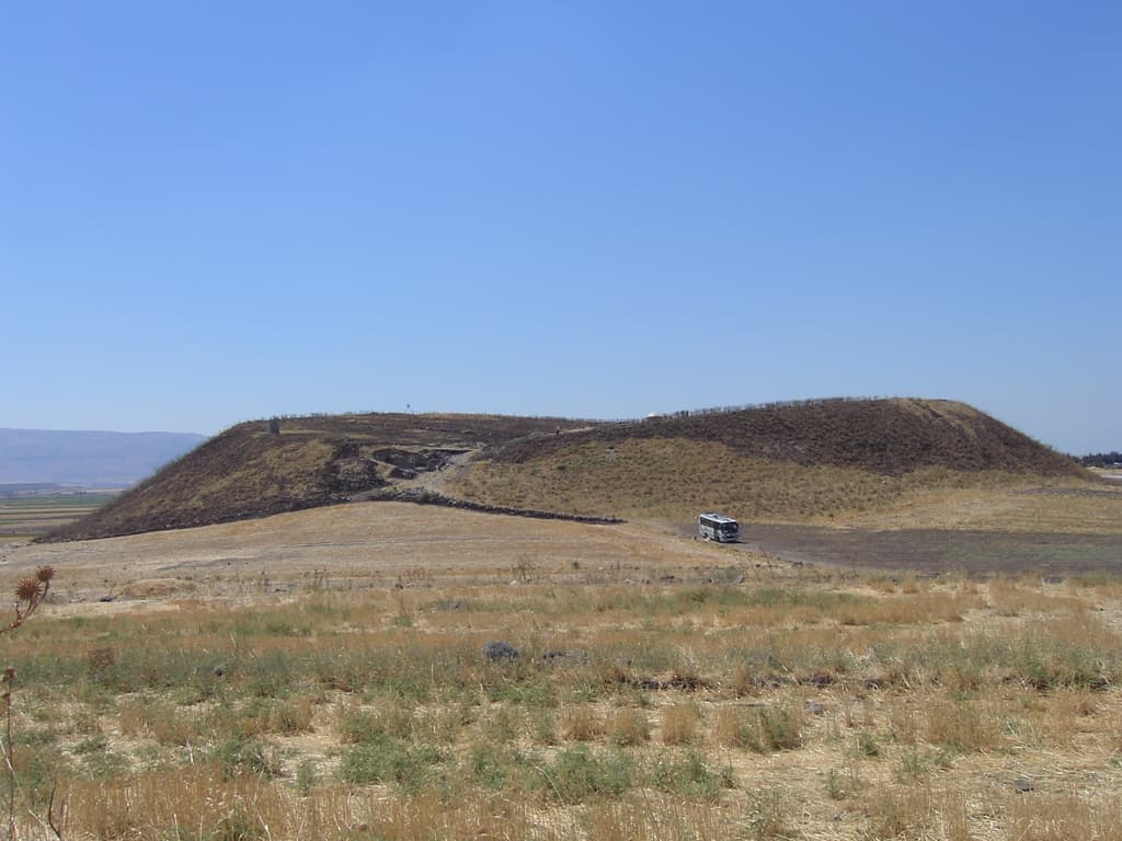
Tell Qarqur is a double mound rising from the flat floor of the Orontes valley in the Ghab plain. It is very probably ancient Qarqar, where the Assyrian king Shalmaneser III fought a coalition of Levantine kings in 853 BC. The mound holds traces of continuous settlement for some ten thousand years, from around 8500 BC to 1350, in the Mamluk period.
Where it is and how to get there
About 7 kilometres south of Jisr al-Shughur and 1 kilometre west of the village of Qarqur. It belongs to the al-Suqaylabiyah district of Hama governorate. There are two mounds, a small one to the north and a large one to the south; the higher one rises 30 metres above the plain and is visible from a long way off. Road and checkpoint conditions change, so ask before you go.
How long it takes
Forty-five minutes: enough to walk from the low northern mound to the high one and look out over the plain.
The Battle of Qarqar
In 853 BC the Assyrian army met a Levantine coalition here that included Hadadezer of Damascus and King Ahab of Israel. The battle is recorded in the Assyrian annals and on the Kurkh Monoliths. That Tell Qarqur is Qarqar is not certain, but it is a strong possibility.
What the excavations found
The mound was excavated by John M. Lundquist for ASOR and Brigham Young University in 1983 and 1984, by Rudolph Dornemann between 1993 and 2001, and by Jesse Casana for the University of Arkansas in 2005, 2007 and 2008. They found stone town walls from several phases, many houses, a temple complex from Early Bronze IV dated between 2200 and 2000 BC, and Iron Age levels. The settlement reached its largest size in the Early Bronze Age, between 3000 and 2000 BC.
What most people miss
A settlement that survived a drought. Around 2200 BC a severe drought struck the region and many settlements collapsed; Qarqar did not, and in fact grew. From the top of the high mound the Orontes plain stretches out end to end.
Tips
- Old excavation trenches may have left pits; keep to the paths on the mound
- Jisr al-Shughur is 7 kilometres north; combine the two in one day
- There is no shade on the mound; in summer go early in the morning
- Road and checkpoint conditions change; ask before you set out
Transparency
- How this was chosen
- Written by hand; opening hours, entry fee and coordinates are kept as data. A field that is not known for certain is marked as variable rather than guessed.
- Facts checked
- September 2026
- Last updated
- September 15, 2026