Aleppo’s Bab al-Nairab quarter: from Otrush Mosque to Badinjk
A two-hour walk in Aleppo from the carved Al-Otrush Mosque past the site of Bab al-Nairab to two mosques outside the walls, the Al-Turantaiyah and the Badinjk.
- Duration
- 2 hours
- Distance
- 1.4 km
- Difficulty
- Easy
- Best season
- March–May, October–November
- stops
- 5
- City
- Aleppo
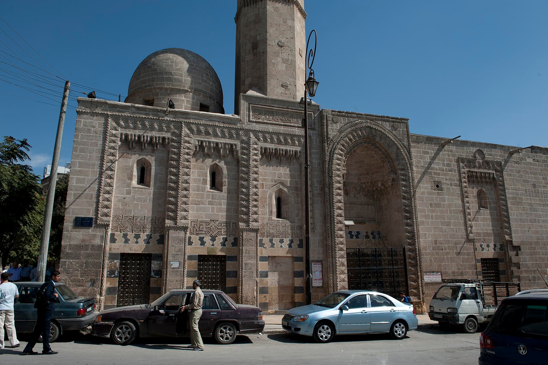
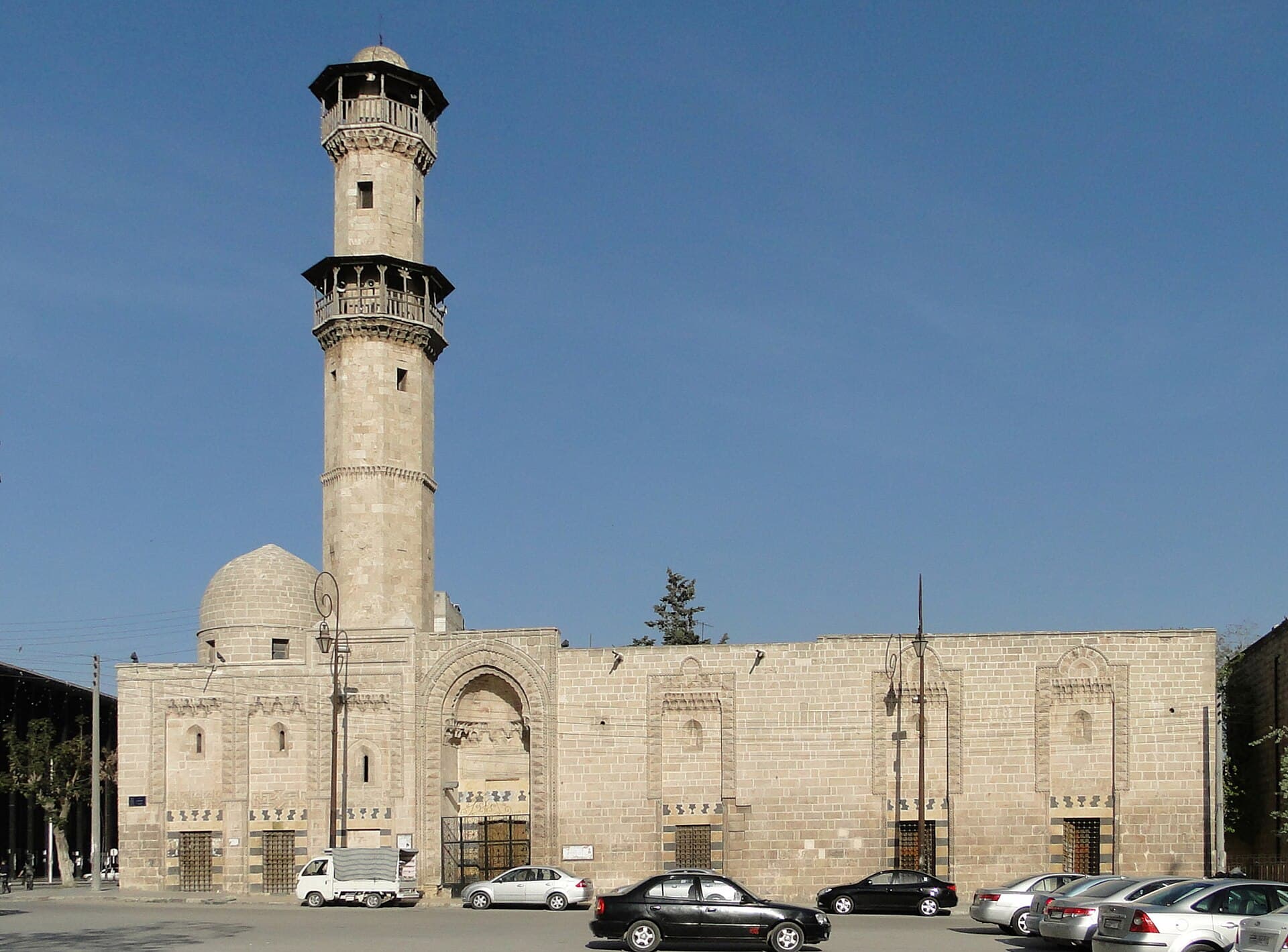
This walk starts south of the citadel and leaves the old city through its south-eastern mouth, a stretch that other Aleppo routes rarely enter. It opens with the carved façade of the Al-Otrush Mosque, built between 1393 and 1408. A few minutes south is the Al-Sakakini Mosque of 1371. Then comes the site of Bab al-Nairab, a gate whose arch was taken down in the 1930s, and the road crosses into the quarter outside the walls. Here stand the Al-Turantaiyah Madrasa, endowed by the historian Ibn al-Adim, and the Badinjk Mosque, whose minaret rises over the entrance passage rather than the courtyard. Just under a kilometre and a half, five stops, two hours.
The route
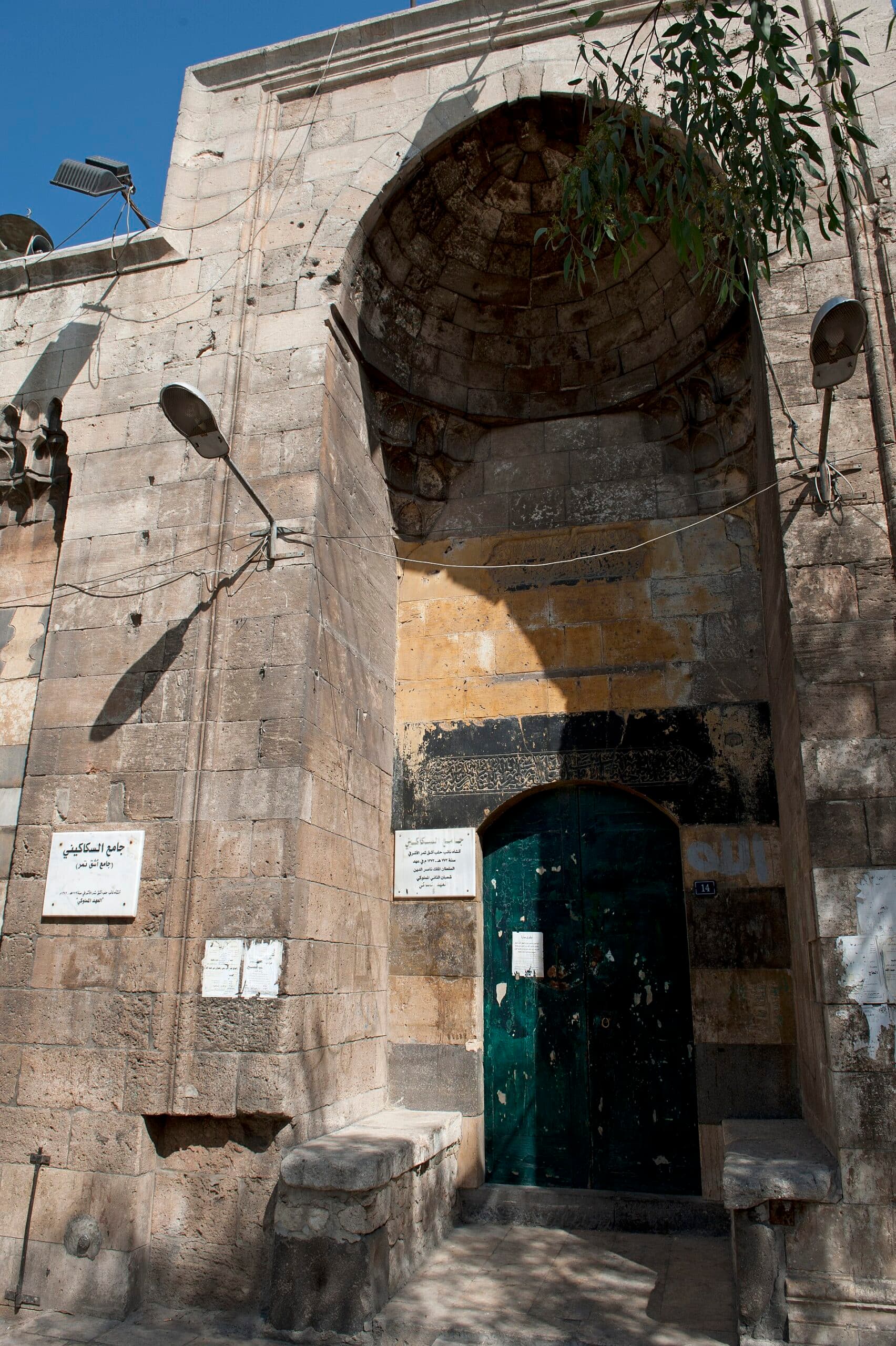
The Al-Otrush Mosque stands south of Citadel Square, next to the Sultaniyya madrasa. Take in the façade from the far pavement, then walk south on the road that runs down to Bab al-Maqam. The Al-Sakakini Mosque is close to 300 metres on, right on the road; its deep stone niche is visible from the street. Turn east here. The site of the Bab al-Nairab gate is about 200 metres away, around the Tawba Mosque. There is no arch, so ask the shopkeepers for ‘Bab al-Nairab’ or for the official name, ‘Muhammad Bey’. From the gate site cross to the outside of the wall and walk east along Muhammad Bey Street. The Al-Turantaiyah Madrasa is about 450 metres ahead. The Badinjk Mosque lies in the same direction, another 450 metres east; the lane is named after the mosque.
Timing
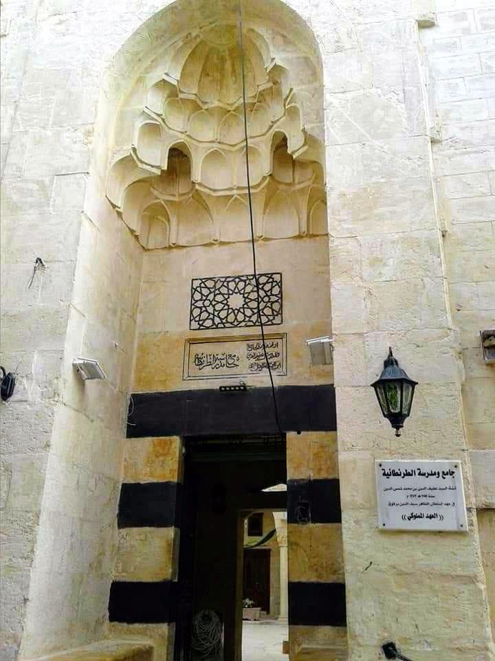
Be opposite the Al-Otrush Mosque at 10:00. Look at the blind arches along the façade and at the inscription band on the minaret shaft; you can read it from the ground. A quarter of an hour. At 10:20, the Al-Sakakini: morning light falls straight on the portal and puts the stalactite half-dome in shadow. The plaque left of the door gives the building’s name, the one on the right its endowment. If the door is open, go to the stone minbar. A quarter of an hour. At 10:40 you are at the site of Bab al-Nairab. The moat in front of the wall was filled in 1911 and a street laid over it; today only the street pattern shows where inside became outside. Ten minutes. At 10:55, the Al-Turantaiyah: look at the stalactite hood and the alternating black and white stone either side of the door. The plaque beside the door names the founder as Afif al-Din ibn Muhammad Shams al-Din and gives the date 1383; the sources tie the building to the endowment Ibn al-Adim set up between 1241 and 1251. Read the two together, then cross the lane to see the small minaret on the corner. Twenty-five minutes. At 11:30, the Badinjk: look up as you walk in, because the minaret stands over the passage that turns at a right angle, not over the courtyard. The sebil, a public drinking fountain, to the right of the door no longer runs. The courtyard pool was once fed by the overflow of Qastal Ali Bey; the iron pulley bracket in front of the east wall is what remains from that time. Twenty-five minutes. The route ends around 12:00.
Take care
Bab al-Nairab saw fighting in August 2012, and on 25 September 2012 the quarter came under artillery fire; we found no dated damage or repair report for the quarter itself. The area south of Citadel Square was also on the front line between 2012 and 2016. We could not verify that the door will be open at any of the five stops; if one is shut, look at the façade and move on. The Al-Sakakini, the Al-Turantaiyah and the Badinjk are working mosques: women need a head covering, shoes come off at the door, and do not walk in during prayers. Street names are patchy on maps, so use both names when you ask the way. Qastal Ali Bey, dated 1509, is the quarter’s best-known fountain; we could not confirm that it still stands, so ask for it by name. All stops are free. Do not turn into closed lanes or enter ruined buildings.
The route on a map
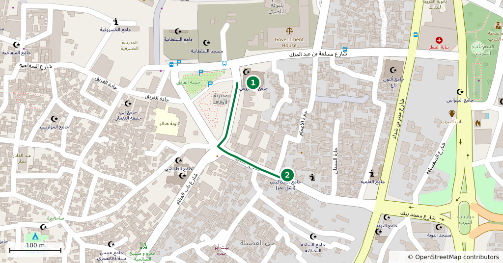
Stops along the route
- 01
- 02
- 03
- 04
- 05
Transparency
- How this was chosen
- The stops and their order were set by hand. The line on the map is real road geometry, not a straight hop between pins; distance and duration belong to that itinerary.
- Facts checked
- September 2026
- Last updated
- September 15, 2026