Ariha and Jabal al-Arbain
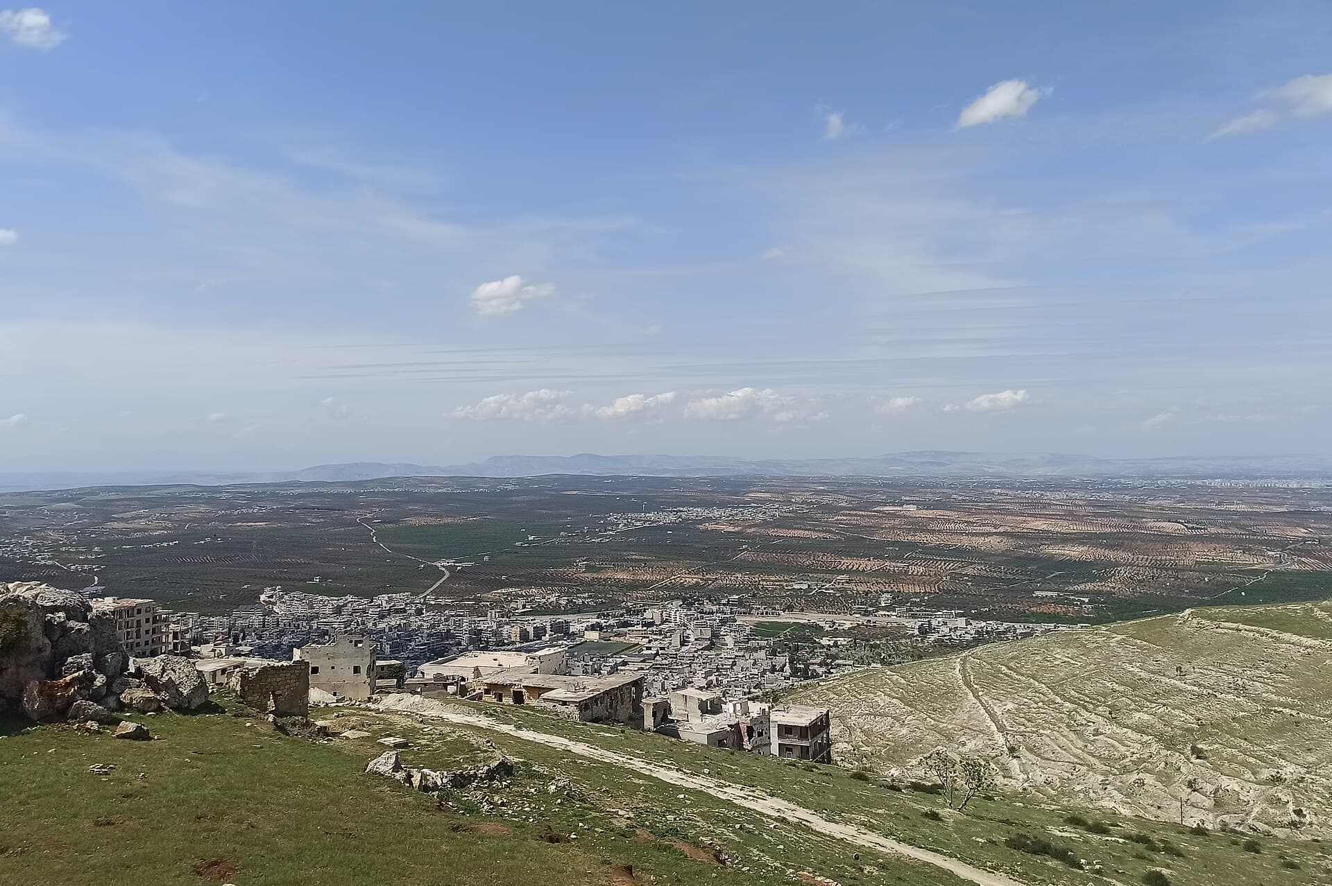
A town south of Idlib where the road turns off for the Dead Cities of Jabal al-Zawiya, known for cherry and fig orchards and the view from 877-metre Jabal al-Arbain.
- Opening hours
- The town at any hour
- Entry
- Free; there is no ticketed site
- Duration
- 120 minutes
- Best time
- Spring and early summer, while the orchards are green; snow on the mountain in winter
- Period
- Roman — Byzantine — Islamic — Ottoman
- Address
- Aleppo–Latakia road, south of Idlib
A town south of Idlib, at the northern foot of Jabal al-Zawiya on the Aleppo–Latakia road, and the centre of Ariha district. It is also called Riha. The road to the Dead Cities of Jabal al-Zawiya, such as al-Bara and Serjilla, turns off here. To the south, 877-metre Jabal al-Arbain looks out over the Idlib plain.
The town’s past
The name is said to mean sweet scent in Aramaic. Under Rome and Byzantium the town belonged to Antioch, and between 240 and 350 it was an important Christian centre. Amr ibn al-As took it in 636 and attached it to the military district of Qinnasrin. In 1226 Yaqut al-Hamawi described it as a small town in the Aleppo region, listing its gardens, orchards and streams and calling it one of the loveliest places on earth.
The earthquake of 1822 hit the town hard. In the mid-19th century Albert Socin recorded a population of about 3000 and a fine setting among olive groves. The 2004 census counted 39501 people.
Khans and fountains
In the early 20th century four khans, merchants’ inns built around a courtyard, stood at the edge of town: Bazar, Suq, Shaybani and Qaysariyya. Seven qastals, public fountains fed by the Ayn springs, supplied the town with water. We could not verify which of them still stand.
What is on Jabal al-Arbain
Jabal al-Arbain, just south of town, is 877 metres high; its traditional name is Jabal Bani Ulaym. It is where local families have long spent the summer. In winter it holds snow, and it is known for its cave. From the slope, the town and the olive-covered Idlib plain lie below you. During the civil war the military posts on the mountain saw heavy fighting in 2014.
What Ariha is known for
Cherry, fig and mahlab orchards; mahlab is the kernel of a wild cherry, used as a spice. The town is regarded as the home of the fig in Syria.
Getting there
Head south from Idlib; the Aleppo–Latakia road runs through town. Jabal al-Arbain is just to the south, and asking in town for the way up is enough. Roads and checkpoints change; check the current situation before you set out.
How long it takes
Two hours for the town and Jabal al-Arbain. A full day with al-Bara and Serjilla.
Don’t miss
The view over the plain from Jabal al-Arbain. From the gardens Yaqut praised to the olive groves Socin saw, the town’s whole story lies below in a single look.
Tips
- Ask in town for the way up Jabal al-Arbain; the plain is best seen from the slope
- The Cave of Blood on Mount Qasioun in Damascus is a different place
- The road to al-Bara and Serjilla turns off at Ariha
- Roads and checkpoints change; ask before you set out
Transparency
- How this was chosen
- Written by hand; opening hours, entry fee and coordinates are kept as data. A field that is not known for certain is marked as variable rather than guessed.
- Facts checked
- September 2026
- Last updated
- September 15, 2026