The Barada River
The water that made Damascus. It rises near Zabadani and enters the city at Rabwa, then splits into six branches that water the gardens of the Ghouta.
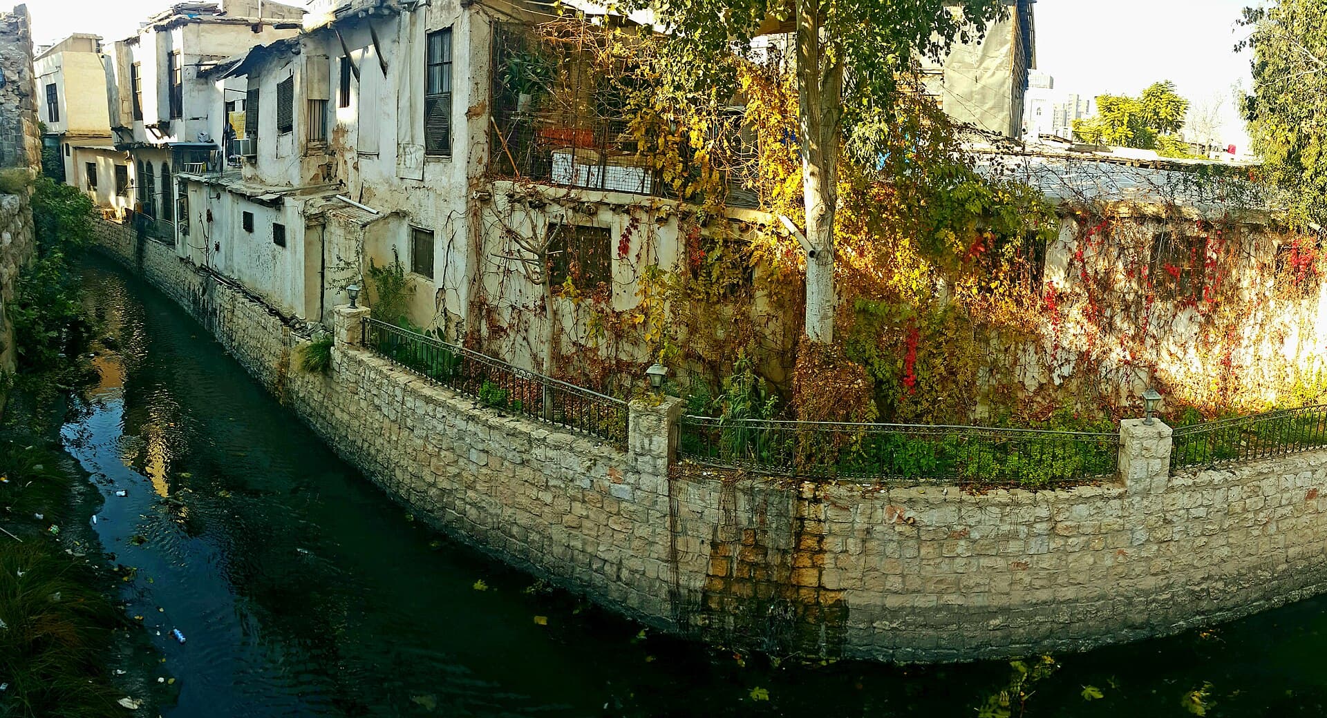
- Opening hours
- Open ground, no set hours
- Entry
- Free
- Duration
- 45 minutes
- Best time
- Spring, when the snowmelt puts water in the bed
- Period
- An irrigation network in continuous use since the Aramaean period
- Address
- The Barada valley and Damascus, from Rabwa to Lake Utayba
If you want to know why Damascus is where it is, the answer is this river. It rises from a karst spring at the foot of Mount Sher Mansur, south-west of Zabadani, above 1100 metres; it cuts the Barada valley and enters the city at Rabwa. Before it gets there it divides into six branches, and those branches water every garden in the Ghouta.
Where the six branches go
On the left the Yazid and the Tora; on the right the Mezzawi, the Dayrani, the Qanawat and the Baniyas. They cross the gorge at Rabwa at different heights and fan out over the city: the highest waters the skirt of Mount Qasioun, the lowest the walled city and its gardens. Those levels decided where the souqs, the bath houses and the courtyard houses of Damascus went.
The name of the city rests on this water
The most common explanation of the name Damascus turns on the sense of a watered place, and this is the water in question. The Arameans built the canals and the distribution network along the river, and every period after them inherited that network and widened it. The river ends to the south-east in Lake Utayba — a river that never reaches the sea and leaves all of its water in one oasis.
What you see today
The bed inside the city is dry for most of the year. What you see is a channel held between walls; it runs when the snowmelt arrives in spring and shows its stones by midsummer. There is no point dressing that up: irrigation in the Ghouta, a growing population and drought keep the water upstream.
Don’t miss
Follow the levels. Rather than standing on a bridge in the old city and looking down at the water, climb north onto the skirt of Qasioun and look back: the line where the branches divide reads across the ground. And then the name. Even where the bed is dry, the water can still be traced through the names of quarters, souqs and bath houses.
Tips
- Don't expect water in the city bed in summer; the flow comes in spring
- Climb the skirt of Qasioun to see the line where the branches divide
- The Ain al-Fijeh and Ghouta entries are two ends of the same water; read all three
Transparency
- How this was chosen
- Written by hand; opening hours, entry fee and coordinates are kept as data. A field that is not known for certain is marked as variable rather than guessed.
- Facts checked
- September 2026
- Last updated
- September 15, 2026