Dehes, the Dead Village That Changed the Debate
On the Jebel Barisha plateau, the village whose excavation changed how the Dead Cities are read: two basilicas, a well-kept baptistery, a stylite relief and presses.
- Opening hours
- Open site, daylight hours
- Entry
- Variable — confirm on arrival
- Duration
- 60 minutes
- Best time
- Spring and autumn, before the summer heat
- Period
- Byzantine
- Address
- Northern plateau of Jebel Barisha, north of Barisha village, Idlib
A Byzantine village on the northern plateau of Jebel Barisha, 606 metres up. Dehes is not a showy place, and that is exactly why archaeologists chose it. Excavations here from 1976 onwards changed the answer to a basic question: who created the wealth of the Dead Cities? Two basilicas stand, along with a well-preserved baptistery, a stylite carved in stone and a large number of olive presses.
Getting there
On the road from Ba’uda to Barisha, a side road turns off to the right one kilometre before Barisha. The ruins are about a kilometre along it. The Bashmishli junction is 2 kilometres to the north-west. Sinkholes full of red earth ring the plateau, and that soil is what made the land fertile. There is no public transport; you hire a car and driver in Idlib or Sarmada. Nothing is signposted.
How long it takes
An hour. That covers the two churches, the presses and the cistern. Add half an hour if you also walk to the monastery of Deir Dehes, 700 metres to the south.
What you see
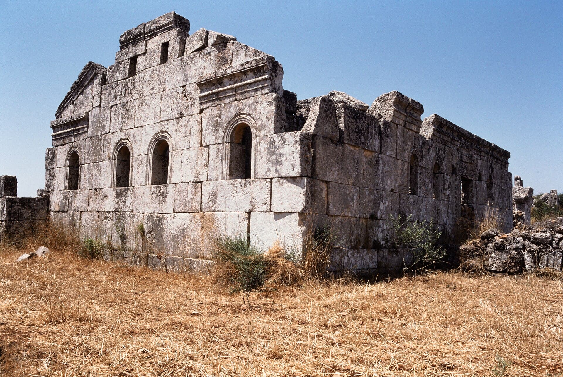
The East Church is a basilica with five openings on each side. In the middle of the nave stands a stone bema, the raised platform where the clergy sat. A baptistery was added later at the south-east corner. According to its inscription it was designed by the architect Yohannan, and it is very well preserved. The church is dated to between the late 5th and the early 6th century.
On the south front, a stylite is carved into the stone beside the east doorway: one of the monks who spent their lives on top of a column. The figure is most likely Saint Simeon. A similar figure appears on the west front of the Church of Qalb Lozeh.
The West Church has four openings on each side and a portico of four columns at its west end. Its east front still stands, with four round-arched windows. Near the church is a house fronted by a two-storey portico.
The rest of the village is plain. There is no wide street, no agora and no andron. Ground-floor rooms have feeding troughs for animals, and there are underground tombs and a barrel-vaulted cistern. Depending on the source, the presses number 22 or 40.
Why Dehes matters
The site has been known since de Vogüé came in 1861. Howard Crosby Butler worked here in 1899/1900, and Georges Tchalenko in 1963 and 1966/67. Tchalenko read the region as an economy built on a single crop, the olive. From 1976, Georges Tate and Jean-Pierre Sodini excavated Dehes for the French Institute of the Near East. Tate chose it on purpose, as a large village with nothing special about it.
The results changed the picture. The houses were not villas but plain farmhouses. No landlord shows up in the village; this was a farming community without masters. Olives were not the only living either: there were livestock, grain and vines. Tate put the golden age between the mid-4th and mid-6th centuries. Jodi Magness, working from the same excavation data, argued that the houses were built in the late 6th and the 7th century. The debate is still open.
The settlement’s own timeline is long. People were here in the Seleucid period, in the 2nd century BC. Around 500 people lived here in the 6th century. The village was abandoned in the 10th century.
How it stands today
The descriptions here rest on excavation reports and on photographs in the Dumbarton Oaks archive. We found no verified record of the site’s condition after the war years. During the war, displaced families took shelter in the Dead Cities of Jebel Barisha; if anyone is on the site, call out, and do not photograph people without asking.
Don’t miss
The stylite on the south front of the East Church. Most visitors head straight for the baptistery and walk past this figure beside the east doorway.
Tips
- The stylite relief is on the south front of the East Church, beside the east doorway
- The baptistery is at the south-east corner of the East Church
- The monastery of Deir Dehes is 700 metres south
- Nothing is signposted; tell the driver about the right turn one kilometre before Barisha
Transparency
- How this was chosen
- Written by hand; opening hours, entry fee and coordinates are kept as data. A field that is not known for certain is marked as variable rather than guessed.
- Facts checked
- September 2026
- Last updated
- September 15, 2026