Deir Turmanin, the Facade That Went Missing
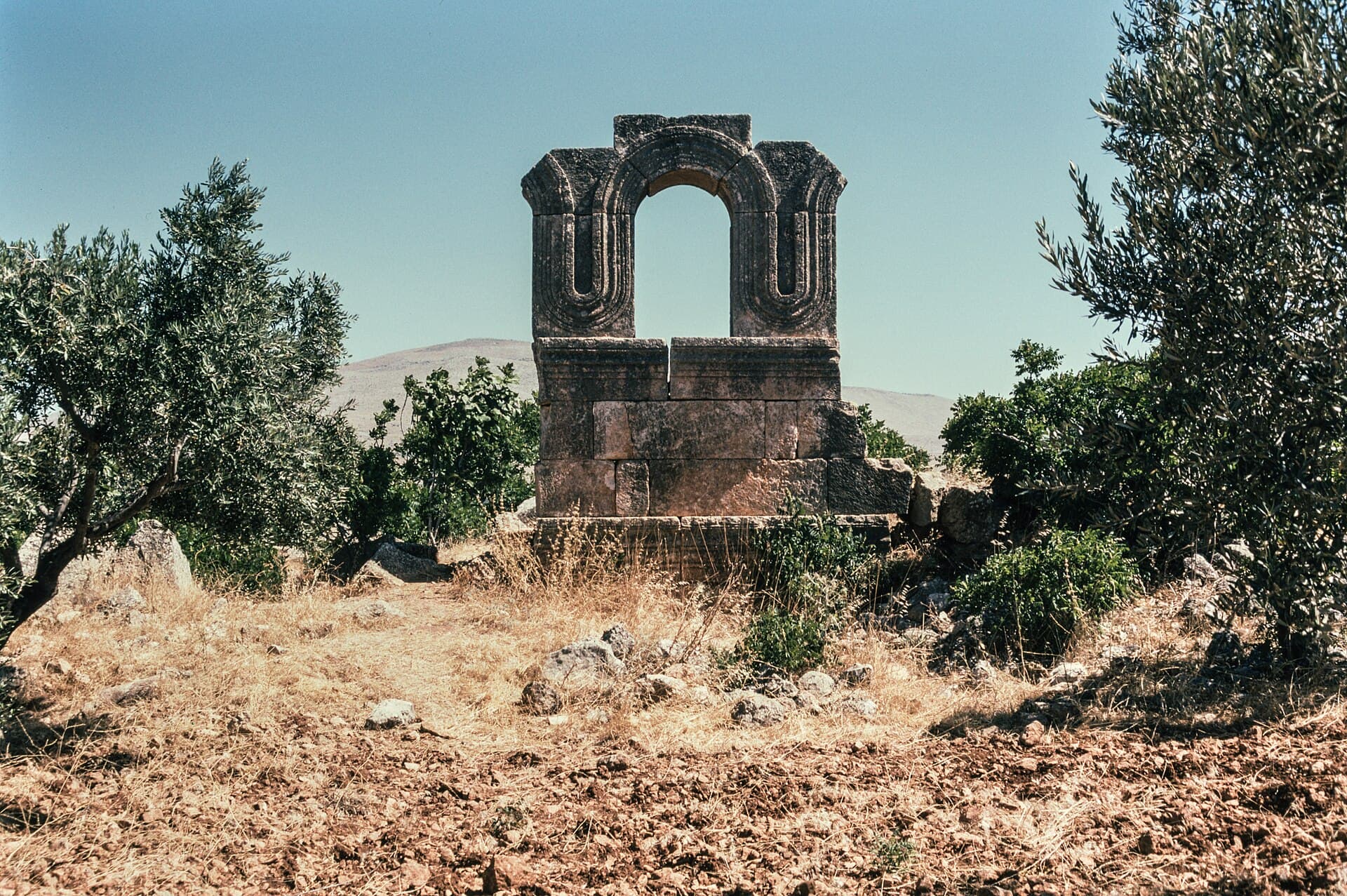
Built around 480, its twin-towered front was the most copied face in the Dead Cities. A single fragment of it is left today, standing in an olive grove.
- Opening hours
- Open site, daylight hours
- Entry
- Variable — confirm on arrival
- Duration
- 45 minutes
- Best time
- Spring, while the fields are green and before the heat
- Period
- Byzantine
- Address
- North-east of Turmanin town, Dana subdistrict, Harem district, Idlib
A monastery ruin north-east of the town of Turmanin, out among the olive groves. The basilica here was built around 480 and its facade fed the church architecture that came after it: two towers, a colonnaded stage between them above the doorway, the towers three storeys high under gabled roofs. That front is no longer standing. One fragment of it is left among the olive trees — a single stone whose mouldings and arched window carry the scale of the whole building.
Getting there
North of Idlib. Al-Dana and Sarmada lie to the south-west, Daret Azza to the north-east, Atarib to the south. The ruin is north-east of the modern town, out in the fields; there is no public transport, so you hire a car and driver in Idlib or Sarmada. The driver has to know the ruin, not just the town.
How long it takes
Forty-five minutes. The site is small and scattered: the facade fragment, the walls of the dormitory block, the courtyard and the cisterns all sit within a few hundred metres.
What you see
The monastery buildings were ranged around a paved courtyard. In the courtyard are two cisterns, a sarcophagus and several tombs. The long wall of the dormitory block is standing, its upper-floor windows readable in a row; from below you can see the plain through it. Of the church itself, what remains is essentially that one piece of facade.
The monastery was not only a place of worship. The sources describe it as a hospice as well, known for its care of the dying. Evidence on the ground shows the monks farmed and kept livestock. The basilica was most likely paid for by wealthy patrons.
Why it matters
The lost facade is one of the heavier faces in the architectural history of the region. You can see the same arrangement — two towers with a wide opening between them — still standing at the church of Qalb Lozeh, and the same scheme surfaces in Europe centuries later. The Turmanin front is known from drawings; the engraving in the 1911 edition of the Britannica is one of them.
How it stands today
Turmanin lies within the spread of Dead Cities on the limestone plateau between Aleppo and Idlib. In 2011 UNESCO inscribed forty of those villages, grouped into eight archaeological parks, on the World Heritage list as the Ancient Villages of Northern Syria. The ruin sits among worked fields with a living town around it; keep off the crops and do not photograph people without asking. Displaced families sheltered in the Dead Cities during the war years; do not enter a building someone is living in. Unexploded ordnance is a reported hazard in rural Idlib: stay on the path, keep out of collapsed buildings, and do not touch metal lying on the ground.
Don’t miss
The mouldings on the lower part of the facade fragment. The arched window above takes the photograph, but what shows you how the stone was worked is the run of profiles beneath it, and you have to walk right up to see them.
Tips
- Describe the ruin north-east of the town to your driver, not just the town
- Walk right up to the facade fragment; the lower mouldings only read from close
- Look out over the plain through the dormitory wall
- The ruin sits among worked fields; keep off the crops
Transparency
- How this was chosen
- Written by hand; opening hours, entry fee and coordinates are kept as data. A field that is not known for certain is marked as variable rather than guessed.
- Facts checked
- September 2026
- Last updated
- September 15, 2026