The Gadara Aqueduct (Qanat Fir’awn)
A Roman aqueduct from a dam at Dilli through Daraa to Gadara in Jordan, with the longest known tunnel of the classical world. What survives on the Syrian side.
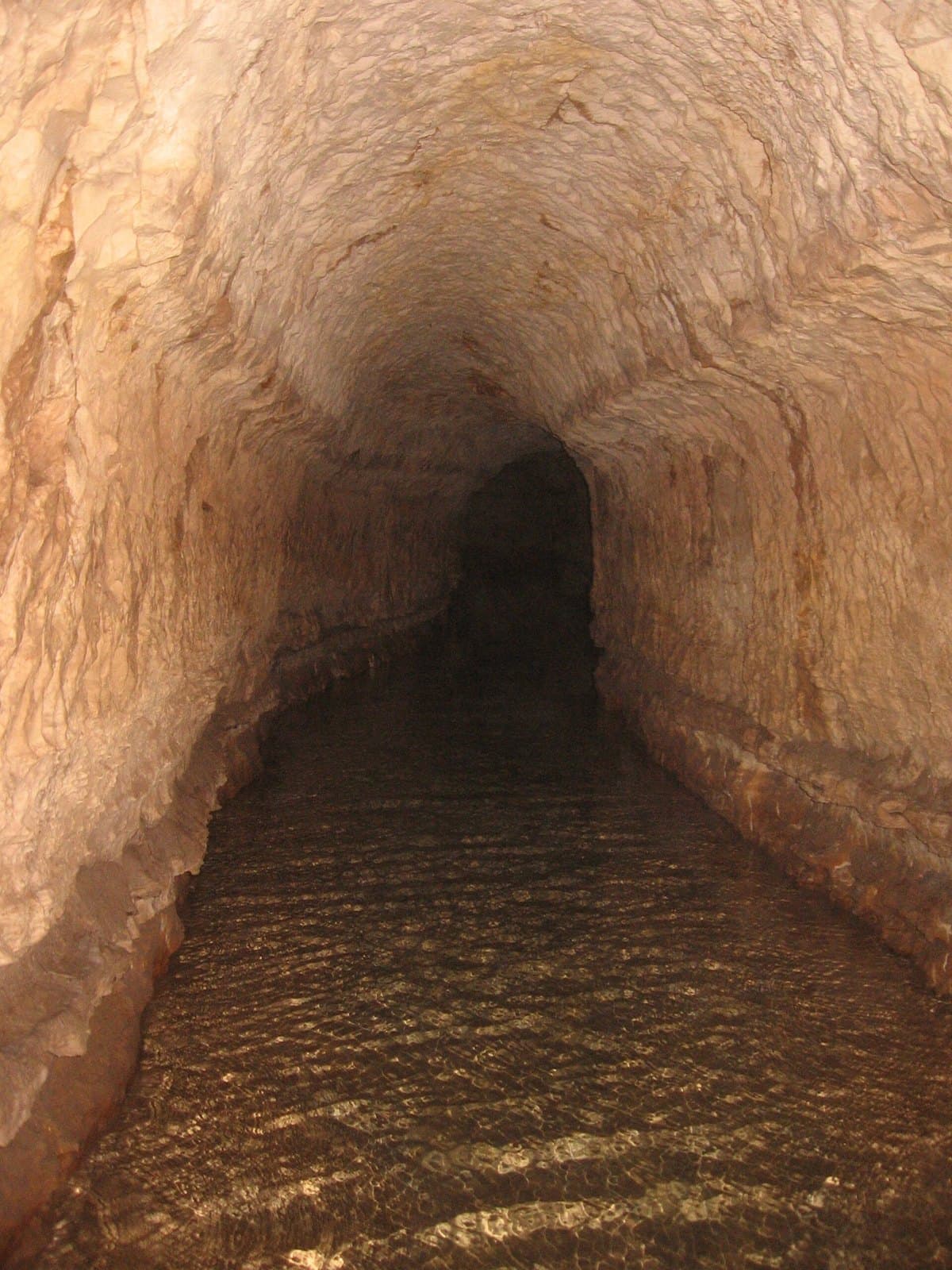
- Opening hours
- A line across open country; no visiting arrangements
- Entry
- No ticket for the line; access to dam sites to be confirmed locally
- Duration
- 60 minutes
- Best time
- Spring, while the plain is green
- Period
- Roman
- Address
- Dilli (north of al-Shaykh Maskin) — Daraa — Jordanian border; no single address
The Roman aqueduct that supplied three cities of the Decapolis, the league of Roman cities in the region: Adraa (modern Daraa), Abila and Gadara (Umm Qais in Jordan). Locally it is called Qanatir Fir’awn or Qanat Fir’awn, Pharaoh’s Watercourse. The longest known tunnel of the classical world is on this line. There is no single place to visit: the aqueduct is not a building but a line running from the Hauran plain into the hills of northern Jordan. This page centres on the Syrian section, where the present condition of the remains has not been verified.
The route
The aqueduct starts in Syria at a Roman dam at Dilli, about 7 kilometres north of al-Shaykh Maskin. From there it crosses several valleys on bridges 5-10 metres high. The Arabic source traces the Syrian route from the plain between Inkhil and Fuqay, through al-Shaykh Maskin, to “Hammam al-Malika” in Daraa. East of Adraa there was a 35-metre bridge; its remains now lie on the site of the new Saad Dam on the eastern edge of Daraa. After a junction with a side channel from the Muzayrib lake, the underground section begins.
How the tunnel was built
A section of more than 106 kilometres was dug using the qanat technique, a channel underground reached from the surface by shafts. Here nearly all the shafts slope at 45-60 degrees and have stairs inside leading down to the channel. In the tunnel section the gradient is about 20 centimetres per kilometre. The best-preserved and most studied part of the tunnel is on the Jordanian side.
Who followed it
The first Western traveller to ride along the line was U. J. Seetzen in 1805. The fullest study covering both the Syrian and Jordanian sections is Mathias Döring’s book of 2016. In the 19th century Wetzstein (1860) and Schumacher (1896) described an underground city beneath Adraa linked to the aqueduct; there is no trace of it today, and modern commentary treats it as a misreading.
What survives in Syria
In recent decades more than 3 kilometres of the surviving substructure on the plain between Dilli and Daraa has been demolished. No map objects were found for the Dilli dam or the bridge remains, and their present condition has not been verified. For anyone tracing the line, the most concrete point of reference is the Saad Dam site east of Daraa; what can be seen there needs to be asked locally.
What not to miss
The logic of the line. The flat plain you cross between Daraa, Muzayrib and al-Shaykh Maskin is the ground over which Roman engineers moved water on a gradient of 20 centimetres per kilometre. Following that distance on a map or on the road shows the scale of the aqueduct better than any single ruin.
Tips
- Do not expect a single site; the aqueduct is a line and its remains are scattered
- Ask permission before entering the Saad Dam site east of Daraa; the bridge remains are there
- The well-preserved tunnel sections are on the Jordanian side
- Muzayrib lake is where the side channel joined the main line, a good stop for understanding the route
Transparency
- How this was chosen
- Written by hand; opening hours, entry fee and coordinates are kept as data. A field that is not known for certain is marked as variable rather than guessed.
- Facts checked
- September 2026
- Last updated
- September 15, 2026