From Daraa to the Yarmouk edge: a day trip to Tafas, Muzayrib and Tell Shihab
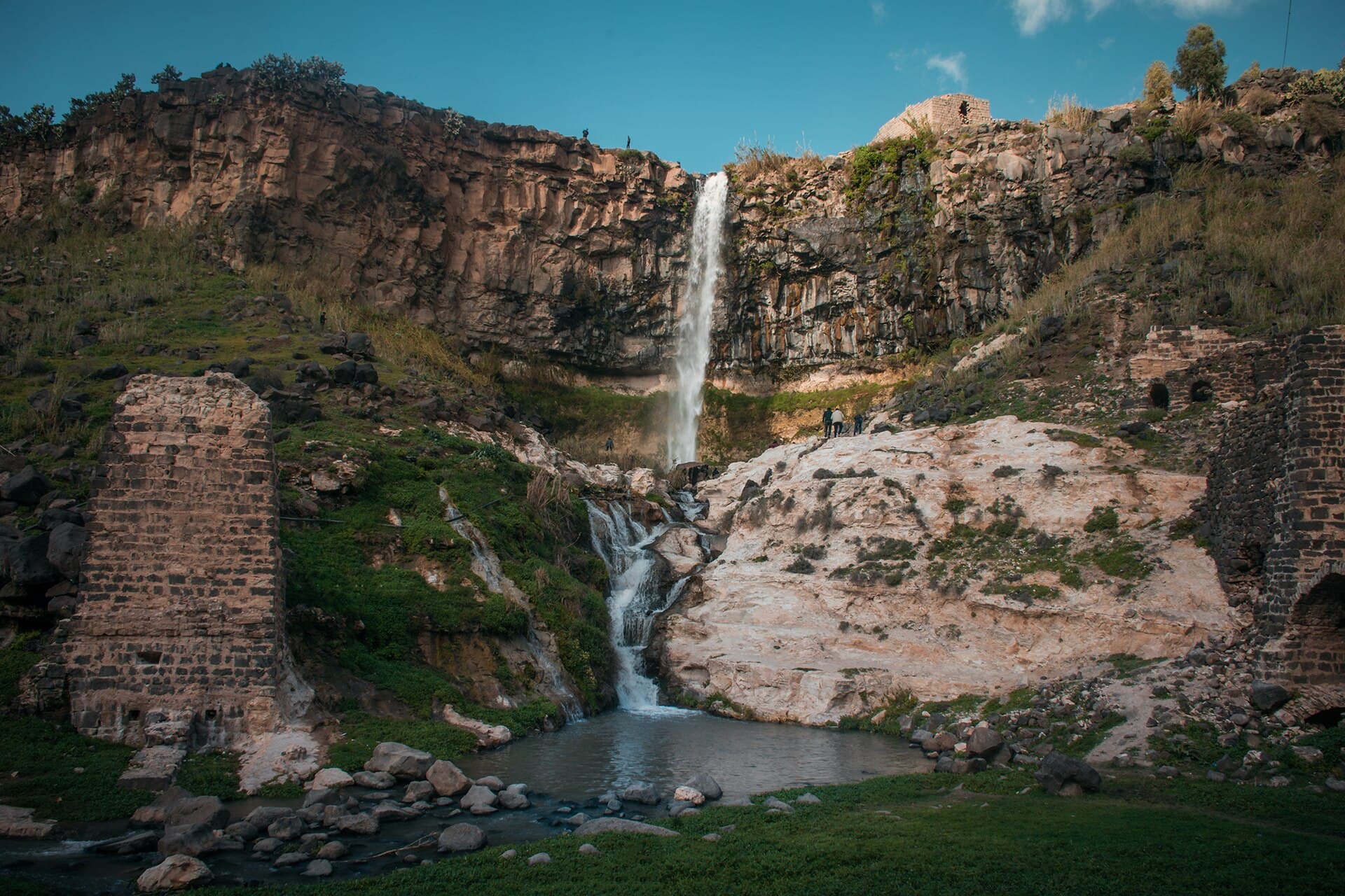
A day in rural western Daraa: Tafas’s old mosque, the Dion candidate Tell al-Ash’ari, the Hajj stop of Muzayrib and the Tell Shihab falls. 55 km, border area.
- Duration
- 8.5 hours
- Distance
- 54.5 km
- Difficulty
- Moderate
- Best season
- March–May, October
- stops
- 5
- City
- Daraa
A day in the countryside west of Daraa, down to the edge of the Yarmouk basin. Tafas has an old mosque built with Roman and Byzantine pieces. The mound of Tell al-Ash’ari is one of three proposed sites for Dion, a city of the Decapolis. Muzayrib was the first major stop of the Ottoman pilgrim caravan, and Tell Shihab sits on the Jordanian border with a waterfall that runs all summer. The round trip is about 55 kilometres, but village roads are slow and close to two and a half hours are spent driving. The route runs right down to the border strip, where the security situation changes from week to week. The plan below does not say you can go; it says how to see the area when you can.
The route
Start at the Omari Mosque in Daraa al-Balad; the last stretch into the quarter is on foot. Head north-west to Tafas, 19 kilometres. The old mosque is in the town centre and is not marked on maps, so ask there. From Tafas go west to Tell al-Ash’ari, 6 kilometres; the mound sits on the rim of the Yarmouk valley and its west side drops away in a deep slope. From the mound head south to Muzayrib on its lake, 5 kilometres. Tell Shihab lies 7 kilometres to the south-west, on the border. The drive back to Daraa is 17 kilometres.
Timing
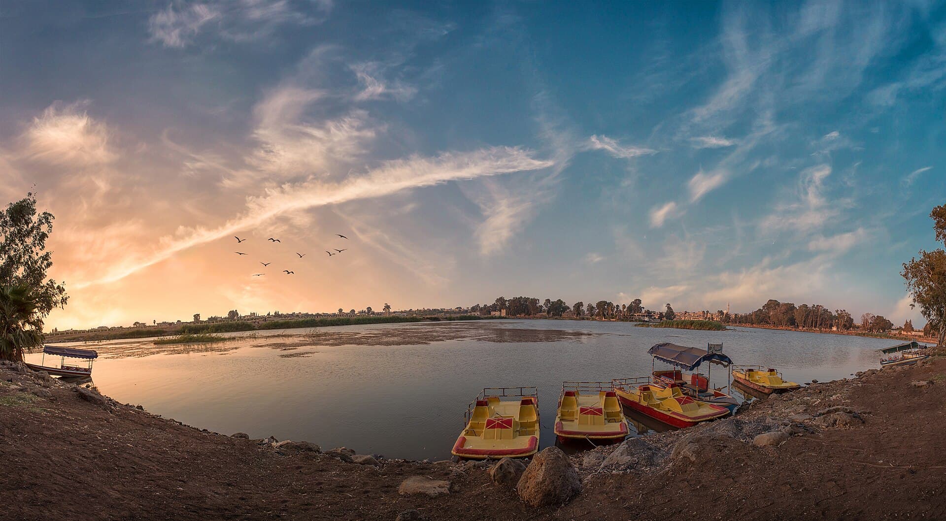
Be at the Omari Mosque at 08:00, when the courtyard is empty. Leave for Tafas at 09:00. Enter the mosque outside prayer times and look for Byzantine crosses in the stones of the houses; an hour is enough. Be at Tell al-Ash’ari around 10:30. There is no shade on the mound, so finish before noon. Drive down to Muzayrib at 12:00 and have lunch by the lake; the fort remains and the basalt blocks in house walls take an hour and a half. Move on to Tell Shihab at 14:30, where the walk down to the foot of the falls and back takes 50 minutes. Head back to Daraa at 16:30. Do not be caught in the border area after dark. If Tell Shihab is out of reach, the day ends by the lake at Muzayrib.
Take care
This route was not written because it is safe today. Daraa province saw armed incidents throughout 2025 and 2026, cross-border military operations continue in the western countryside, and in August 2026 artillery fire fell around Abdin. Tell Shihab is in the border strip, where military zone rules can change: do not go there without confirming the current situation locally, and end the route at Muzayrib instead. Access to Tafas and Tell al-Ash’ari has not been confirmed either. The mound was looted during the war years; keep out of excavation pits and tomb openings. Unexploded ordnance remains a risk in Daraa al-Balad and in ruined buildings, so stay on streets and paths. The path down to the falls is slippery when wet. Keep your passport with you at checkpoints.
The route on a map
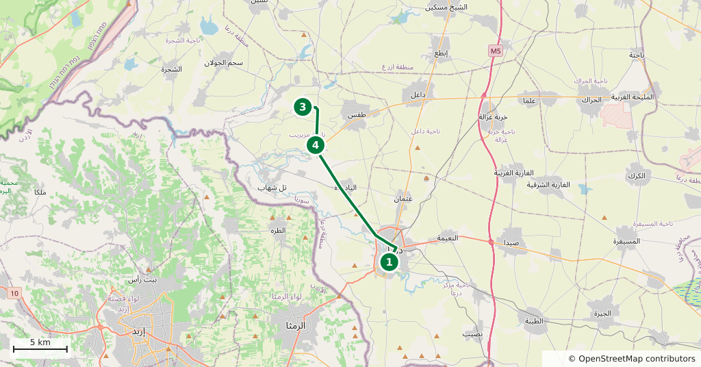
Stops along the route
- 01
- 02
- 03
- 04
- 05
Transparency
- How this was chosen
- The stops and their order were set by hand. The line on the map is real road geometry, not a straight hop between pins; distance and duration belong to that itinerary.
- Facts checked
- September 2026
- Last updated
- September 15, 2026