The Citadel of Hama
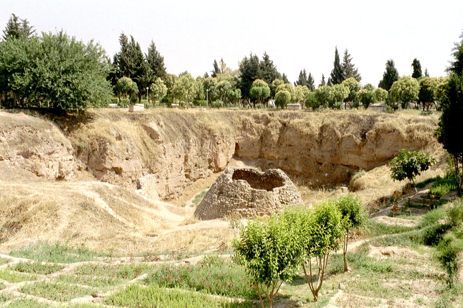
The mound on the west bank of the Orontes is where Hama began. Of the fortress only stone facing and excavation trenches remain; the top is now a park.
- Opening hours
- Daylight hours — the summit is used as a public park
- Entry
- Free
- Duration
- 45 minutes
- Best time
- Towards sunset; the river line and the waterwheels come into view together
- Period
- Seleucid — Zengid — Ayyubid — Mamluk; pulled down in 1401
- Address
- West bank of the Orontes, city centre, Hama
A mound rising in the middle of the city, on the west bank of the Orontes. It is called a citadel, but no citadel stands: the summit has been planted with trees and is used as a public park. This mound is where Hama began. Excavation counted 13 archaeological layers here, the oldest reaching the fifth millennium BC and the most recent the Mamluk period. In the first millennium BC the hill was the seat of the Aramaean kingdom of Hamath, which gave the city its name.
Getting there
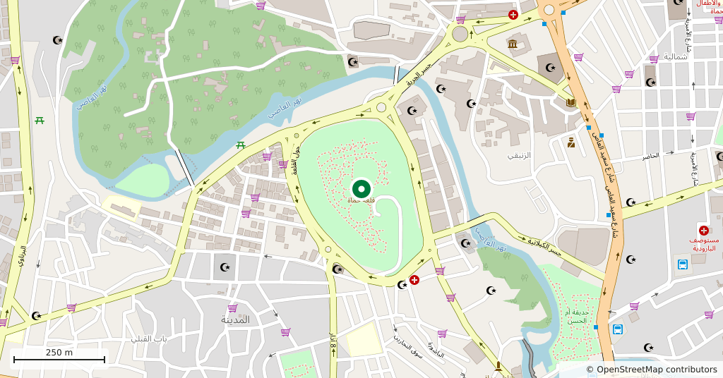
On foot from the city centre. The Azm Palace and the big norias lie about 400 metres east of the mound, along the river; finish the riverside walk, turn west and you are at the foot of the hill. A stone retaining wall and a paved square wrap around the slope, and the climb starts there.
Where the castle went
The Seleucids raised the first stronghold on the summit, when the city was called Epiphaneia. After Rome it changed hands with the conquest of Abu Ubayda ibn al-Jarrah, then passed in turn to the Qarmatians, to the Mirdasids of Aleppo and to the Zengids. The earthquake of 1157 brought the fortress down; Nur al-Din Zengi rebuilt it and strengthened the city walls. Under the Ayyubids it was held by Shihab al-Din Mahmud, an uncle of Saladin. The Mongols destroyed it in 1258 and Baybars rebuilt it. In 1401, as Timur marched into Syria, the notables of the city carried out the keys and asked for quarter; quarter was granted, but the citadel was ordered pulled down. Under the Ottomans it lost any military value and nothing of the building survived.
How long it takes
Forty-five minutes. That covers the climb, a circuit of the flat top and a stop at the view. There is no interior to visit; what this place offers is a section through the city’s past and a vantage point.
What you see
The mound itself, first of all: what remains of the citadel is the stone facing around the slope, still exposed in places. On top are the trenches opened between 1931 and 1938 by the Danish expedition under Harald Ingholt — cut earth faces, the lines of foundations, the odd stretch of wall. Pines and cypresses were planted between and around them, so what you walk through sits somewhere between an excavation site and a park. The dig turned up a stairway flanked by basalt lions and an altar; some of the lion fragments are now in the National Museum of Denmark in Copenhagen.
Do not miss
The view north from the top. The line of the river, the norias and the Abu al-Fida Mosque on the far bank all fall into one frame — this is the spot that explains the plan of Hama in a single look.
Tips
- Do not expect a standing castle: what is left is the stone facing around the mound and the trenches on top
- At the top turn north — the river, the norias and the Abu al-Fida Mosque in one frame
- The Azm Palace and the big wheels are 400 metres east; string all three into one walk
- The dig's basalt lions are not here — some fragments are in the National Museum of Denmark in Copenhagen
Transparency
- How this was chosen
- Written by hand; opening hours, entry fee and coordinates are kept as data. A field that is not known for certain is marked as variable rather than guessed.
- Facts checked
- September 2026
- Last updated
- September 15, 2026