Khirbet Hass, a Dead City in Southern Jebel Zawiya
Beside the town of Hass on Jebel Zawiya: six churches, a hall with a Doric-colonnaded court, a courtyard villa and a two-storey pyramid tomb of the 6th century.
- Opening hours
- Open site, daylight hours
- Entry
- Variable — confirm on arrival
- Duration
- 60 minutes
- Best time
- Spring, before the grass dries and while the stones are easy to pick out
- Period
- Roman — Byzantine
- Address
- Beside the town of Hass, Maarat al-Numan district, Idlib
A scattered ruin field in the south of Jebel Zawiya, right beside the town of Hass at 630 metres above sea level. Among the stones are six churches of the Roman and Byzantine periods, a large building with a courtyard ringed by Doric columns, and a two-storey, pyramid-roofed tomb of the 6th century. The site is listed as a component of the Ancient Villages of Northern Syria, a UNESCO World Heritage property.
Getting there
It lies in Maarat al-Numan district. Kafr Nabl is west of Hass, Kafr Ruma and Maarat al-Numan are east, and Al-Bara is north. There is no public transport; hire a car and driver in Maarat al-Numan. Neighbouring ruins in the area have names that get mixed up: Shinsharah and Rabia are separate places. Settle with the driver at the start which ruins you mean.
How long it takes
An hour. The remains are spread out, so the walk takes longer than it looks. Al-Bara is to the north and can join the same day.
What you see
The churches. One of the six measures about 20 metres by 13 metres, and its nave takes up almost half the width. Its floor had a mosaic with peacocks. We found no record of whether the mosaic is still in place.
The courtyard building. A large public building with a rectangular courtyard surrounded by Doric columns.
The tomb. A two-storey, pyramid-roofed tomb of the 6th century carried on Corinthian columns; the town of Hass lies just north-west of it. It is counted among the square pyramid tombs of Jebel Zawiya, with those at Al-Bara, Ba’uda and South Dana.
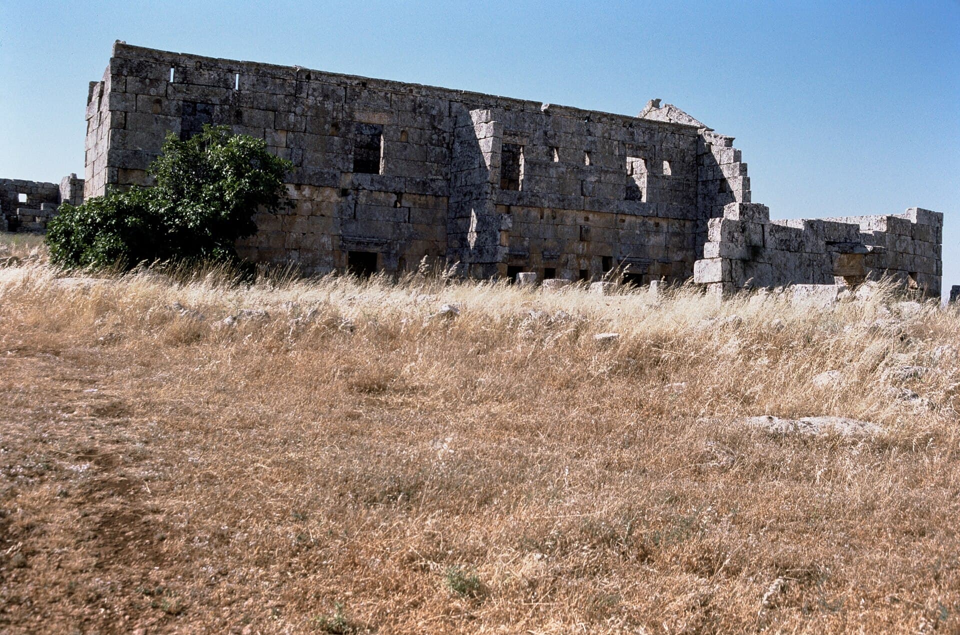
The courtyard villa. The building the Dumbarton Oaks archive photographed most. It has a central courtyard, walls and columns along the courtyard’s east side, and long north and south fronts still standing. Most doorways have flat stone lintels. In the distance, at the far end of the plain, the ruins of a monastery are visible.
The French Ifpo archive holds a vertical aerial photograph of the site taken in 1933, one of the early records that show the spread of the ruins from above.
Don’t miss
A cross carved in relief at the north-west corner of the villa’s west front. You cannot make it out from a distance; you have to walk up to the corner.
Tips
- Shinsharah and Rabia are neighbouring but separate ruins; make sure the driver takes you to Khirbet Hass
- Walk to the north-west corner of the villa's west front; the relief cross is there
- The ruins are spread out; wear sturdy shoes and carry water
- Stay on cleared paths; ask locally about unexploded ordnance from the war in the countryside
Transparency
- How this was chosen
- Written by hand; opening hours, entry fee and coordinates are kept as data. A field that is not known for certain is marked as variable rather than guessed.
- Facts checked
- September 2026
- Last updated
- September 15, 2026