Sa’neh Roman Fort
A square Roman frontier fort with 12 towers at 1365 metres east of Jabal al-Arab: basalt walls up to 3 metres high, planned in 1990 and never excavated.
- Opening hours
- Open ground; current access not confirmed
- Entry
- No known ticket office
- Duration
- 60 minutes
- Best time
- Spring or autumn; there is no shade on the high plateau
- Period
- Roman
- Address
- East of the hamlet of as-Sa'na, al-Mushannaf subdistrict, Suwayda governorate
A square fort that held the eastern frontier of the Roman Empire, east of Jabal al-Arab where the basalt desert begins. Each side runs 87 metres, and the walls, of neatly cut basalt blocks, still stand up to 3 metres high. With its 12 rounded projecting towers, two gates and a main street splitting it in two, the plan still reads clearly from the ground. Between the 2nd and 5th centuries the fort was a link in the frontier line known as the Limes Arabicus, and it has never been excavated.
Where is it?
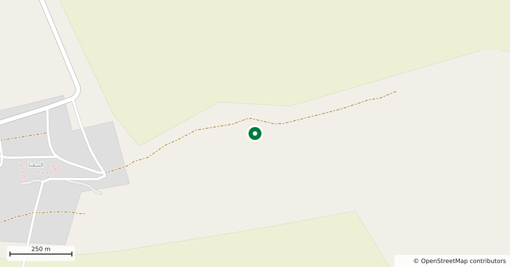
About 13 kilometres east of the 1803-metre summit of Jabal al-Arab, at an altitude of 1365 metres. Bosra lies 48 kilometres to the south-west. The fort stands east of the present-day hamlet of as-Sa’na, whose houses are about 900 metres to the west. Just south of it the ground drops into a wadi canyon. That wadi joins another three and a half kilometres to the east, and from here the fort controlled the head of the east-west road towards Namara. The next link to the north is Diyatheh Roman Fort, 10 kilometres away; to the south the line continues with further forts.
What is the plan?
The fort is a square with sides of about 87 metres, its main axis running from south-south-west to north-north-east. The curtain wall is more than two metres thick. Four of the 12 towers stand at the corners. Each of the two gates is flanked by a pair of gate towers, and the north and south walls carry two intermediate towers each. There are gates only in the east and west walls, with openings of about 4 metres. The main street linking them is just over eight metres wide and divides the fort in two. The headquarters building, the principia, stood in the northern half. North-east of the fort, visible from the air, lies a large civilian settlement, possibly walled; the Romans called such fort villages a vicus.
What was it called?
Most likely Sounoa. The name appears in a Greek inscription. Another inscription, found in a village nearly 3 kilometres south of the fort, mentions Sountha. No military inscription from after the middle of the 5th century has been found at the fort.
Who studied it?
Johann Gottfried Wetzstein, the Prussian consul in Damascus, came in 1858. He took the fort for the palace of an unknown dynasty, found its north-east square full of the finest almond trees, and saw two Greek inscriptions beside the village mosque, one of them a soldier’s epitaph. Maurice Dunand was the first to suggest, in 1931, that the building was a Roman fort. Antoine Poidebard published two aerial photographs in 1934. The French researchers Bauzou and Broise relocated the site in October 1989. Lenoir drew the plan in June 1990, and it was corrected in October 1990 by Broise, Jolivet and Braemer.
What not to miss
The main street between the two gates. Walking straight from the east gate to the west gate is the easiest way to read the 87-metre square, the paired towers beside each gate and the headquarters half to the north. Where the walls still stand up to 3 metres, the work on the cut basalt blocks shows up close.
Current situation and access
The fort lies in the eastern countryside of Suwayda governorate, and current access could not be confirmed by any source published in the last 12 months. The governorate has been caught up in armed conflict since July 2025. On 23 August 2026 the newspaper Al-Watan reported that the Damascus–Suwayda road had been cut at the Umm al-Zaytoun checkpoint. On 2 and 10 September 2026 Snack Syrian wrote that entry to and exit from the governorate were effectively restricted. This page describes what the fort is; it does not say the site can be visited today. Anyone thinking of going should first check the current situation with official sources.
Tips
- Before setting out, check with official sources whether the Damascus–Suwayda road and the governorate entry are open
- Look at the flat ground north-east of the fort too; the civilian settlement seen from the air lies that way
- Think of it together with Diyatheh Roman Fort; the two are links 10 kilometres apart in the same frontier chain
Transparency
- How this was chosen
- Written by hand; opening hours, entry fee and coordinates are kept as data. A field that is not known for certain is marked as variable rather than guessed.
- Facts checked
- September 2026
- Last updated
- September 15, 2026