Tell Sabi Abyad
Four mounds in the Balikh valley north of Raqqa: Syria’s oldest known pottery, a burnt village full of seal impressions, and a Middle Assyrian fort on top.
- Opening hours
- Open excavation site; whether it is open to visitors could not be confirmed
- Entry
- Variable — confirm on site
- Duration
- 60 minutes
- Best time
- A spring morning, when the valley is green and the mounds stand out from the fields; summer middays are very hot
- Period
- Neolithic (7500–5500 BC), Halaf; Middle Assyrian (13th–12th century BC)
- Address
- Balikh valley, Tell Abyad district; about 30 km from the Turkish border
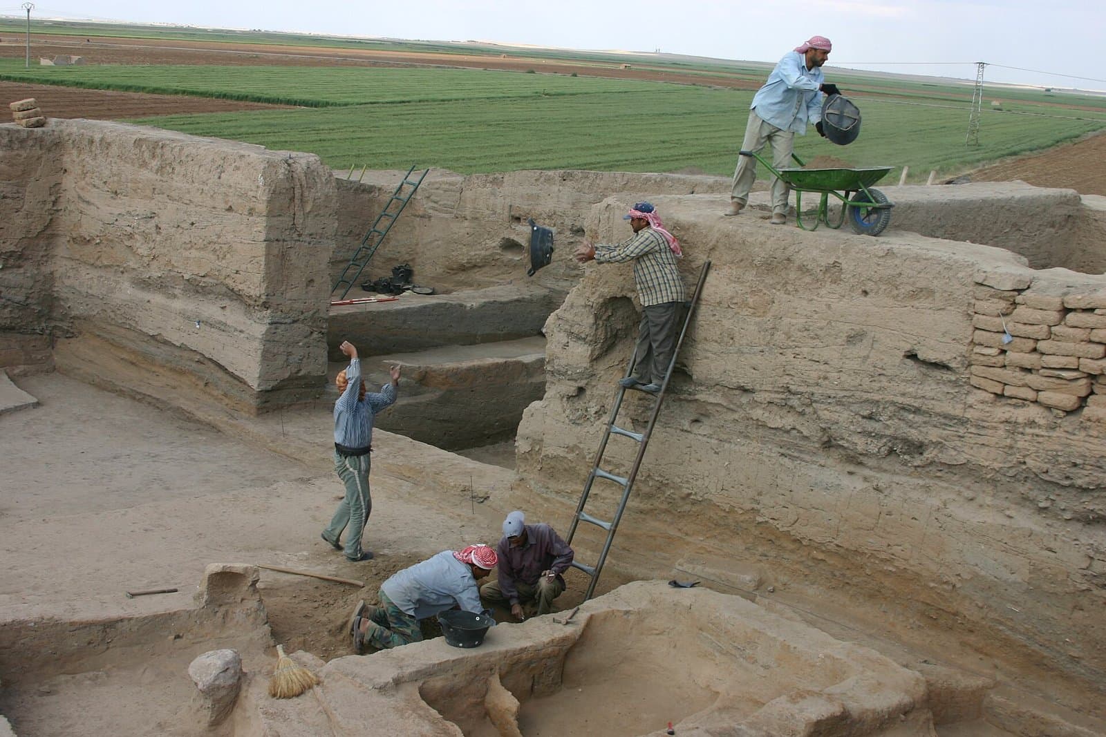
Tell Sabi Abyad is an excavation site of four mounds strung north to south along the Balikh valley, in the north of Raqqa province. Between 7500 and 5500 BC the village moved back and forth between these rises, and the oldest pottery known in Syria was made here around 6900-6800 BC. Thousands of years later, in the 13th century BC, a Middle Assyrian fort went up on top of the Neolithic village. What a visitor sees is trenches and the shape of the mounds. The finds are in museums.
Where it is and getting there
The mounds lie in the valley of the Balikh river, about 30 kilometres from the Turkish border. The neighbouring mound of Tell Hammam et-Turkman is 2 kilometres to the south-west, and both fit into one trip. The site is in Tell Abyad district, a border strip that has changed hands several times since October 2019. Which road reaches the site today, and whether there is a guard, could not be confirmed. Ask in Raqqa before setting out.
Four mounds, two thousand years
The main mound, Tell Sabi Abyad I, measures about 240 by 170 metres and rises 10 metres. Tell Sabi Abyad II is smaller, 75 by 125 metres, and older: 7550-6850 BC. Mound IV has never been dug. It is the village cemetery today. For two thousand years the village did not stay on one hill but shifted from rise to rise. That is why one valley holds four separate traces of it.
Excavation began in 1986 under Peter Akkermans of Leiden University and continued in stages until the war: seasons in 1988, 1991-1992, 1994-1999 and 2001-2003, then soundings in 2005 and 2010.
What was found
The first pottery dates to around 6900-6800 BC, and some of it is painted. Around 6700 BC it went into series production. The odd part: the early painted wares were then dropped, and paint only came back around 6200 BC. The same date marks another break in village life. Storehouses, round buildings known as tholoi, and seals appear. Researchers link the change to the cooling event of 8200 years ago.
The economy rested on herding, mostly goats, and on emmer wheat, einkorn, barley and flax. The dig turned up more than 1000 sling balls of unfired clay.
Do not miss: the Burnt Village
What put Sabi Abyad into archaeology textbooks is a village layer that burned. In this Burnt Village, dated to around 6000 BC, stood an archive building. It held more than 275 seal impressions made by at least 61 different seals, along with counting tokens. It is the largest group of seals and tokens found at any single settlement. Thousands of years before writing, people here were recording in clay who had put what into storage. Publications disagree on the date; some place the same layer around 5200 BC.
The Assyrian fort on top
In the Late Bronze Age a Middle Assyrian fort of 23 by 21 metres was built on the summit, over an older Mitanni tower. It had eight rooms, mud-brick walls two and a half metres thick and a staircase to an upper floor. More than 400 cuneiform tablets from the 13th and 12th centuries BC came out of it. The building ended in a fierce fire some time after 1180 BC.
The site today
The war stopped the excavations. In 2014 Akkermans announced that the site and the dig storehouses had been looted. The mound carries damage from the war and from construction. How much of the trenches remain open, and whether the site is protected, could not be confirmed.
Tips
- Ask in Raqqa about the border-area road and the state of the site before setting out
- Add Tell Hammam et-Turkman to the same trip: 2 km to the south-west, the large hill you see from afar
- Mound IV is the village cemetery; do not walk over it
- Keep back from the trench edges; unmaintained mud-brick sections can collapse
Transparency
- How this was chosen
- Written by hand; opening hours, entry fee and coordinates are kept as data. A field that is not known for certain is marked as variable rather than guessed.
- Facts checked
- September 2026
- Last updated
- September 15, 2026