Khirbet al-Umbashi
A Bronze Age herders’ village in the black lava desert 36 kilometres east of Shahba: over 100 hectares, a walled quarter, a dam and a disputed great burning site.
- Opening hours
- Open ground; current access not verified
- Entry
- No known ticket office
- Duration
- 120 minutes
- Best time
- Spring or autumn; in summer the lava field heats up and there is no shade
- Period
- Early and Middle Bronze Age
- Address
- 36 kilometres east of Shahba, as-Sura as-Sughra subdistrict, Suwayda province
A Bronze Age settlement lies among the lava flows east of Jabal al-Arab, 36 kilometres east of Shahba. The site covers more than 100 hectares at 670 metres above sea level. The village was founded in the 4th millennium BC or at the start of the 3rd, and its people lived mainly from livestock, with little farming. It was abandoned in the middle of the 2nd millennium BC, for reasons still unknown. With its stone houses, wall, dam and cemeteries, it is one of the best-documented places for herding life in the “black desert”, the basalt country of southern Syria.
Where it is
80 kilometres south-east of Damascus, in the as-Sura as-Sughra subdistrict of Shahba. The Tulul as-Safa lava field lies to the north and east, the Ard al-Kiraa flows to the south-east and the Wadi Mas’ad to the west. The site is on the edge of the Badia, the Syrian steppe, in empty lava country with no village or roadside services nearby. The sources place it at points hundreds of metres apart and the site is very large, so this page carries no map.
How long it takes
Two hours. Most of that goes on walking from the scattered houses in the north to the walled part in the south and the remains of the dam to the west; the ground is lava rock the whole way.
What to see
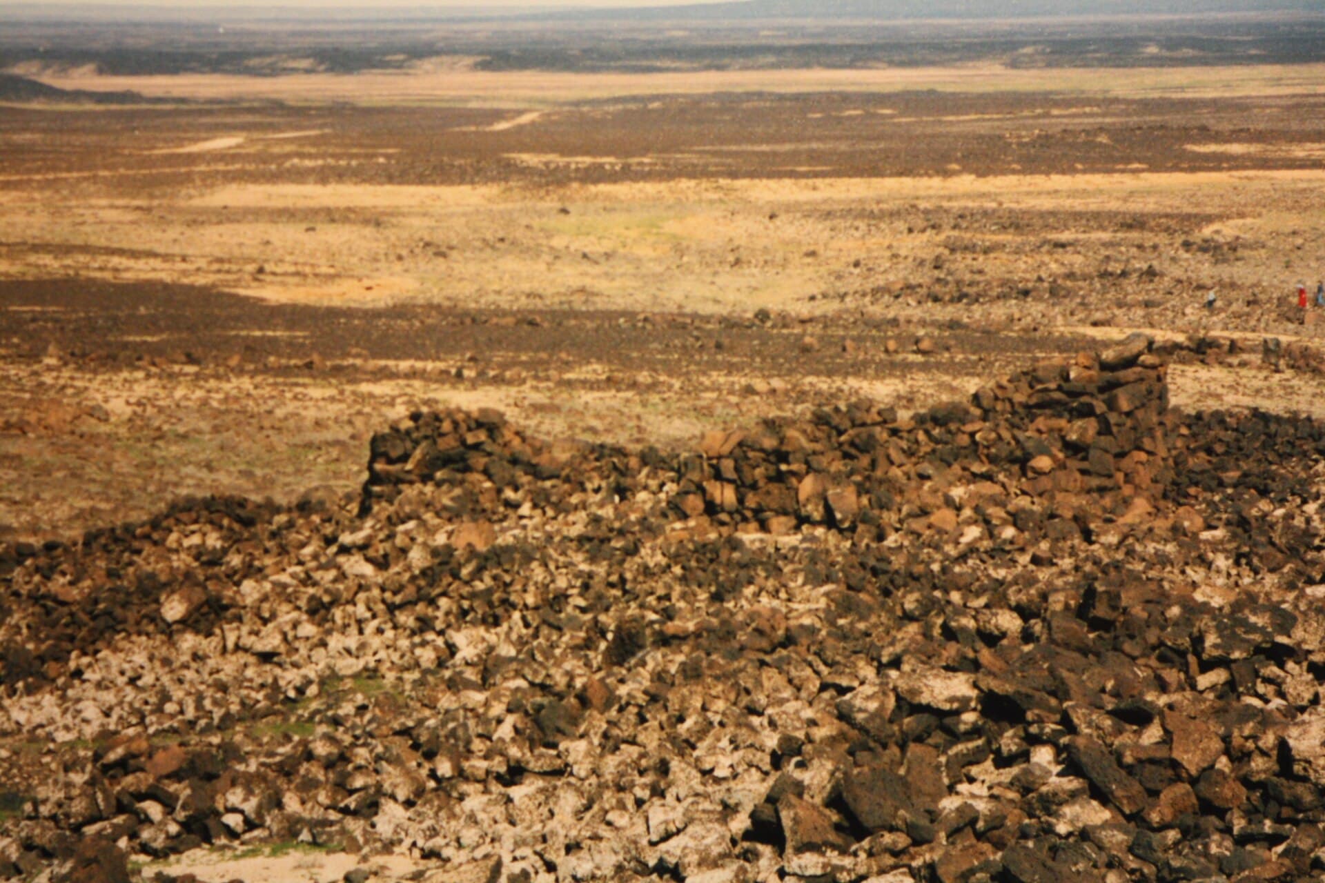
The settlement has two parts. In the northern part the houses are scattered and far apart: most are rectangular, of basalt or rough stone, with one to three rooms and an open-air animal pen. The southern part is gathered inside a stone wall, with houses on square or round plans. According to Arabic sources the wall encloses about 4 hectares; its remains can still be traced on the north and east sides, and traces of towers on the south-east. A dam was built across the wadi beside the western track, and the water held behind it was carried by a channel to the north-west of the settlement; the dam still partly stands. There are two cemeteries, to the east and the south. Safaitic inscriptions and drawings of camels have been recorded on the sides of the wadi.
Who excavated it
The French geologist Louis Dubertret was among the first to examine the site and took the settlement for Roman. In the middle of the 20th century the Dutch researcher Willem van Liere, struck by the animal bones among the lava, compared Umbashi and its neighbour Hibariyeh to Sodom and Gomorrah. He was also the one who used radiocarbon dating to place the site in the 3rd millennium BC. The main excavations were carried out between 1991 and 1995 by a joint Syrian-French mission led by Frank Braemer, Jean-Claude Échallier and Ahmad Farzat Taraqji. The results were published as a book in 2004 by the French Institute of the Near East in Beirut.
Do not miss
The great burning site and the argument around it. The site holds burnt and calcined bones of sheep, goats, gazelles and camels, and the sources estimate they came from between 10000 and 40000 animals. The explanation put forward in 1954 was that a volcanic eruption had buried the herds alive, and the neighbouring villages still tell the story that way. Later studies showed that all the bones are animal, that no human bones were found, and that the bones were heated slowly rather than all at once. So the burning was most likely done by people. Why is not clear. The three explanations offered are fertiliser, sacrifice, and burning rotting bones to keep disease away.
Sister sites
Umbashi is not alone. Khirbet al-Hibariyeh, 6 kilometres to the south-east, is a small settlement of about 1 hectare on a basalt hill, abandoned along with Umbashi. The third site is Khirbet ad-Dabab. Field surveys between 1984 and 1993 concentrated on these three places, which show the transition from the Early to the Middle Bronze Age.
The site today
In 2011 the Suwayda environment directorate added the site to its archaeological inventory for a planned geopark, meant to be the first in Syria. Since then there has been no independent information about it. Umbashi lies east of the Leja, on the edge of the Badia, along the line where Bedouin and Druze fighting took place in 2025. Access could not be verified; this page describes what the place is and does not say it can be visited today.
Tips
- Do not go without a local guide or driver; tracks vanish in the lava field and there is no village nearby
- Compare the scattered houses in the north with the walled part in the south; two different layouts side by side
- Look for the remains of the dam to the west; the channel that carried water to the settlement started behind it
- Carry water and fuel; there is neither village nor shade along the way
Transparency
- How this was chosen
- Written by hand; opening hours, entry fee and coordinates are kept as data. A field that is not known for certain is marked as variable rather than guessed.
- Facts checked
- September 2026
- Last updated
- September 15, 2026