Al-Lajat Lava Field (Trachonitis)
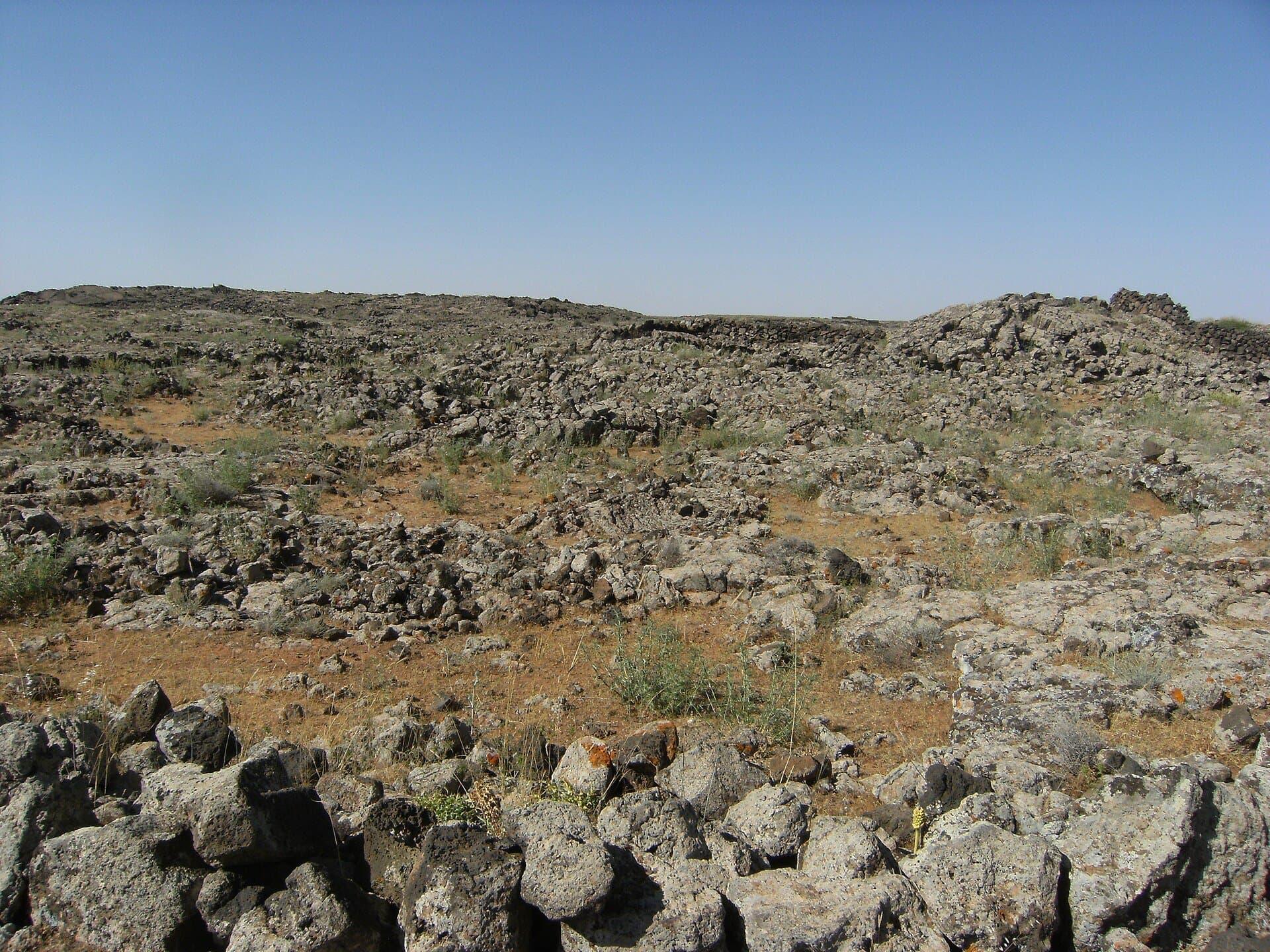
Some 900 square kilometres of broken basalt, 50 km south of Damascus: ancient Trachonitis, Roman and Byzantine villages, a UNESCO biosphere reserve since 2009.
- Opening hours
- Open country; no posted visiting hours
- Entry
- Variable — confirm at the entrance
- Duration
- 240 minutes
- Best time
- April–May or October; at midday in summer the basalt heats up and there is no shade
- Period
- Volcanic formation; Roman and Byzantine villages
- Address
- North-west of As-Suwayda, about 50 kilometres south of Damascus
Al-Lajat is the largest lava field in southern Syria: about 900 square kilometres of grey, broken basalt. It begins some 50 kilometres south of Damascus and forms a rough triangle. Its southern edge is the 45-kilometre line between Izra and Shahba, its northern tip lies near Buraq, and the Wadi al-Ajam marks its northern boundary. Roman and Byzantine villages, churches and bathhouses stand among the rocks. In 2009 it became UNESCO’s first biosphere reserve in Syria, and it is still the only one.
What the ground is like
The average height is between 600 and 700 metres. The surface is far from flat: the lava cracked as it cooled, and blocks pitted by gas bubbles lie heaped on one another. The highest point is the cone of Tell Shihan near Shahba, at about 1140 metres. Here and there, soil has collected in hollows between the rocks. Locally these are called ka’; they are around 100 metres across, and this is where crops are sown. Walls and houses are built of the same basalt.
Where the name comes from
Older texts use other names: Argob in the Hebrew Bible, and in Greek Trachonitis, the rough and stony country. The Gospel of Luke also names the region this way. The Arabic al-Lajat means ‘refuge’. The name goes back to the Mongol invasions of the 13th century, when people fleeing them hid in this sea of stone.
What lies among the stones
The Romans built a road through the middle of the field. Under Byzantium a wave of building followed: churches, houses, bathhouses, colonnaded streets. On the north-western edge lie Phaena, the capital of Trachonitis and today’s Al-Masmiyah, and Sha’ara; to the south, Harran and Najran; on the eastern side, Shaqqa and Hit. By the 17th century the field was almost empty, grazed by the flocks of the Sulut Bedouin. Druze families arrived from Lebanon early in the 19th century. Today the villages in the east and centre are Druze, and those on the western edge Muslim and Melkite Christian.
What grows here
According to UNESCO, the reserve’s trees are Atlas pistachio (Pistacia atlantica), bitter and wild almond, olive, sumac and hawthorn, with caper spreading below them. The area was placed under protection by ministerial decision in 2006; the UNESCO reserve covers 12038 hectares.
A refuge in history
This is hard ground for an army. Accounts say the troops of the Egyptian commander Ibrahim Pasha took losses here, and that during the 1925 revolt fighters took refuge here from the French.
How to see it
There is no single entrance. The field is seen from the villages on its rim and from the roads that cross it. Half a day is enough for one edge and a village or two.
Where it stands now
Al-Lajat was a conflict zone between 2012 and 2018. In July 2025 the fighting in Suwayda reached Ariqa and Shahba, on the southern and eastern edges of the field. Current security and access cannot be confirmed from independent sources. This page tells you what al-Lajat is; it does not tell you that you can go there today.
Tips
- The ground is broken basalt; thick soles and ankle support make a difference
- There are no paths and it is easy to lose your bearings among the rocks; do not head in alone
- See the field from the villages on its rim: Shahba, Shaqqa and Al-Masmiyah
- Check the current security situation locally before setting out
Transparency
- How this was chosen
- Written by hand; opening hours, entry fee and coordinates are kept as data. A field that is not known for certain is marked as variable rather than guessed.
- Facts checked
- September 2026
- Last updated
- September 15, 2026