The Nabataean Arch in Bosra
The 1st-century arch that closes Bosra’s main street at its east end: Petra-style capitals, the sanctuary-gateway theory, and what stands of it today.
- Opening hours
- Open-air site; no fixed timetable could be confirmed
- Entry
- Variable — confirm on the spot
- Duration
- 20 minutes
- Best time
- Morning or late afternoon; there is little shade and the basalt heats up at midday
- Period
- Nabataean
- Address
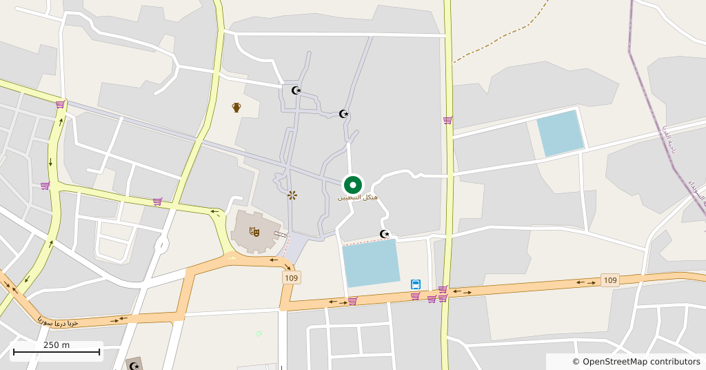
- East end of the main street, eastern quarter, Bosra
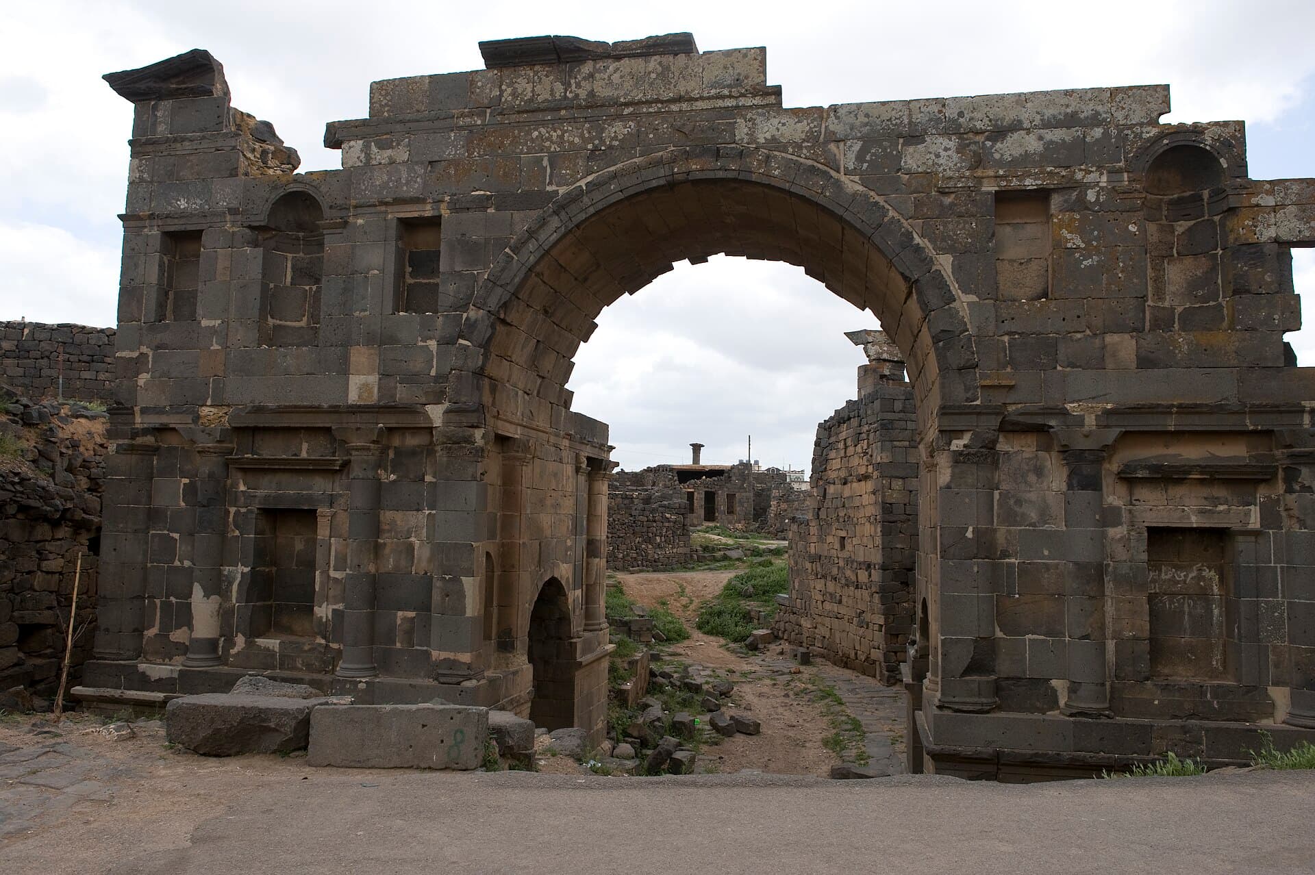
Bosra’s main east-west street ends at a black basalt arch. Its face is divided into storeys, niches and half-columns, and it was built in the 1st century under the Nabataeans — the Arab kingdom whose capital was Petra. It is one of the few pieces of the pre-Roman city still standing. It is neither quite a city gate nor quite a triumphal arch, but something between the two.
Where it is and how to get there
In the eastern quarter of the ancient city, at the east end of the main street. Walk north from the theatre to the street and turn east; the street brings you straight to the arch. The Cathedral of Bosra, the Mosque of Fatima and Birket al-Hajj are in the same quarter, a few minutes apart on foot.
What to see
The arch stands on four rectangular piers. The main passage runs along the axis of the street under a vault. A second, lower vaulted passage opens at a right angle to it. The ground storey is plain and ends in a moulding; the middle and upper storeys carry corner pilasters, half-columns and niches. Both faces once had a pediment. Neither survives.
Most of the plain capitals on the middle storey are in the Nabataean style you see on the rock-cut facades of Petra. No other detail in Bosra shows as clearly who was cutting stone here before Rome.
What was it the entrance to
The first survey drawings were made by the American expedition led by H. C. Butler. Jean Starcky read the arch as the monumental entrance to a Nabataean sanctuary in the eastern quarter. Comparing it with the Qabr al-Turkman tomb at Petra, he dated it to the reign of the Nabataean king Malichus II, between 40 and 70.
Excavations in 1981-1982 and 1992 showed that the arch did not stand alone. Two walls with doorways run east from either side of it and join two blocks decorated with half-columns. These blocks face a different direction from the arch, and together they outline a space with a trapezoid plan. Before it was the end of a street, the arch was the way into an enclosure.
Restoration
Suleiman Mougdad restored the arch between 1955 and 1968, together with the city’s West Gate. The arrangement you see today is the result of that work. Sources name the structure differently — some call it the East Gate, others the Nabataean Arch — but it is the same monument.
What not to miss
Walk through the arch to its east side and look left and right. The walls uncovered by the excavations run out from there. That turn is the only way to read the arch as the entrance to a space rather than a simple gate.
Tips
- Walk through the arch and look at the wall remains on the east side; it was the entrance to an enclosure
- Look for the plain capitals on the middle storey; that is where the Nabataean style of Petra shows
- The cathedral, the Mosque of Fatima and Birket al-Hajj are in the same quarter and fit into one walk
Transparency
- How this was chosen
- Written by hand; opening hours, entry fee and coordinates are kept as data. A field that is not known for certain is marked as variable rather than guessed.
- Facts checked
- September 2026
- Last updated
- September 15, 2026