Bosra crossroads walk: from the al-Omari Mosque to the al-Khidr Mosque
A walk through Roman Bosra’s crossroads between two Burid mosques: the exedra columns, Bab al-Qandil, a 108-metre cryptoporticus and the tetrapylon square.
- Duration
- 2.5 hours
- Distance
- 1 km
- Difficulty
- Easy
- Best season
- April–May, October–November
- stops
- 5
- City
- Bosra
Most visitors walk Roman Bosra along its east–west main street. This route reads the other axis. It goes down from the al-Omari Mosque along the north–south street to the crossroads, turns west at Bab al-Qandil, walks above the cryptoporticus to the tetrapylon square and heads north to finish at the al-Khidr Mosque. It begins and ends at two mosques of the Burids, the dynasty that ruled from Damascus in the 12th century, and both are tied to Bosra’s governor Gumushtakin. The route lies entirely inside the walls and runs one way: about a kilometre on foot, two and a half hours with the stops.
The route
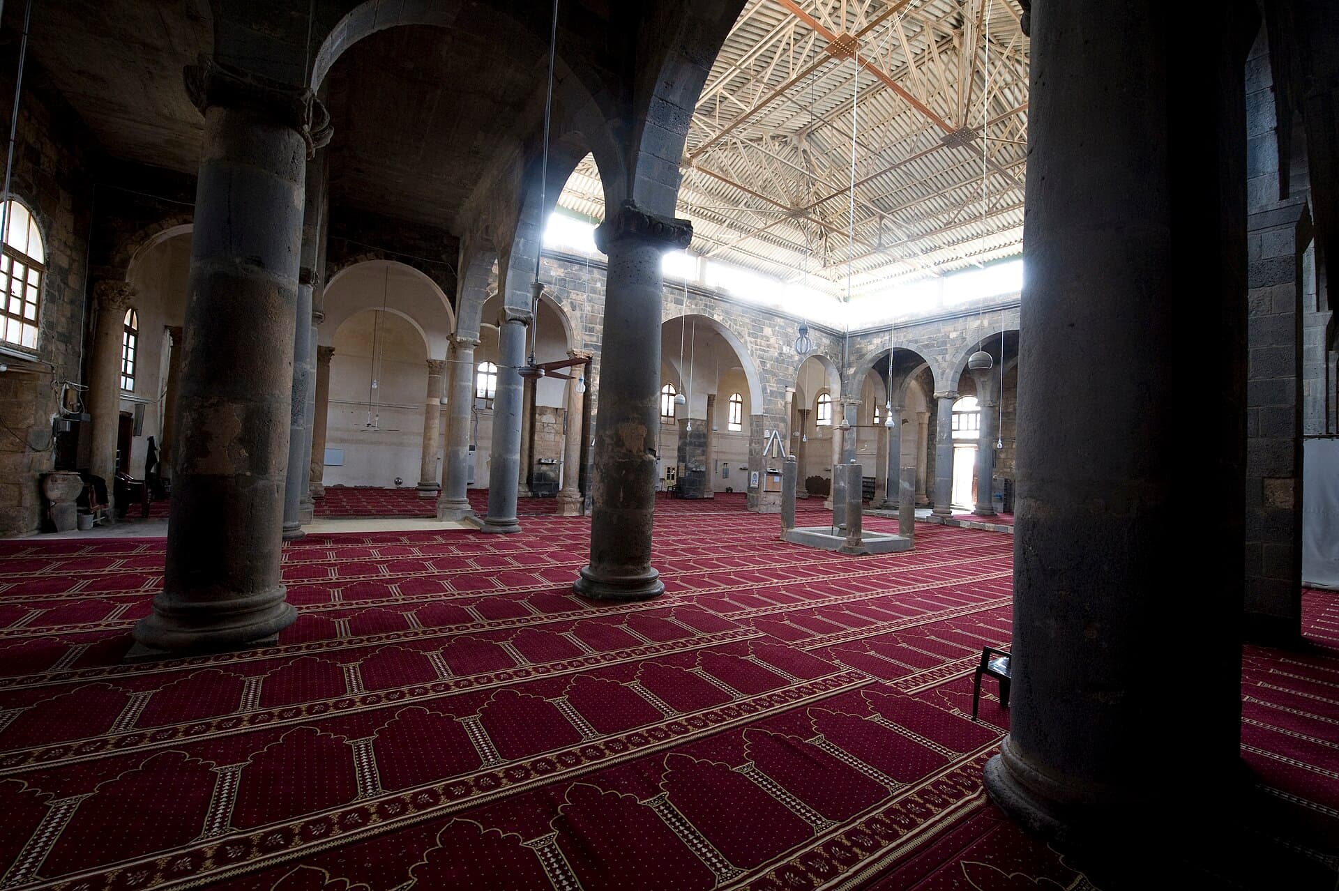
Start at the al-Omari Mosque. The courtyard measures 16 by 13 metres, paved in geometric patterns of black basalt and white limestone. Compare the capitals of the 44 columns inside; no two match. Gumushtakin rebuilt the mosque in 1112-1113; the minaret dates from 1221-1222 and served as the model for the al-Khidr minaret at the end of the route. From the mosque, walk south onto the north–south street opened in the 1990s. Its ancient paving is laid on the diagonal and runs between two Ionic colonnades.
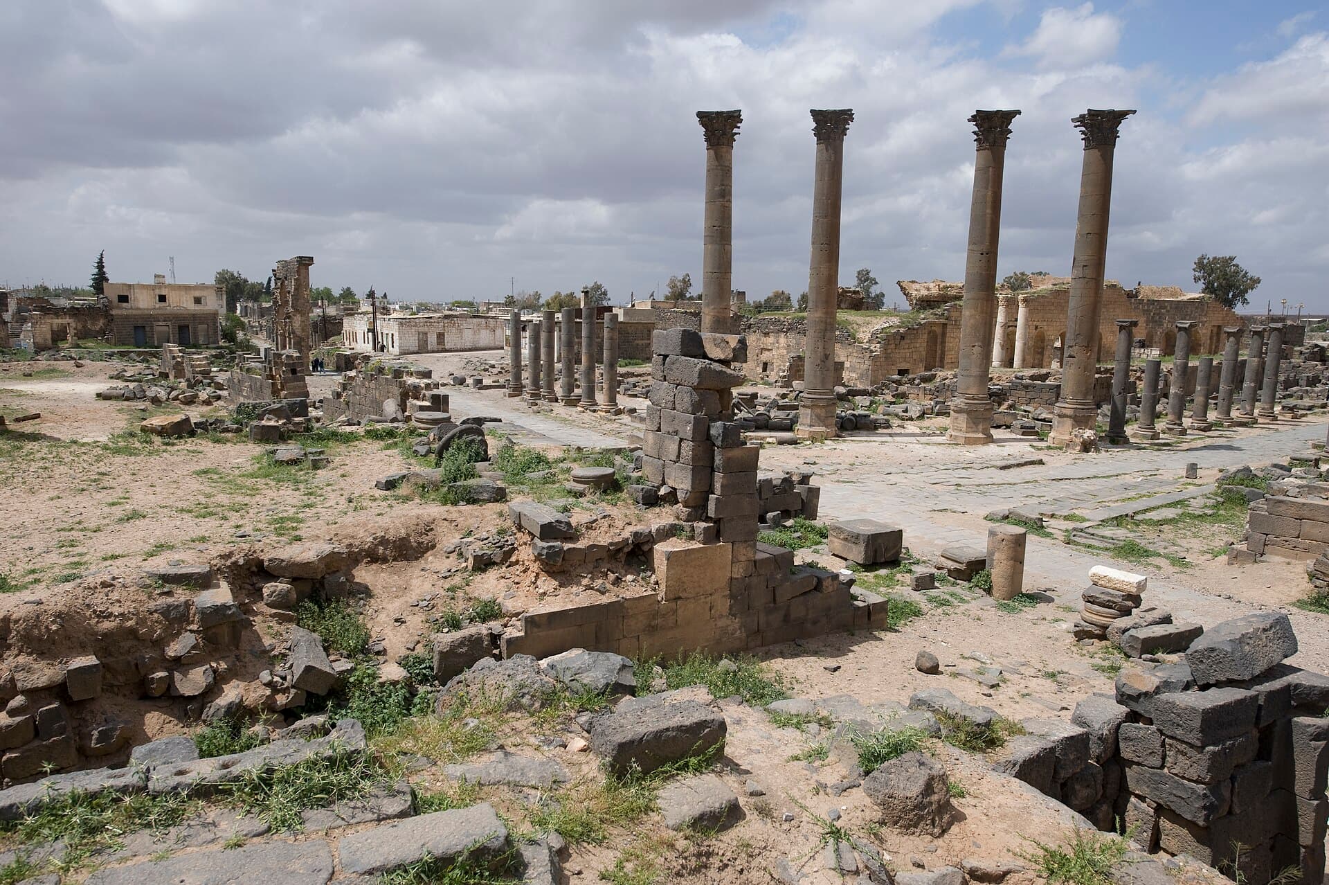
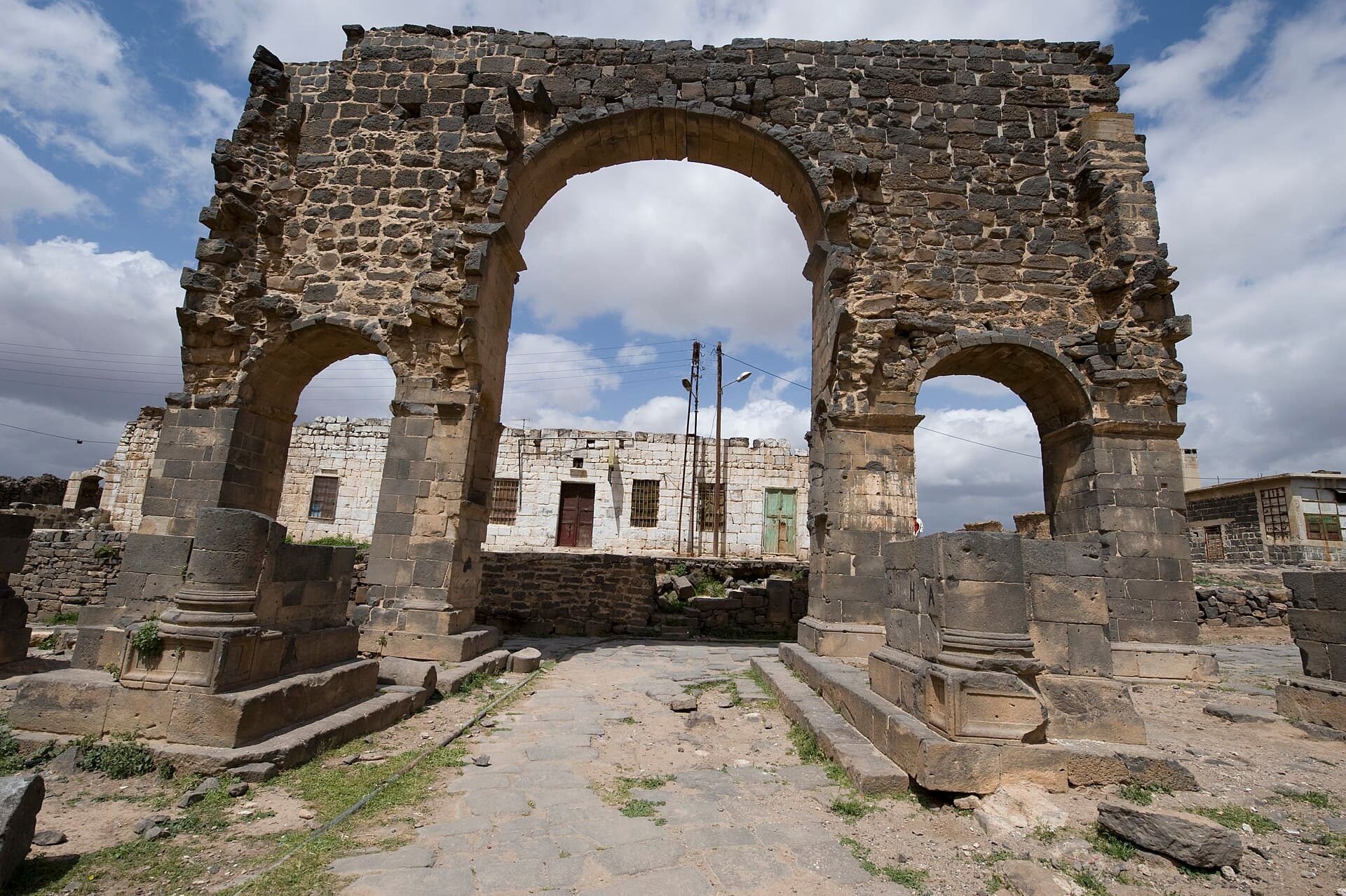
The street ends at the crossroads with the main street. Here four Corinthian columns stand turned at 45 degrees to both streets. Butler called them a nymphaeum; according to Ifpo, the French institute for the Near East, they belong to an exedra with an apse behind it. The real nymphaeum is the low-fronted building across the street: its facade is nearly 24 metres long, with a long, narrow basin in front. Look for the small holes in the column bases, left by marble and metal cladding. From the crossroads, turn west. The three-bay arch of Bab al-Qandil stands on the south side of the street, at the head of the street down to the theatre.
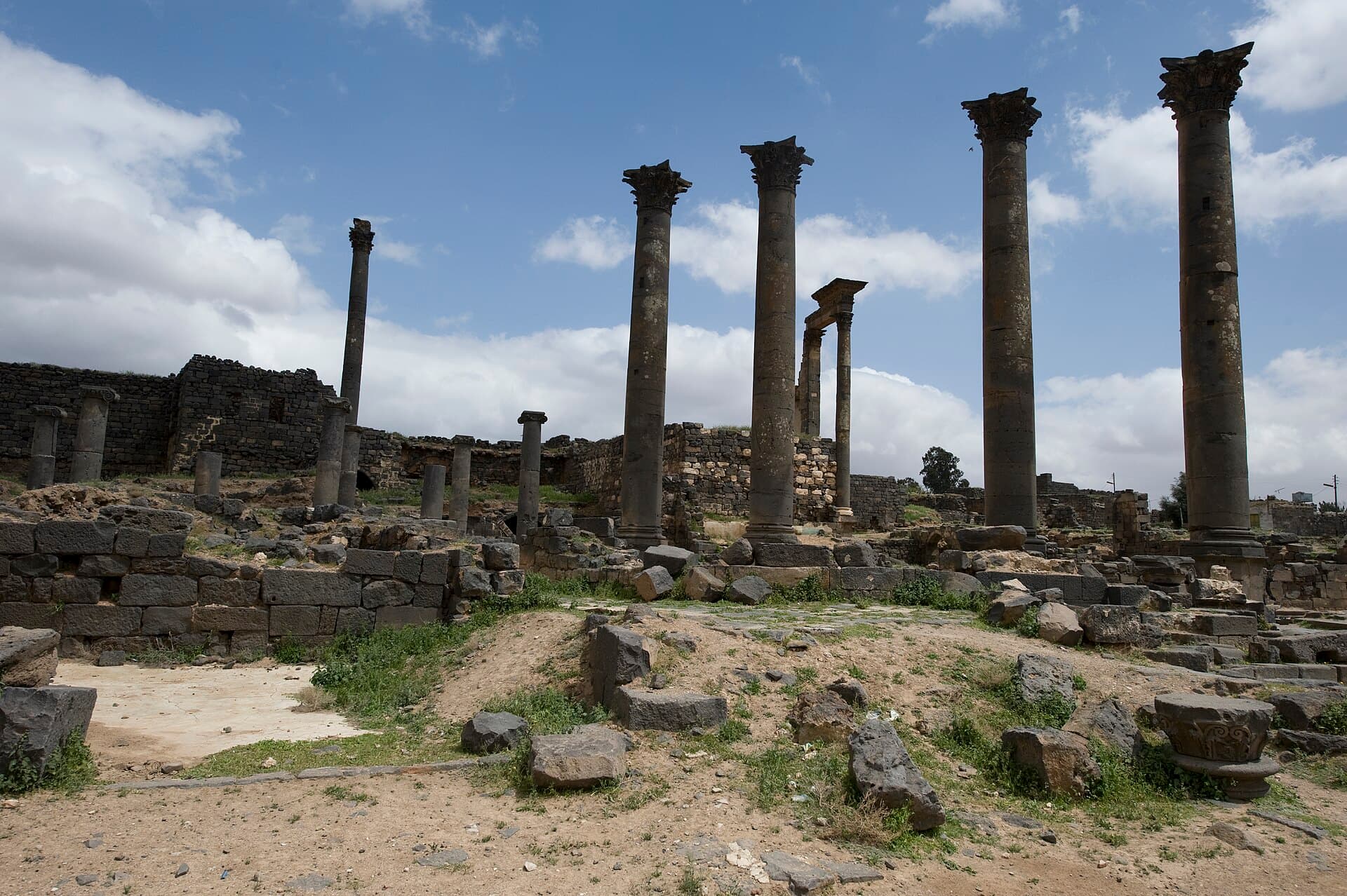
Look at the niches in the arch’s central passage and the traces of half-columns on the sides of its piers. Then cross to the north side of the main street and carry on west. Columns from the entrance porch of the Roman market, the macellum, stand in the street; Ifpo says three are in place. The cryptoporticus starts here: a vaulted gallery running 108 metres beneath the street’s northern colonnade, with 34 light shafts in its south wall opening onto the street. Its western end reaches the tetrapylon square. The square was laid out in the late 3rd or early 4th century, and its four square bases remain. Look down: the paving is small square stones set at 45 degrees. A 4th-century description of the world, the Expositio totius mundi, mentions Bostra for its tetrapylon.
From the tetrapylon, turn onto the north–south street and walk north. The al-Khidr Mosque is in the western part of the town, roughly halfway between the tetrapylon and the al-Jahir spring. Its prayer hall is a cube about 7 metres on each side, and the square minaret beside it is 17 metres tall. The inscription over the north door dates the building to 528 AH, or 1134, and names Gumushtakin as its founder. Nabataean and Roman blocks are reused in the walls. North-west of the mosque stands an old house known as the tomb of Mar Jirjis, or Mar Elias.
Timing
Be at the al-Omari Mosque at 08:30, while the courtyard is empty and the stone pattern has no shadows. Go in outside prayer times and allow half an hour. You reach the crossroads around 09:15, when the low morning light brings out the carving on the capitals. Arrive at Bab al-Qandil at 09:45, when the eastern sun picks out the niches. At 10:00 give the cryptoporticus and tetrapylon square half an hour. Be at the al-Khidr Mosque around 10:45. This order fits the walk into the morning; there is little shade on the way and the basalt heats up towards noon.
Take care
It is not confirmed whether the cryptoporticus is open to visitors today or how the al-Khidr Mosque is used now; ask locally. If they are closed, you can still see the gallery through the light shafts in the street, and the mosque and minaret from outside. Do not enter a dark underground gallery alone or without a torch. The al-Omari Mosque is in use for prayer and free; cover shoulders and knees, and women need a headscarf. Keep out of fenced areas and away from the edges of excavation pits. The route stays inside the walls, but unexploded ordnance from the war remains a risk in Daraa province: stay on streets and paths. For transport and the current situation, see the site’s guide on getting to Bosra, and check locally before setting out.
The route on a map
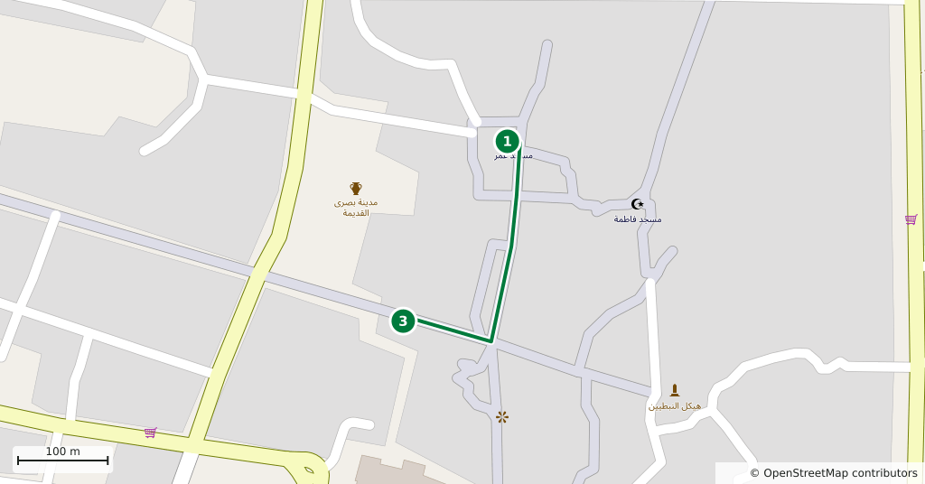
Stops along the route
- 01
- 02
- 03
- 04
- 05
Transparency
- How this was chosen
- The stops and their order were set by hand. The line on the map is real road geometry, not a straight hop between pins; distance and duration belong to that itinerary.
- Facts checked
- September 2026
- Last updated
- September 15, 2026