The Roman Temples at Rakhlah
An hour from Damascus: two Roman-Phoenician temples on the flank of Hermon. The larger is 25 by 17 metres, with a sun god’s face 100 centimetres across.
- Opening hours
- An open site, all day; a border area, access depends on the situation
- Entry
- Free; transport extra
- Duration
- 90 minutes
- Best time
- Spring, when the air is cool and the wooded slope is green
- Period
- Roman — Late Antiquity
- Address
- Rakhlah, Qatana district, 31 km west of Damascus
A Druze village on the flank of Jabal al-Shaykh, 31 kilometres west of Damascus, between 1450 and 1550 metres, with the remains of two Roman-Phoenician temples inside it. This is the nearest Roman temple still standing within an hour of Damascus. The 2004 census recorded 368 people in the village; the largest family is Abu Khayr.
Getting there
31 kilometres west of Damascus, by way of the Qatana district. The road climbs onto the flank of Hermon and the village sits above 1450 metres. The area lies close to the Lebanese boundary; confirm the situation with a local guide before you set out.
How long it takes
An hour and a half. That covers both temples, the relief and the rock-cut tombs around them.
What to see
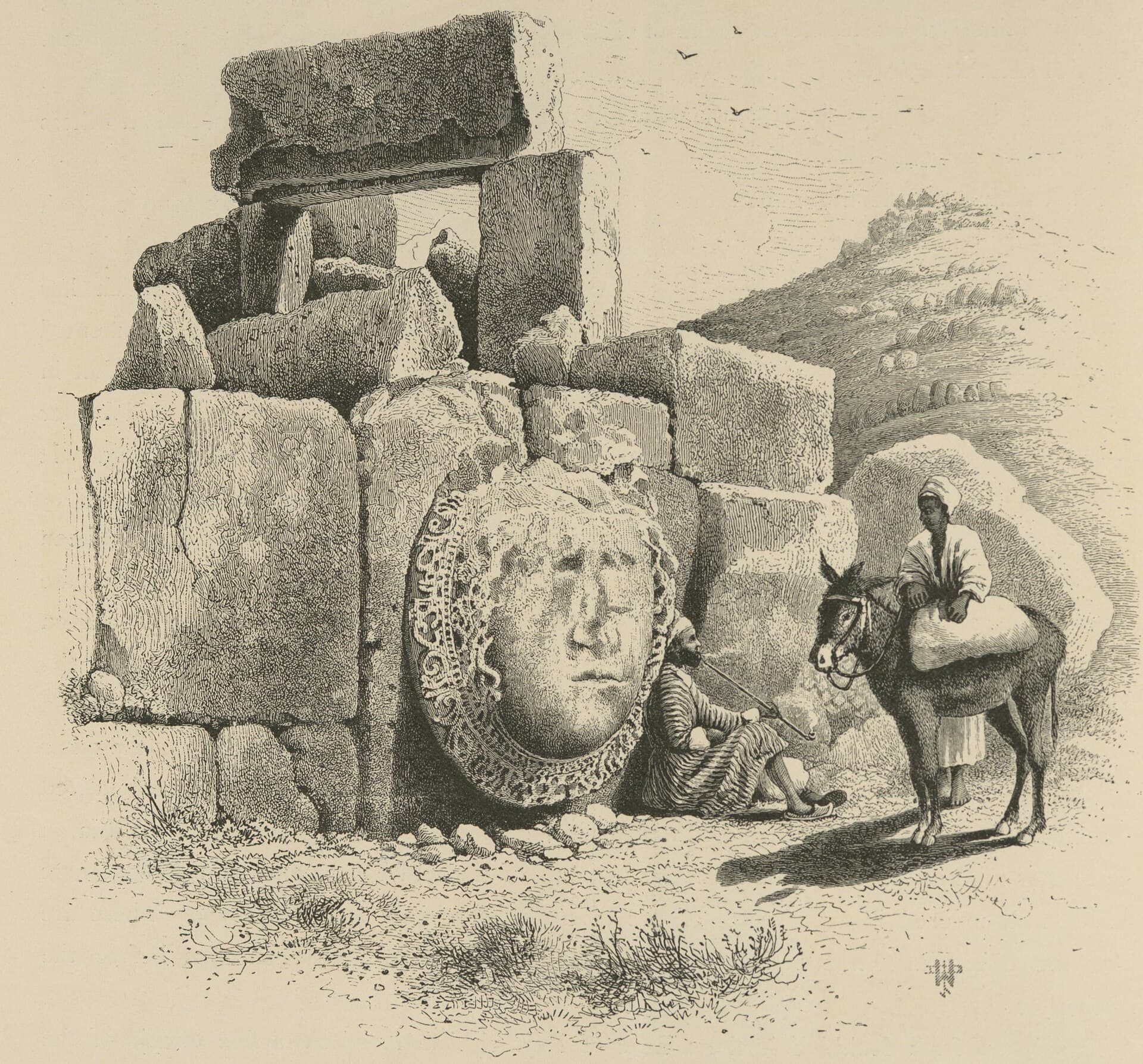
Both temples are counted among the temples of Mount Hermon. The smaller one has an apse and is cut into the bedrock. The larger measures about 25 by 17 metres and is built of giant limestone blocks. It was most probably used as a church later on. Inside, two rows of Ionic columns run along the walls from the entrance to the semicircular altar. Two stones beside the doorway carry a bird with its wings open. Edward Robinson saw them in place in 1852, called them Assyrian in character, and wrote that the stones may have been brought from a distance. The slope below the village is oak and holly-oak forest, and rock-cut tombs and caves lie scattered around.
What most people miss
The relief. On one wall of the large temple, set so that it faces Hermon, there is the face of a sun god inside a wreath 100 centimetres across — most probably Baal. The upper part of it was destroyed with gunpowder. It is easy to walk past without knowing where it is: outside the south wall, near the east corner.
What the inscriptions say
Greek inscriptions record the worship of the sea goddess Leukothea here from AD 60 onward. One records a building paid for out of temple revenues in 253, another a new gate financed by the treasurers in 379. In Late Antiquity the village was known as Zenopolis, and at the end of the 5th century it became a city and a bishopric. The synod held at Tyre in 518 was signed by Elias, bishop of the Rakhlenoi. The acts of the Second Council of Constantinople in 553 name Anastasios, bishop of the Rakhlenoi in the province of the Tyrians.
Tips
- This is close to a border area; confirm the situation with a local guide before you set out
- The relief is outside the south wall near the east corner; it is easy to miss if you do not know
- Follow the rows of columns from the entrance towards the altar; that is the only way the plan reads
- The rock-cut tombs around the site are not signposted; ask in the village where they are
Transparency
- How this was chosen
- Written by hand; opening hours, entry fee and coordinates are kept as data. A field that is not known for certain is marked as variable rather than guessed.
- Facts checked
- September 2026
- Last updated
- September 15, 2026