Souq Wadi Barada
The site of ancient Abila, in the narrowest gorge of the Barada valley. A Roman road cut into the cliff, the Latin tablets above it, and rock-cut tombs.
- Opening hours
- Open ground, all day; not an enclosed site
- Entry
- Free
- Duration
- 60 minutes
- Best time
- Spring; the river is full, the valley green and the rock not yet hot
- Period
- Roman — the road and its tablets, 2nd century
- Address
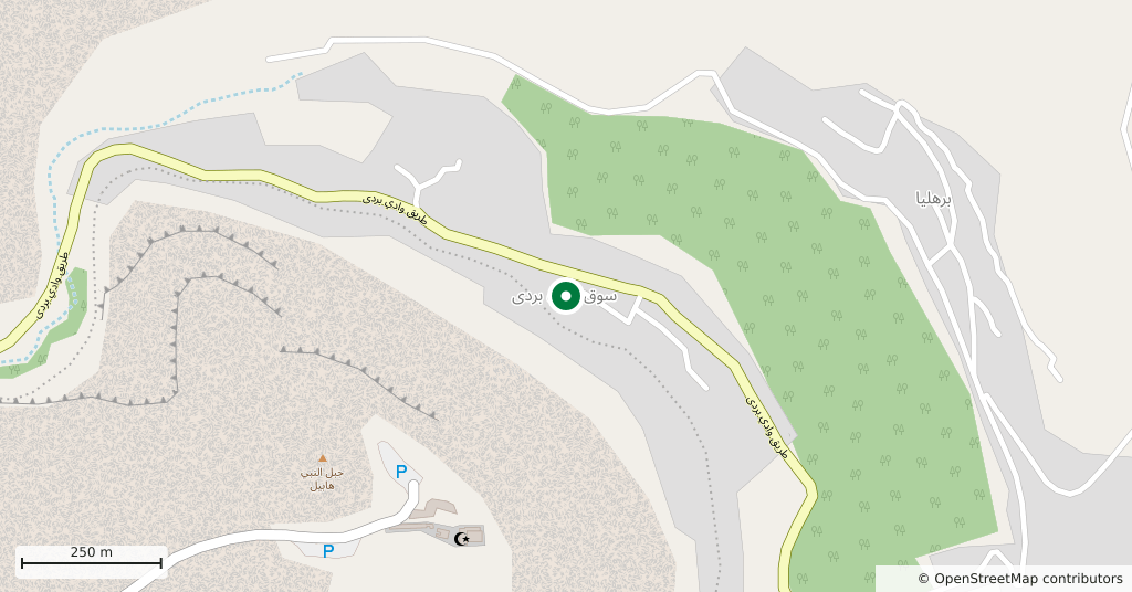
- Souq Wadi Barada, 40 km north-west of Damascus, Rif Dimashq
The road that climbs from Damascus to Zabadani runs into the narrowest part of the valley, between two high walls of rock. The village here is called Souq Wadi Barada, and the ground under it is ancient Abila. Under Rome it was the centre of the district of Abilene, and it is named in the Bible at Luke 3:1. The river’s old name was the Abana, in Greek Chrysorrhoas, “streaming with gold”.
Getting there
40 kilometres north-west of Damascus, about forty-five minutes. Coming down from Zabadani it is 16 kilometres. The road runs through the valley and the village is on the edge of it; cars are left in the village.
How long it takes
An hour. The remains are scattered and this is not an enclosed site; you look at it on foot.
What is there
The real thing is in the rock itself. On the north side of the valley, about 30 metres above the river, a road has been cut into the cliff. It runs some 180 metres and is about 5 metres wide, and traces of a rock parapet survive along its edge. Latin tablets are carved into the wall above the road. One of them gives the name of the place: Abila. The longer one records that the emperors Marcus Aurelius and Lucius Verus had the road restored.
The tombs above
The face of the cliff curves round like an amphitheatre, and higher up there are tombs hewn out of the rock, some reached by stairs also cut into the rock. One tomb was counted as having five chambers and 12 niches for bodies. An aqueduct runs below the road, partly tunnelled through the rock and partly roofed with stone slabs.
What most people miss
The name itself. Because Abila and Abel sound alike, a tradition grew up that Abel is buried here, and the shrine above the valley comes from that tradition. The two names are unrelated in origin and meaning; the likeness is a coincidence. The tradition is more than a thousand years old all the same, and people here still tell it.
An honest warning
This is not a managed archaeological site: no ticket, no signs, no guard. The road and the tombs are up in the cliff and climbing is dangerous; you can see enough from below. Wadi Barada was a battleground at the end of 2016 and the start of 2017, and the villages carry damage. Ask in the village about the state of the road and the path, and ask permission before photographing anything around the water plant.
Tips
- Do not climb the cliff; the road and the tombs can be made out from below
- Ask in the village about the state of the path; nothing is marked
- Ask permission before photographing around the water plant
- Stop here on the way up to Zabadani or on the way back; it is 16 kilometres along the road
Transparency
- How this was chosen
- Written by hand; opening hours, entry fee and coordinates are kept as data. A field that is not known for certain is marked as variable rather than guessed.
- Facts checked
- September 2026
- Last updated
- September 15, 2026