Half a day in Aleppo: from the Jawshan slope to the Syriac quarter
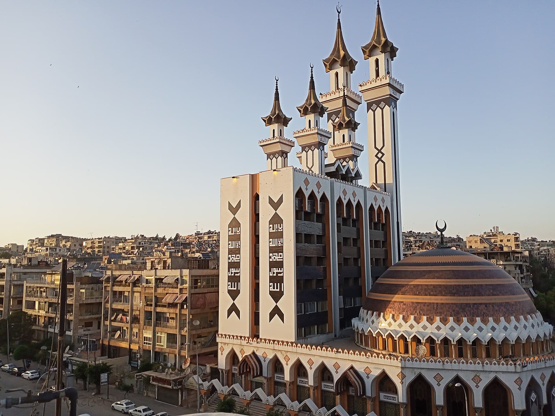
3800 metres across west Aleppo, three stops: a shrine built around a single rock, a Syriac church in dark stone and a modern mosque with six minarets.
- Duration
- 4 hours
- Distance
- 3.8 km
- Difficulty
- Easy
- Best season
- March–June, September–November
- stops
- 3
- City
- Aleppo
The west side of Aleppo sits away from the crowds of the old city and almost never appears on a visitor’s list. Three stops, three congregations, three buildings that face one another. 3800 metres in all, but you do not walk all of it: the first leg is 3000 metres and needs a taxi, the second is 800 metres and walks easily. Daylight sets the order.
The route
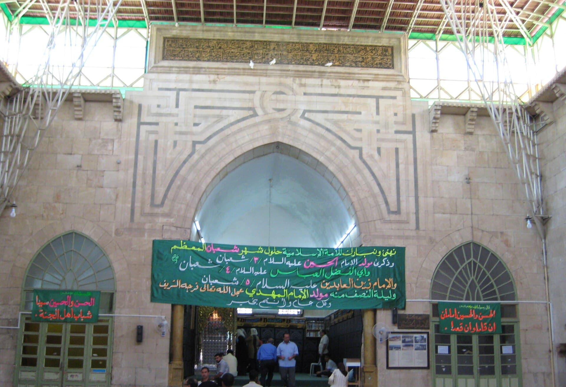
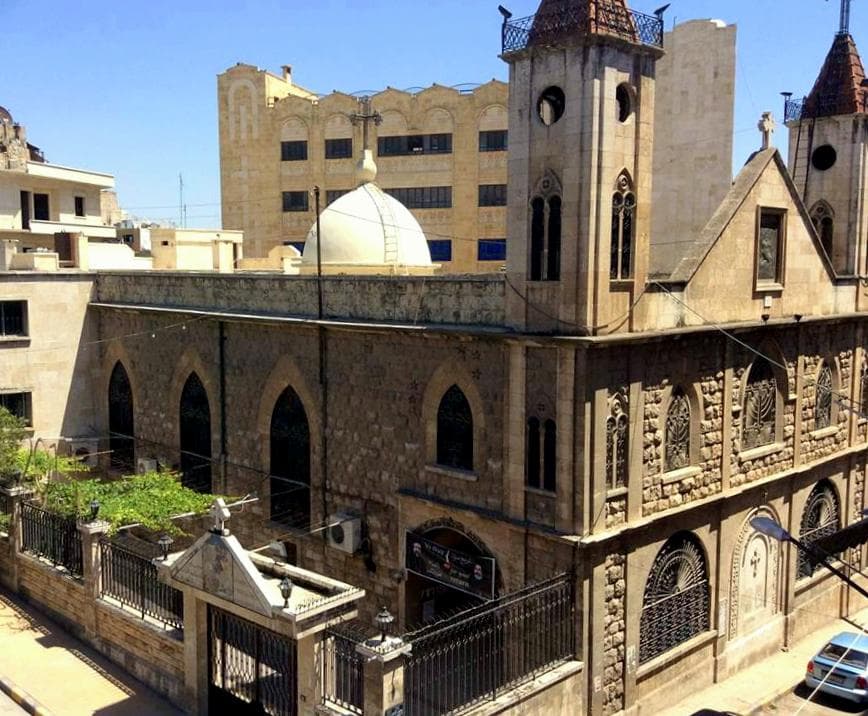
Start at Kallaseh, on the lower slope of Jabal Jawshan. The Nuqta Mosque was built around a single rock; the part that holds it is on the qibla side of the court, behind the iwan. Mashhad al-Siqt is on the same slope a few hundred metres away. From here take a taxi north — 3000 metres, ten minutes, with no fabric worth walking through in between. In the old Syriac quarter the entrance to the Mar Girgis church is on the side; the face that looks like a main door from the street is turned west. The last leg runs 800 metres west to the Rahman Mosque, at the north end of King Faisal Street.
Timing
Be at the Nuqta Mosque at 09:30, before the groups. Reach Mar Girgis on a Sunday morning as the service comes out; at other hours the door is usually locked, and the ring of windows in the drum can only be counted from inside. If you want to see the manuscripts, say so in advance — they are not on display. Leave the Rahman Mosque to the end: after 16:00 the western light brings out the copper tone of the dome, while at midday the same building reads flat and grey.
Take care
All three are in use for worship. The Nuqta Mosque is a place of pilgrimage: shoes come off at the door and quiet is expected. Do not photograph in the church during a service. The Rahman Mosque will not fit in a frame from close up, so cross to the far pavement to take the dome and the minarets together. Public transport between the first two stops is not reliable, so arrange the way back as well. The dark stone of the church, whose dome was finished in 1951, reads better on a cloudy day.
The route on a map
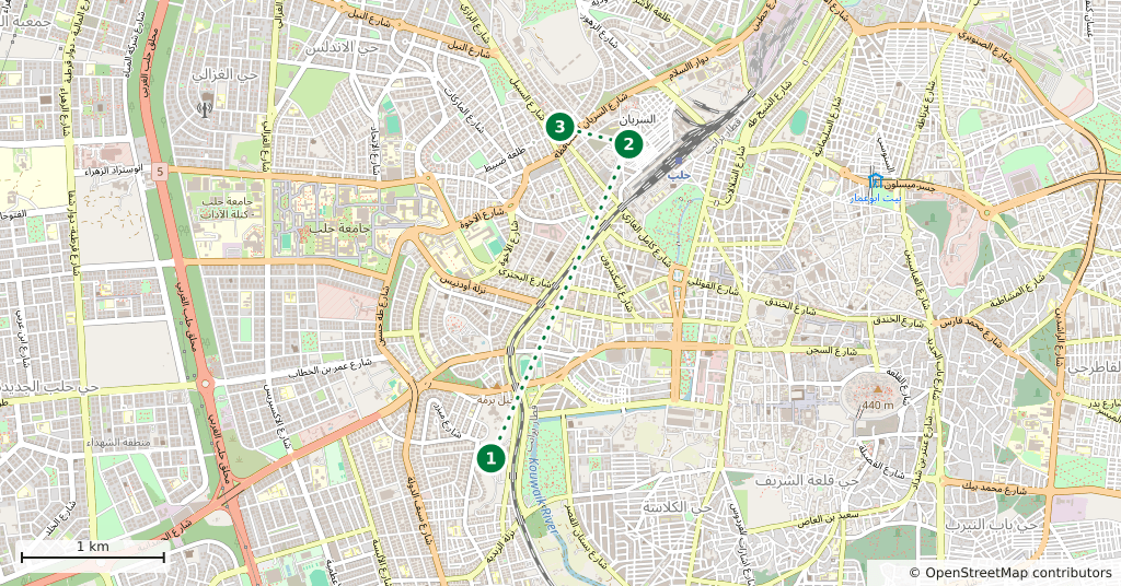
Stops along the route
- 01
- 02
- 03
Transparency
- How this was chosen
- The stops and their order were set by hand. The line on the map is real road geometry, not a straight hop between pins; distance and duration belong to that itinerary.
- Facts checked
- September 2026
- Last updated
- September 15, 2026