Afrin
A town 63 kilometres north-west of Aleppo, cut in two by its river: more than thirteen million olive trees, pine forest and the valley road to Ain Dara.
- Opening hours
- The town at any hour; the presses work in the harvest season
- Entry
- Free
- Duration
- 180 minutes
- Best time
- October and November, the olive harvest
- Period
- A modern town in old country
- Address
- Afrin, north-west Aleppo Governorate
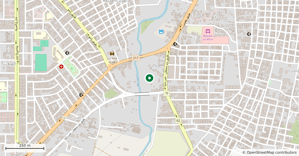
Afrin is a town in the far north-west corner of Syria, 63 kilometres from Aleppo. The river it is named after cuts the town in two. The country around it is hilly: heights run from 700 to 1269 metres, and the highest point is Jabal al-Kabir, where the Taurus range reaches down into Syria.
How large the district is
The Afrin district measures 55 kilometres east to west and 75 north to south, about 3850 square kilometres, which is 2 per cent of the area of Syria. The Afrin river runs 85 kilometres inside the country. The town centre holds around fifty thousand people. The district takes in seven subdistricts — Sharran, Sheikh al-Hadid, Jindires, Rajo, Bulbul, the centre and Mabatli — and 366 villages, with a total of over half a million at the end of 2010.
Olives
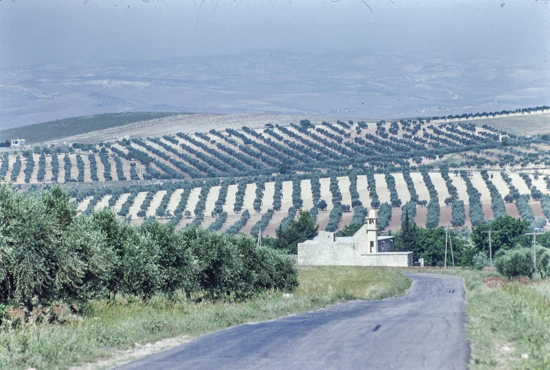
Olives are what the district is known by. There are more than thirteen million trees, and the economy rests on them: pressing oil, making soap, using the pomace. Hand weaving of carpets sits alongside. The widest forest cover in Aleppo Governorate is here as well, mostly pine and cypress.
The climate
Being close to the sea makes the weather Mediterranean: mild summers, cold winters with snow.
How the town grew
Afrin was founded as a market in the 19th century. It had 800 permanent residents in 1929 and 7000 by 1968, and the French Mandate authorities developed it. The old settlement runs north up a hillside; newer neighbourhoods have spread across the river. In March 2018, at the end of Turkey’s Operation Olive Branch, the town was taken by Turkish-backed forces and thousands fled. Control passed to the new Syrian government in early 2025, and by October that year twenty thousand families were reported to have returned.
What is nearby
The temple of Ain Dara and Nebi Huri, ancient Cyrrhus, both fall inside this district. You can leave the town and see both in the same day; the valley road links them.
What most people miss
The pattern of the groves. The trees are set out on the slopes in terraces with ploughed strips left between them, so from the road you see parallel lines drawn along the gradient. In morning light that order is the clearest thing in the landscape.
Tips
- Come in the harvest season, when the presses are running
- Take the valley road; Ain Dara and Nebi Huri are on the same line
- In winter there is snow in the higher villages, so plan tyres and timing for it
- If you want to see an olive press or a soap works, ask ahead in the harvest season
Transparency
- How this was chosen
- Written by hand; opening hours, entry fee and coordinates are kept as data. A field that is not known for certain is marked as variable rather than guessed.
- Facts checked
- September 2026
- Last updated
- September 15, 2026