Ain Diwar Bridge
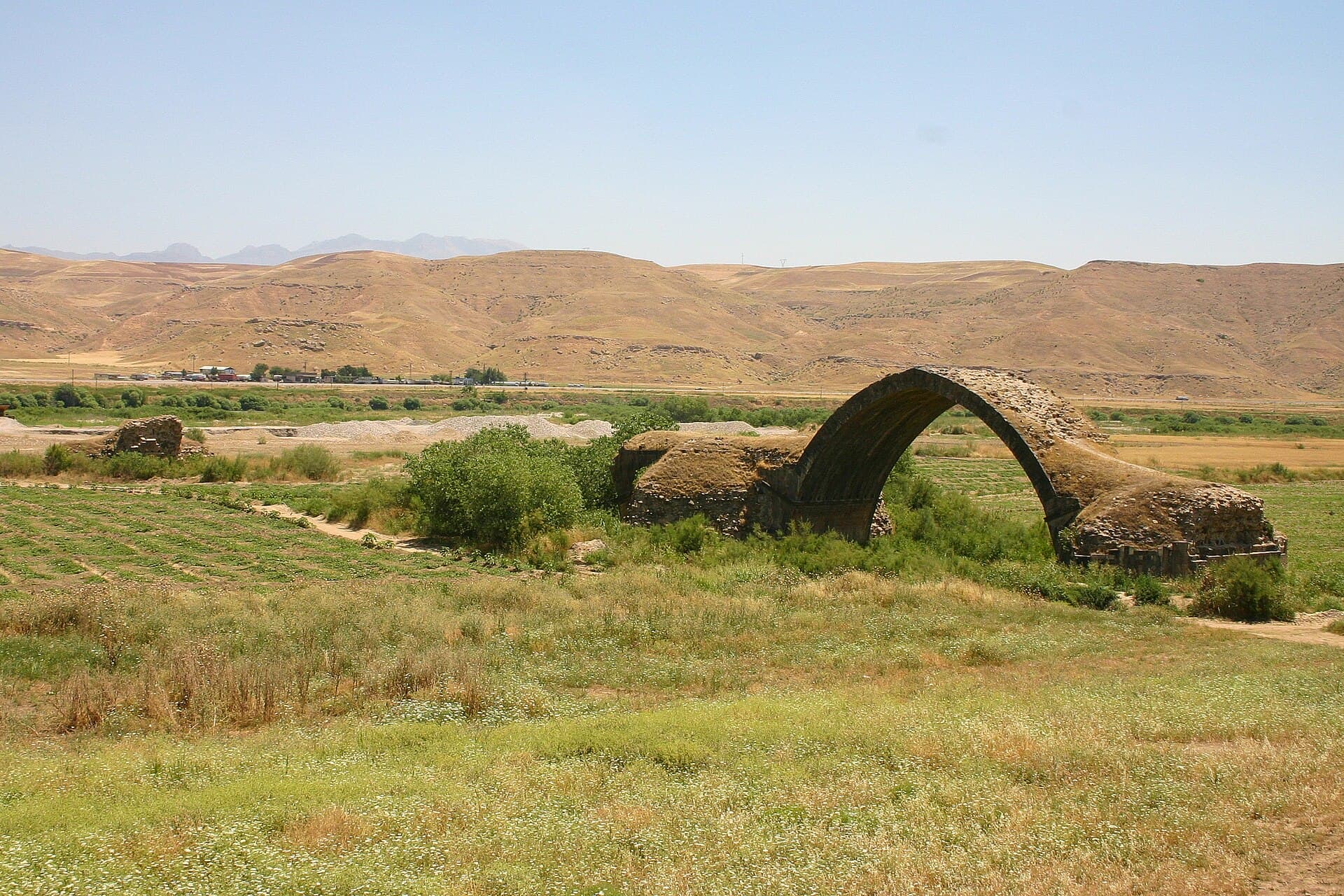
A single pointed arch standing alone in the middle of the Tigris plain in Syria’s far north-east. Long called a Roman bridge; the masonry turned out Zangid.
- Opening hours
- Open ground, daylight hours
- Entry
- Free
- Duration
- 60 minutes
- Best time
- Spring, when the fields around the arch are green
- Period
- Zangid
- Address
- North-east of Ain Diwar, Malikiyah; 112 km east of Qamishli
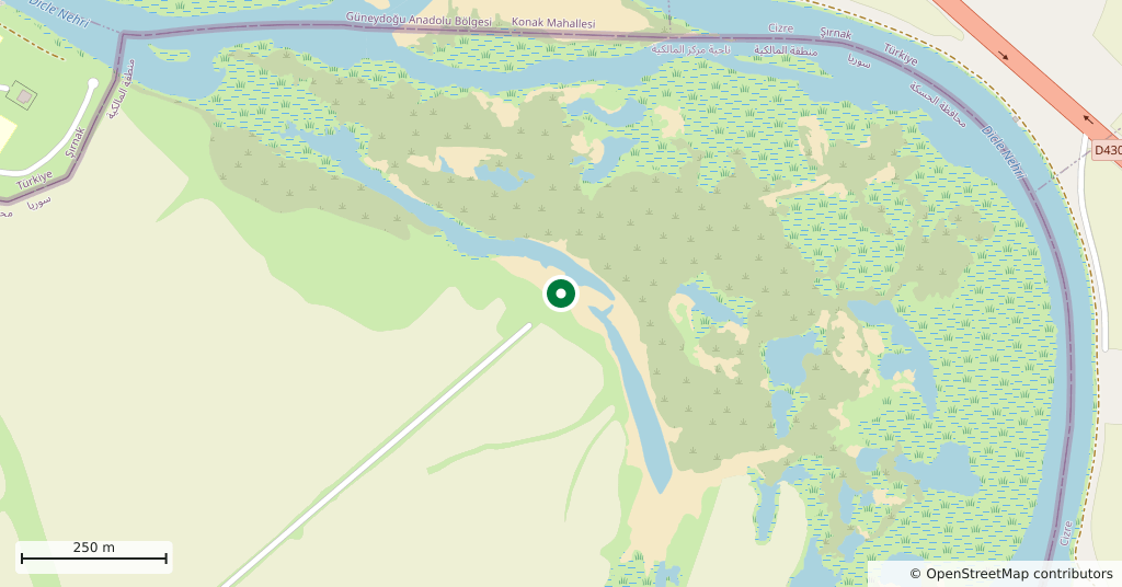
One arch stands in the middle of the plain. Near the point where Syria meets Turkey and Iraq, north-east of the village of Ain Diwar, it is all that is left of a stone bridge. The bridge once crossed the Tigris; the river has shifted its bed since then and now runs five hundred metres to the east. So the structure stands out on the plain as a bridge over no water at all.
Getting there
112 kilometres east of Qamishli by road, through Malikiyah. Two hours by car. Going out and back from Qamishli is a day on its own and cannot be joined to the day of the tells. The road runs parallel to the border.
How long it takes
An hour. The arch, the wrecked piers and the fields around them; the real work is walking up close and looking at the stone.
What to see
The one surviving pointed arch, the piers on either side reduced to rubble, and a line of ruin running a few hundred metres to the west. The carvings on the structure can still be read: signs of the zodiac, figures standing for heavenly bodies, and mounted horsemen. That carved programme is the main evidence for dating the bridge and a typical piece of Zangid work. Gertrude Bell photographed it shortly before the First World War, and in those plates the ground around the arch looks far less worn than it does now.
What not to miss
The name of the thing. The bridge was long known as a Roman bridge and is still called one in many sources: built, the story went, in the second century AD so that Rome could cross into Upper Mesopotamia, then repaired by Seljuks and Arabs. A reappraisal published in 2014 turned that around. Arabic sources show that the bridge was built between 1146 and 1163. The order came from Jamal al-Din Muhammad al-Isfahani, vizier to Qutb al-Din Mawdud, the Zangid ruler of Mosul. There is no real evidence that any bridge stood on this spot before. Neither of the two comprehensive surveys of Roman bridges lists it. So what you stand under is not Roman but twelfth-century — and it may never have been finished.
The site today
The arch is standing, but it sits in farmland with no maintenance regime. This is the corner where three borders meet, so both the road and permission to approach can change from day to day. Keep off the border strip and take no photographs of military positions. Ask in Qamishli about the road before you set out.
Tips
- Look closely for the zodiac signs and horsemen carved on the arch; they do not read from a distance
- The river is no longer here: the Tigris runs five hundred metres east of the arch
- Do not climb onto the arch; the stone is loose and nothing supports it
- This is the three-border corner: keep off the border strip and do not photograph military positions
- Out and back from Qamishli is a full day; do not join it to the day of the tells
Transparency
- How this was chosen
- Written by hand; opening hours, entry fee and coordinates are kept as data. A field that is not known for certain is marked as variable rather than guessed.
- Facts checked
- September 2026
- Last updated
- September 15, 2026