Dreikish Dam and Lake
A 41-metre rockfill dam on the Qais river north of Dreikish, with a lake a kilometre long behind it. Built for drinking water, in a valley ringed by villages.
- Opening hours
- Open natural area; access to the crest road varies — confirm on site
- Entry
- Variable — confirm on site
- Duration
- 90 minutes
- Best time
- Spring and autumn, when the slopes are green and the weather mild
- Period
- Modern — 1999–2015
- Address
- Near Al-Dalbeh village, north of Dreikish, Tartus
The Dreikish Dam is a rockfill dam on the Qais river, north of the town of Dreikish in the hills inland from Tartus, near the village of Al-Dalbeh. It is 276 metres long at the crest and 41 metres high. Behind it a lake one kilometre long has formed, ending at the Al-Dalbeh spring that feeds it all year round. This is not a heritage site. People come for the water, the slopes of the valley and the villages that look down on the lake.
Getting there
The lake lies just north of Dreikish, which is reached from Tartus by the road heading east. The villages of Al-Burikhiyah, Sraigis, Hamoush Raslan, Al-Dalbeh and Al-Maraj, as well as Dreikish itself, overlook the lake, and the shore is approached along their roads. We found no recent source on current access to the dam. Ask on site whether the crest road is open.
How the dam was built
The Tartus water resources directorate began construction on 26 June 1999. With interruptions the work took 15 years, and the General Company for Construction finished the asphalt layer in 2015. The body is rockfill. Its water side is sealed with an impermeable asphalt facing, and a cement curtain ties the foundations to that facing. Side channels were also built to carry off any seepage that might press on the dam body.
What the water is for
The dam was built for drinking water, not irrigation. The visible storage in the lake is 6 million cubic metres, but the larger contribution is underground: the dam recharges groundwater springs with 23 million cubic metres a year. The basin’s water resources total 76 million cubic metres, and the area gets more than 1200 mm of rain a year. The Qais is a tributary of the Husayn al-Bahr river, and the dam was planned as the upper reservoir of the Husayn Dam, which is expected to hold 52 million cubic metres.
What the lake is like
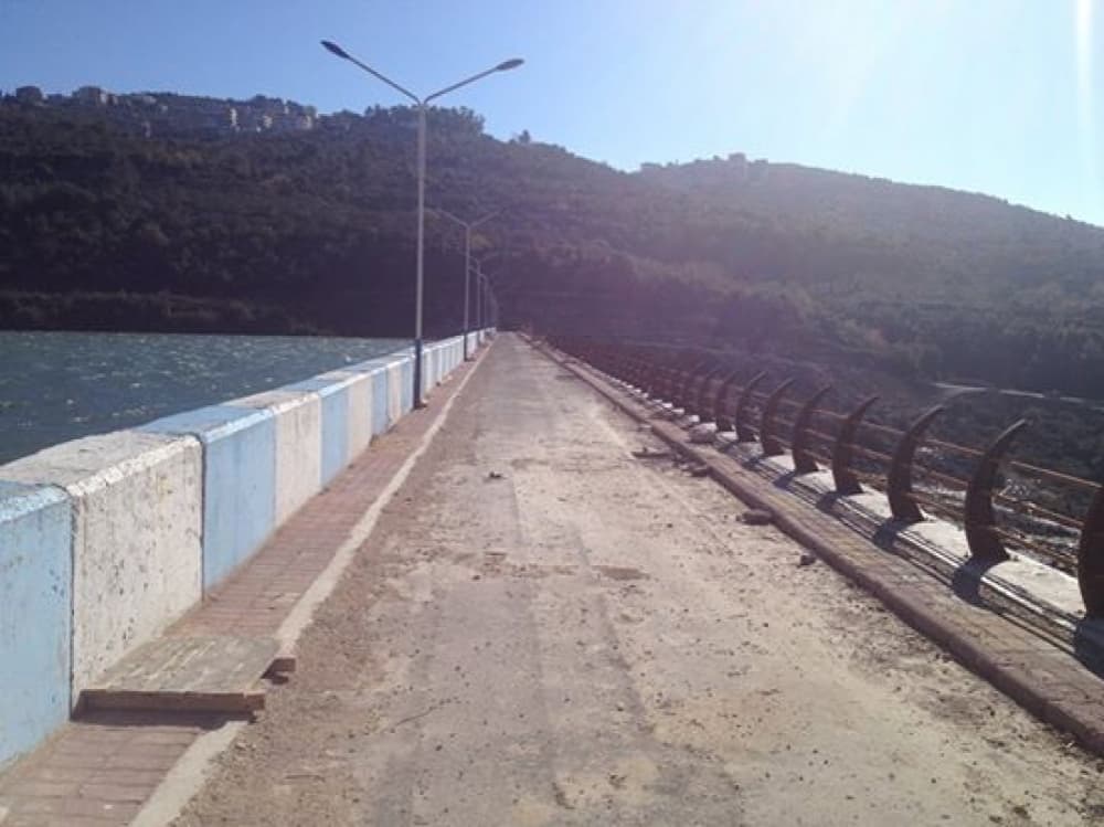
The lake is one kilometre long and on average 350 metres wide: a narrow valley lake. Photographs from 2015 and 2016 show slopes of olive groves and scrub with village houses on the ridges, and a road along the crest lined with street lamps.
How long it takes and when to go
An hour and a half is enough to see the lake from the shore and look along the crest. Spring and autumn are mild. The slopes are green then, while in summer there is little shade at midday.
What most people miss
If walking on the crest is allowed, stop in the middle and look both ways: the lake on one side, the valley 41 metres below on the other. Only from there does the size of the dam register. The Al-Dalbeh spring at the far end of the lake is one of the main sources of drinking water in the area.
Tips
- The lake was built for drinking water; ask on site about swimming and going near the water
- The slopes along the shore are steep and stony; wear shoes with grip
- Dreikish town and Safita fit into the same day
Transparency
- How this was chosen
- Written by hand; opening hours, entry fee and coordinates are kept as data. A field that is not known for certain is marked as variable rather than guessed.
- Facts checked
- September 2026
- Last updated
- September 15, 2026