The Jaghjagh River
The Jaghjagh rises in Tur Abdin, runs through Qamishli and joins the Khabur in Hasakah: 124 kilometres long, once the Mygdonius, and dry in town for a decade.
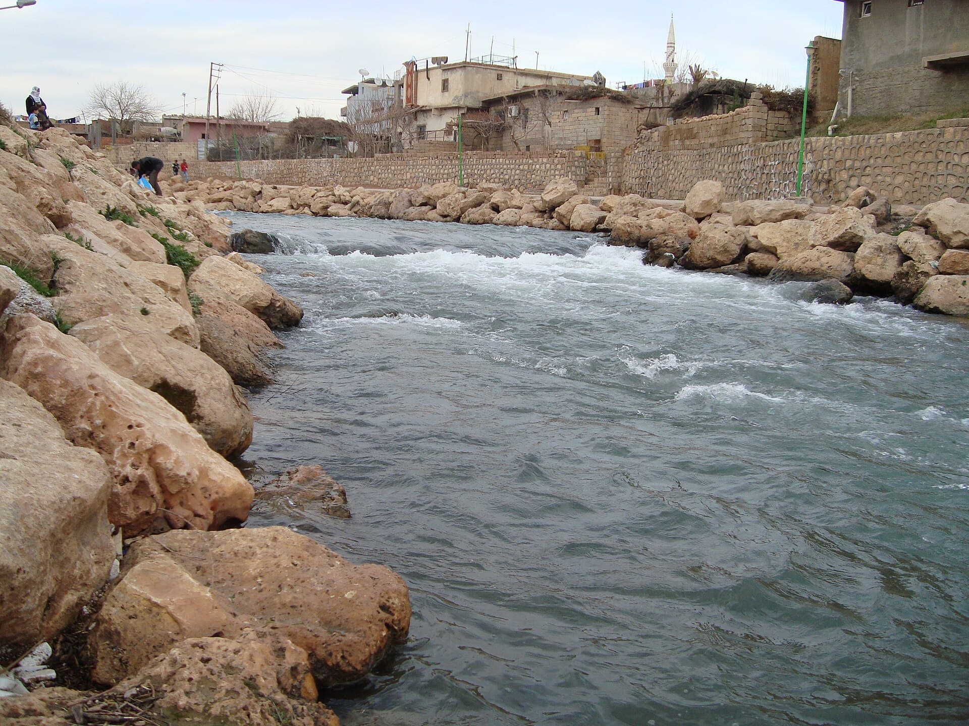
- Opening hours
- Open ground, no set hours
- Entry
- Free
- Duration
- 60 minutes
- Best time
- Spring after a wet winter; in dry years the bed in Hasakah is empty
- Period
- Natural; anciently the Mygdonius, the Hirmas in Arabic sources
- Address
- South from the Nusaybin–Qamishli border to the Khabur in central Hasakah
The Jaghjagh is one of the eastern tributaries of the Khabur and the water that links the two main cities of the Jazira, Syria’s north-eastern plain. It rises on the Tur Abdin plateau in Turkey, crosses the border between Nusaybin and Qamishli, and flows south to join the Khabur in the centre of Hasakah. Arabic Wikipedia gives its length as 124 kilometres, 100 of them in Syria. It once watered more than 50 thousand dunams of farmland. Today its bed swings from year to year between a flowing river and a dry, rubbish-filled ditch.
Where it rises and where it runs
It comes from two sources. The longer branch, the Siyahsu, Ava Reş in Kurdish (“black water”), rises near the village of Toptepe in the Nusaybin district; mining leaves its water greyish and undrinkable. The shorter branch, the Beyazsu or Ava Spî (“white water”), runs clear. The two springs rise 10 kilometres apart and meet two and a half kilometres downstream. The river feeds the Nusaybin dam, splits Nusaybin in two and enters Qamishli at the border.
Beyond Qamishli it makes a wide curve to the south-west, turns at the village of Safa, flows south to Hasakah and joins the Khabur just below the city. Its flow is given as 8 to 12 cubic metres a second. Both countries draw on it for irrigation, so the water drops in summer, and pollution has been documented. Freshwater mussels and turtles live in the river.
Why it ran dry for years
In November 2025 the bed in Hasakah’s al-Mufti neighbourhood had been dry for more than ten years: rubbish had piled up in it and mosquitoes had become a problem for the area. Residents recalled fishing there. In March 2026, after heavy rain, the river flowed through Hasakah again. In Qamishli, in July 2025, people protested against covering over the riverbed for commercial buildings. In short, the river in town changes from one year to the next: water that runs one year may be gone the next.
Where the name comes from
Its ancient Greek name was the Mygdonius, and Nusaybin’s Hellenistic name, “Antioch in Mygdonia”, comes from it. Arab and Syriac sources call the river the Hirmas. Qamishli’s Syriac name, Beth Zalin, means “house of reeds”, and the Arabic name Qamishli comes from the Turkish word for reed, “kamış”. Both point to the reed beds on the banks. In the Abbasid period a canal was dug from this river to Tell Brak.
Where to see it
The river runs through two cities, so no special trip is needed: the banks inside Qamishli and Hasakah are public. Whether there is water to see depends on that year’s rain. The city of Hasakah has been under the administration of government security forces since 2 February 2026. The cover photograph was taken in January 2009 in Nusaybin, on the Turkish side of the border; crossing there from Syria is not what this page is about.
Don’t miss
The meeting point in Hasakah. The Jaghjagh joins the Khabur in the city centre, and Tell al-Hasakah, the city’s ancient mound, stands 1700 metres from the confluence. The city’s two rivers and its oldest layer sit within one small area.
Tips
- Ask in Hasakah whether the river is flowing before you go; the bed was dry for more than ten years
- Stay out of the dry bed; rubbish and mosquitoes there are documented
- Ask before photographing bridges or the banks near the border
- The Khabur River and Tell al-Hasakah entries describe the same confluence; read them together
Transparency
- How this was chosen
- Written by hand; opening hours, entry fee and coordinates are kept as data. A field that is not known for certain is marked as variable rather than guessed.
- Facts checked
- September 2026
- Last updated
- September 15, 2026