The Khabur River
The largest perennial tributary of the Euphrates in Syria, from the springs of Ras al-Ayn to al-Busayra, with the Jazira’s great tells from Tell Halaf to Tell Brak.
- Opening hours
- Open ground, no set hours
- Entry
- Free
- Duration
- 60 minutes
- Best time
- Spring, when the seasonal tributaries are most likely to hold water
- Period
- Natural; settlement along its banks from the Lower Palaeolithic to today
- Address
- From Ras al-Ayn through Hasakah to the Euphrates near al-Busayra
The Khabur is the largest perennial tributary of the Euphrates in Syria. It rises in Turkey, but most of its water comes from karst springs around Ras al-Ayn, just south of the border. The river cuts across the Jazira plain from north to south, runs through Hasakah and joins the Euphrates near al-Busayra in Deir ez-Zor province. Some of the earliest cities of Upper Mesopotamia — Tell Halaf, Tell Brak, Tell Leilan — stand on the banks of this river and its tributaries.
The Khabur triangle: where the tributaries come from
North of Hasakah several valleys converge to form the plain known as the “Khabur triangle”. From east to west the tributaries are the Wadi Radd, the Wadi Jarrah, the Jaghjagh — the ancient Mygdonius — the Wadi Khanzir and the Wadi Awaij. Most of them carry water for only part of the year.
Annual rainfall in the basin is above 400 millimetres in the north and drops below 200 millimetres in the south. The further south you go, the more farming depends on the river rather than the rain, which is why the Khabur has carried this plain throughout its history.
Where to see it
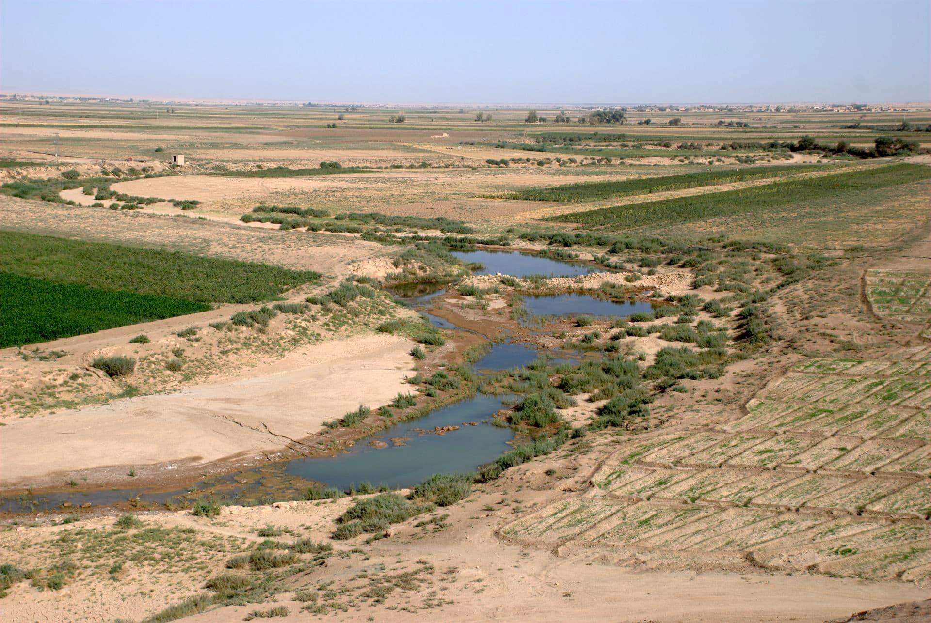
No special trip is needed: the Khabur crosses Hasakah and the riverbank in town can be walked. In the north it passes Tell Halaf near Ras al-Ayn. At Tell Tamer the main road crosses the river, and that is where the line of Assyrian villages along the bank begins. In the south, beside Tell Sheikh Hamad in Deir ez-Zor province, the valley widens; as in the cover photograph, in autumn the bed can break up into shallow pools between the fields.
A name unchanged since Akkadian texts
Akkadian and Amorite texts call it ḫabur. In the Hebrew Bible it is the Habor: the Assyrian king Tiglath-Pileser is said to have taken his deportees to Halah, Habor, Hara and the river of Gozan, and that identification is not in dispute. Ptolemy and Pliny call it the Chaboras; Strabo, Zosimus and Ammianus, the Aborrhas; Procopius, the Chabura. Whether it is the same as the river Chebar in the Book of Ezekiel is debated.
What lies along it
Excavations since the 1930s have shown that the basin has been inhabited since the Lower Palaeolithic. Sites on the river and its tributaries include Tell Halaf, Tell Brak, Tell Leilan, Tell Mozan, Tell Barri and Tell Mashnaqa. The painted pottery of the early 2nd millennium BC takes its name from the river: archaeologists call it “Khabur ware”. The Mitanni kingdom rose in this basin too.
The 20th century brought two things to the banks. In the 1930s Assyrians arriving from Iraq founded villages along a 25-kilometre stretch of riverbank around Tell Tamer. And in the 1960s work began on the Khabur valley project, a system of dams and canals; the Basil dam in the Shaddadi area is one of them.
Don’t miss
The blue line on the map can mislead. Most of the tributaries in the Khabur triangle are seasonal, and a valley drawn as a stream may turn out to be a dry bed on the ground. The permanent water is in the main channel, the branch that flows south from Ras al-Ayn.
Tips
- Most tributaries are seasonal; a valley shown as a stream may be dry on the ground
- In the north the Ras al-Ayn area is very close to the border; keep away from the border strip
- Ask before photographing dams and bridges
- The Tell Halaf, Tell Brak and Tell Tamer entries sit on the same river; read them together
Transparency
- How this was chosen
- Written by hand; opening hours, entry fee and coordinates are kept as data. A field that is not known for certain is marked as variable rather than guessed.
- Facts checked
- September 2026
- Last updated
- September 15, 2026