Kharab Sayyar (al-Jarud)
An Abbasid town 40 km east of the Balikh inside a square wall 650 metres a side: an excavated mosque, market and bathhouse, and stucco in the style of Samarra.
- Opening hours
- No visiting arrangement; access unconfirmed
- Entry
- Variable — confirm at the entrance
- Duration
- 90 minutes
- Best time
- A spring or autumn morning; there is no shade on the open plain
- Period
- Abbasid (the caliphate ruling from Baghdad and Samarra)
- Address
- Wadi Hamar, about 40 km east of the Balikh; Ras al-Ayn district, Hasakah
Kharab Sayyar is the ruin of a provincial Abbasid town known in the 9th century as al-Jarud. The clearest feature of the 42-hectare site is its wall: a square of roughly 650 by 650 metres with projecting half-round towers. Excavations in 1997-2011 uncovered a mosque, a market, a bathhouse, houses and a water supply system inside it. The town had its best years while the Abbasid capital was at Samarra, and emptied after a short life.
Where it is
About 40 kilometres east of the Balikh River, in the Wadi Hamar area; administratively in the Ras al-Ayn district of Hasakah province. It lies on the plain between Ras al-Ayn and Tell Abyad, more than 50 kilometres from each as the crow flies. The sources place the site up to 2 kilometres apart, so this page carries no map.
How long it takes
An hour and a half. Each side of the wall runs 650 metres, and walking to the mosque, the market, the bathhouse and the mound in the south-east corner takes most of that time.
Why a town grew here
According to Stefan Heidemann’s study of the coins, al-Jarud was only built to any significant extent in the middle of the 9th century. The Abbasid capital was then at Samarra, the caliphs’ city on the Tigris, and demand for farm produce was at its height. The town stood on an east-west trade route. Around it lay a well-farmed plain: at least 60 settlements of the same period have been identified within a radius of 13 kilometres. Jan-Waalke Meyer, one of the excavation directors, first proposed an earlier Umayyad phase and later withdrew the idea. The latest dated coin fragment from the site belongs to the reign of the caliph al-Mu’tadid, between 892 and 902, and the town was probably abandoned soon after.
What to see
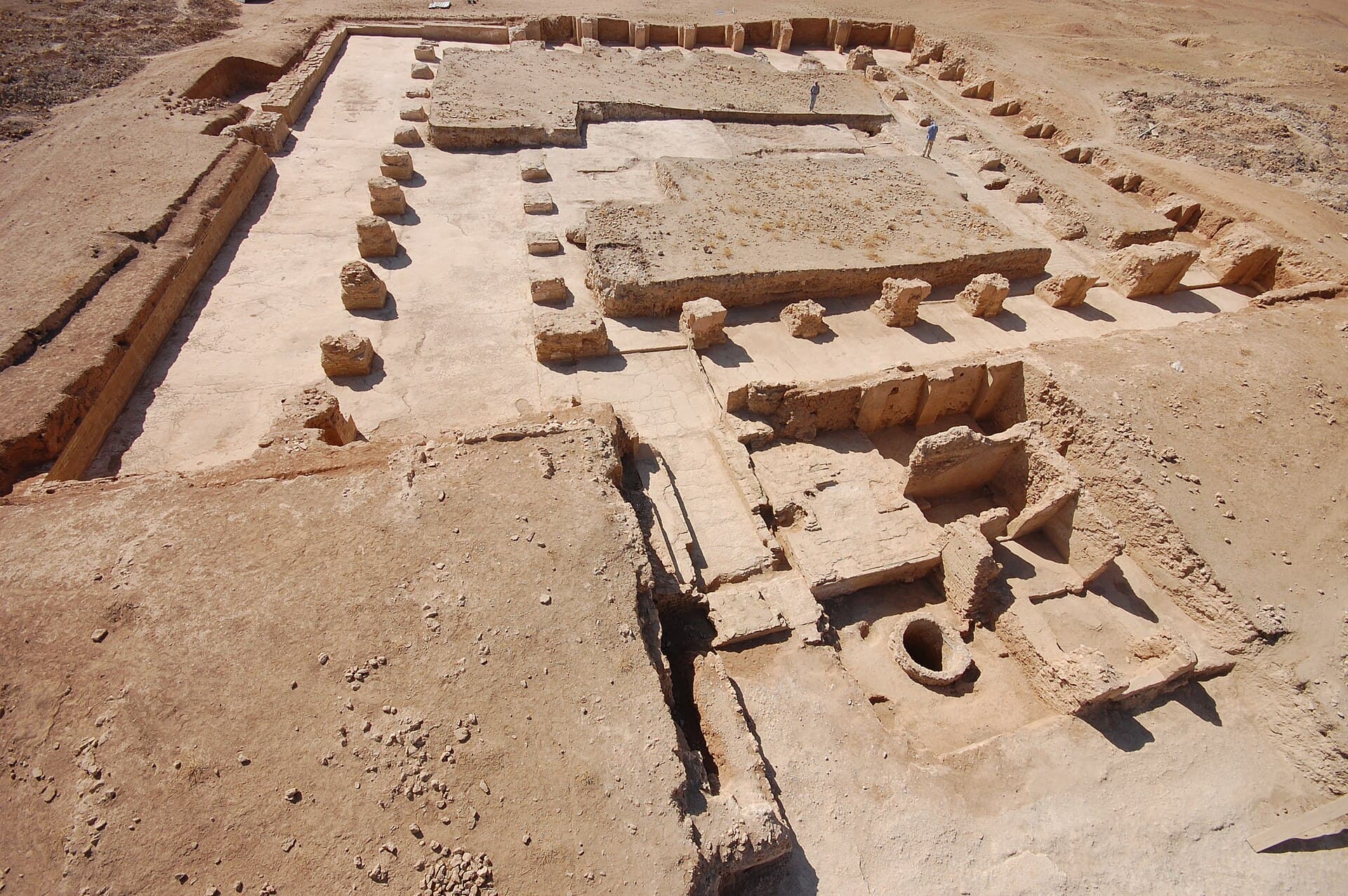
Start with the mosque. The mosque excavated in the north-west, with the stretch of market beside it, is the easiest part of the site to read: the stone pier bases in the cover photograph belong to this mosque. At least seven houses and a small prayer hall were uncovered in the same quarter. A gate and part of the wall came to light on the west side, and a bathhouse towards the centre. In the south-east corner, on top of a third-millennium BC mound enclosed by the wall, stands a large building; the town was laid out around an older mound. Various parts of the water supply system were also excavated.
What not to miss
The stucco. The rooms of two houses and part of the mosque were covered in carved stucco resembling the decoration of Samarra. One panel is now on display in the Museum of Islamic Art in Berlin: deeply cut leaf and branch motifs that show the style of the capital reaching as far as a provincial town.
Excavation and the site today
The site was excavated in 1997-2011 by a joint team from the Syrian Directorate-General of Antiquities and Museums and Goethe University Frankfurt. Imad Mussa and Jan-Waalke Meyer led the work, and the results are being published in the series Ausgrabungen in Kharab Sayyar. Since October 2019 the area has been in the Ras al-Ayn to Tell Abyad strip under the control of Turkey and the Syrian National Army. We could not confirm the administrative situation in 2025-2026 or access to the site; the strip lies close to the border and there is no fixed visiting arrangement. If you are thinking of going, ask first in Ras al-Ayn or Hasakah.
Tips
- Before setting out, ask in Ras al-Ayn or Hasakah about the state of the site; the area is in the border strip
- The mosque is in the north-west; its pier bases and the market lie side by side
- Climb the old mound in the south-east corner; the square plan of the wall reads better from above
- The stucco panel on display is not on site but in Berlin
Transparency
- How this was chosen
- Written by hand; opening hours, entry fee and coordinates are kept as data. A field that is not known for certain is marked as variable rather than guessed.
- Facts checked
- September 2026
- Last updated
- September 15, 2026