Qreiye-Ayyash Roman Fort
A square legionary fort 220 metres a side, built under Septimius Severus above the Euphrates west of Deir ez-Zor and used for only a few decades. Access unconfirmed.
- Opening hours
- No visiting arrangement; access unconfirmed
- Entry
- Variable — confirm at the entrance
- Duration
- 60 minutes
- Best time
- A spring or autumn morning; there is no shade on the plateau
- Period
- Roman (Severan dynasty)
- Address
- Right bank of the Euphrates, north of Ayyash village; west of Deir ez-Zor
Qreiye-Ayyash is a Roman fort on the right bank of the Euphrates, built on the edge of a plateau above the valley. It is square, 220 by 220 metres, and covers about 5 hectares. It was built from scratch under the emperor Septimius Severus, at the end of the 2nd century or the start of the 3rd, and abandoned only a few decades later, in the middle of the 3rd century. It was one of two large garrisons on the Euphrates road; the other was at Dura-Europos. Access today could not be confirmed.
Where it is and can you go?
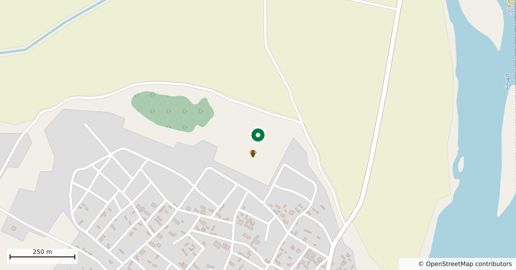
The fort lies just north of the modern village of Ayyash, upstream of Deir ez-Zor, 12 or 14 kilometres away depending on the source. The point on the map is the one given by the Ifpo atlas; it matches the site outline in OpenStreetMap to within 53 metres.
The administration of the region changed in January-February 2026. No dated source specific to the site from the last 12 months was found. A North Press Agency (NPA) report of 18 June 2025 describes illegal digging with metal detectors in the Ayyash villages. An NPA report of 26 March 2026 says people were killed by mine explosions in the western desert of Deir ez-Zor province. This page is not a suggestion to visit; the authorities in Deir ez-Zor should be asked first.
Why was a fort built here?
After the emperor Lucius Verus pushed the Roman frontier to the Tigris and the Khabur, Septimius Severus placed two large garrisons on the Euphrates road along the edge of the desert. At Dura-Europos the soldiers moved into the existing town. At Qreiye-Ayyash a fort was built from the ground up on an empty plateau. That also explains its short life: once the frontier moved, the fort was no longer needed.
What was it called?
This is disputed. The Ifpo atlas suggests Birtha or Birtha Arupan. Older publications refer to the site as Tell el-Ajjâsch or Tell Ayyash.
Who found and excavated it
Antoine Poidebard found the fort in 1929 during his aerial photography survey. A joint Syrian-German project excavated it in 2002-2006, led by Markus Gschwind of the German Archaeological Institute (DAI) and Haytham Hasan. Geophysical surveys followed with different ground-penetrating radar systems in 2009 and with satellite radar in 2012. The final excavation report was published by the DAI in 2025. The Ifpo atlas lists the site as protected.
What not to miss
The comparison with Dura-Europos. Both garrisons came from the same emperor’s decision about the same frontier, yet one fitted inside a town and the other was built on an empty plateau. Because Qreiye-Ayyash was abandoned after a few decades, it preserves the military plan of a single period; read alongside the Dura page, it shows how the Severan frontier was set up.
Tips
- Before setting out, ask in Deir ez-Zor about the site and the road; mine deaths were reported in the province's western desert in 2026
- Illegal digging was reported in the Ayyash villages in 2025; keep away from the edges of open pits
- The fort's twin garrison was at Dura-Europos; read the two pages together
Transparency
- How this was chosen
- Written by hand; opening hours, entry fee and coordinates are kept as data. A field that is not known for certain is marked as variable rather than guessed.
- Facts checked
- September 2026
- Last updated
- September 15, 2026