Tell Qaramel
Circular stone towers on this mound 25 km north of Aleppo date to 10650-9650 BC, the oldest such structures known. Excavation stopped in 2011 because of the war.
- Opening hours
- Open ground; excavation halted since 2011 — confirm on site
- Entry
- Variable — confirm on site
- Duration
- 45 minutes
- Best time
- A spring morning; there is no shade on the mound
- Period
- Pre-Pottery Neolithic A — Hellenistic
- Address
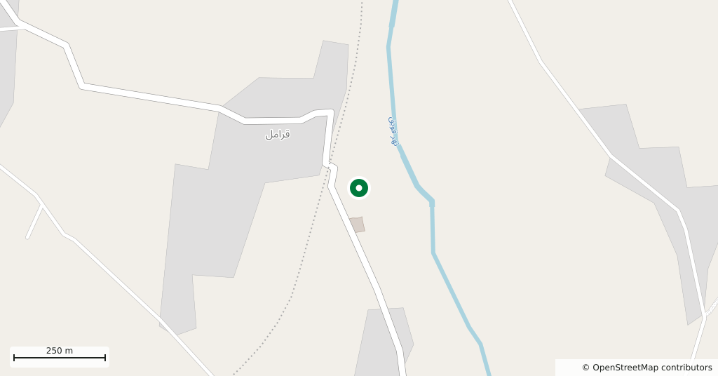
- East of Qaramel village, towards the Queiq river, 25 km north of Aleppo
Tell Qaramel is a tell — an ancient settlement mound — 25 km north of Aleppo in the basin of the Queiq river. Its importance lies not in the later layers on top but in the stone buildings at the bottom: the circular stone towers found here date to between 10650 and 9650 BC, the oldest structures of their kind known so far.
Where it is
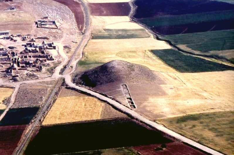
The mound lies between the present-day village of Qaramel and the Queiq river to the east. Its summit stands 444 m above sea level; the Neolithic settlement extends to the south of it and lies about 20 m lower. This is a fertile river valley and a trade route of long standing. A railway still runs between the village and the tell, cutting through the Neolithic site.
What was found
A survey in the late 1970s found traces of settlement from the Pre-Pottery Neolithic A through to the Hellenistic period. The later phases are on the mound itself. The Neolithic phase covers a wider area stretching south and southwest of the tell, buried under up to two and a half metres of Bronze Age and Iron Age deposits. The Neolithic settlement covers an area of 190 by 160 m.
Why it matters
Before the excavations, it was assumed that permanent settlement appeared only together with the first cereal farming and the domestication of animals such as sheep and goats. The stone buildings at Qaramel turned out to be older than that, and they are among the first evidence of permanent settlement built in stone. On the radiocarbon dates, the site is older than Göbekli Tepe in Turkey.
The dates are not undisputed. The excavators themselves rejected several samples that did not fit the stratigraphy, and some dates look too early compared with similar phases at other sites.
Who dug it
From 1999 a joint Polish-Syrian team worked here under the Polish Centre of Mediterranean Archaeology, led by Ryszard F. Mazurowski of Warsaw University and Youssef Kanjou of the Aleppo Museum. About six areas were investigated and four excavated — less than 2 per cent of the whole site. After 2011 the excavations were suspended because of the war.
What most people miss
The railway. The line between the village and the mound runs straight through the area where these early stone towers were found. An aerial photograph shows it plainly: the village on one side, the track and a road in the middle, and on the other side the mound with its excavation trench on the slope.
Tips
- Do not expect to see the towers exposed; the state of the trenches since work stopped is unknown
- The railway still runs between the village and the mound; cross the track with care
- The land around is farmed; approach the mound along field edges and tracks
Transparency
- How this was chosen
- Written by hand; opening hours, entry fee and coordinates are kept as data. A field that is not known for certain is marked as variable rather than guessed.
- Facts checked
- September 2026
- Last updated
- September 15, 2026