Zarzar Lake
A reservoir at about 1200 metres on the road to Zabadani, dammed in 1969. It dried out in summer 2025 and refilled in 2026; what to check before you go.
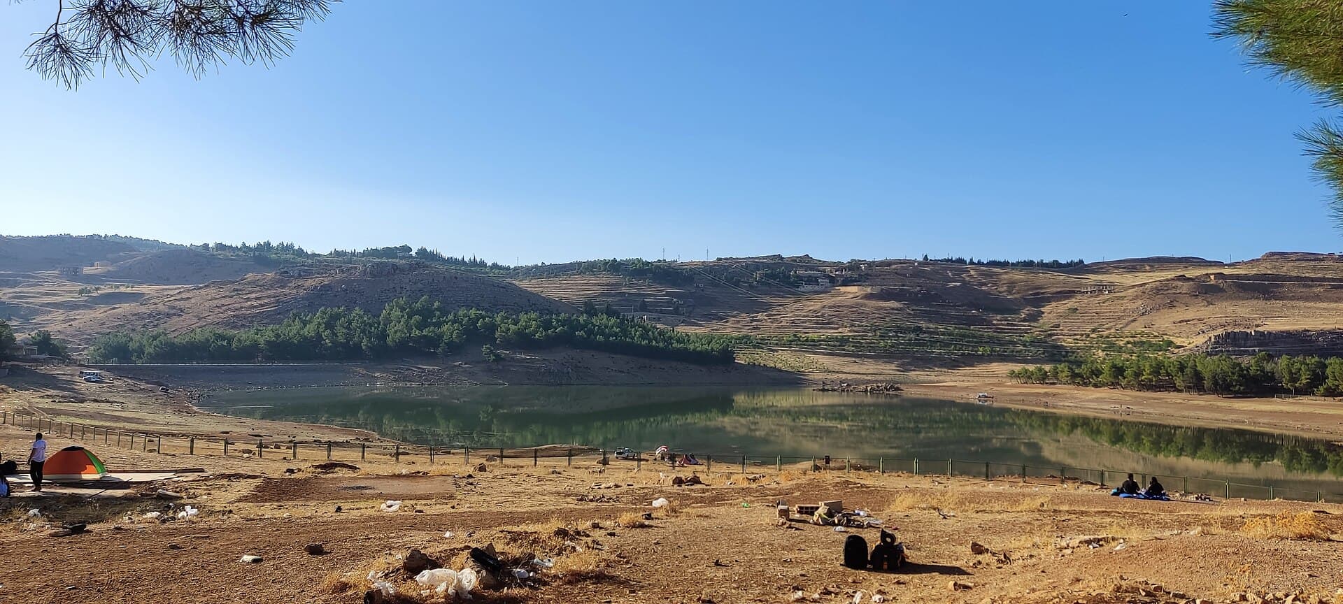
- Opening hours
- Open ground, no set hours
- Entry
- Free
- Duration
- 120 minutes
- Best time
- Spring, once snowmelt has filled the lake. The level can fall by late summer
- Period
- Modern — dam completed 1969
- Address
- Between Rawda, Hosh Bajed and Takiyeh, Zabadani area, Rif Dimashq
Zarzar is a man-made lake about 30 kilometres northwest of Damascus, in the Zabadani area, between the villages of Rawda, Hosh Bajed and Takiyeh. It sits at roughly 1200 metres. The water collects behind a dam on Wadi al-Qarn that was finished in 1969, which is why locals also call the place Zarzar Dam. For years it was a weekend outing for people from Damascus. The lake is not the same every year: in summer 2025 it almost completely dried out, and the rains of 2026 filled it again.
Is there water in the lake right now?
Ask before you go. The lake has no source other than snowmelt and rain. The winter of 2024-2025 was the driest in decades, and by the end of September 2025 almost the whole lakebed was exposed. The water came back in 2026. Since June 2026 the dam’s outlet gates are reported to have stayed open, so the level may drop over the summer.
Getting there
The lake lies off the Damascus–Beirut highway, on the road up to Zabadani. Takiyeh is 4 kilometres from Hosh Bajed. The area is close to the Lebanese border and the Jdeidet Yabous crossing. There can be military checkpoints on the way, and photographing them causes trouble. Whether minibuses stop at the lake has not been confirmed; ask before you set out.
What to see
Pine groves and dry, terraced slopes surround the shore. The dam is at the northeastern end of the lake. Its capacity is given as around 400 thousand cubic metres. It was built for irrigation, to catch floodwater, to recharge groundwater and to raise fish. In January and March 2026 a local initiative released carp into the lake; reports say the open gates now put those fish at risk.
For birdwatchers
The lake is inside BirdLife’s Wadi al-Qarn–Burqush Important Bird Area, where the steppe eagle and the Syrian serin have been recorded. Burqush, in the same bird area, has the remains of a basilica built on the podium of a Roman temple. Whether you can fit both into one day depends on getting permission for Burqush.
What most people miss
The bare strip of shore between the water and the slope. That band shows most plainly how far the water can pull back in a dry year, and it tells you at a glance that this lake runs on a calendar.
Tips
- Ask whether there is water in the lake before you set out; the bed was dry in summer 2025
- Do not photograph checkpoints or anything facing the border
- Bring binoculars; the lake lies inside the Wadi al-Qarn–Burqush bird area
- Evenings at 1200 metres are cool; take a light layer even in summer
Transparency
- How this was chosen
- Written by hand; opening hours, entry fee and coordinates are kept as data. A field that is not known for certain is marked as variable rather than guessed.
- Facts checked
- September 2026
- Last updated
- September 15, 2026