Tell Tuneinir (Thannuris)
40 hectares on the east bank of the Khabur, lived in from 2700 BC to AD 1401: Justinian’s frontier fortress of Thannuris and a church used for six centuries.
- Opening hours
- Open site, daylight hours; confirm access beforehand
- Entry
- Variable — confirm at the entrance
- Duration
- 60 minutes
- Best time
- A spring morning; the light suits reading the mound
- Period
- Ninevite V — Roman-Byzantine — Islamic — Ottoman
- Address
- East bank of the Khabur, Al-Basil Dam reservoir; 15 km south-east of Hasakah
Tell Tuneinir is a 40-hectare site on the east bank of the Khabur: a central mound more than 18 metres high, surrounded by a lower town. People lived here without a break from around 2700 BC until 1401, for more than four thousand years. In the Roman and Byzantine period it was called Thannuris and served as a fortress facing the Persian frontier. Under Islamic rule it became a small town where Syriac-speaking Christians and Arabic-speaking Muslims lived side by side.
Where it is
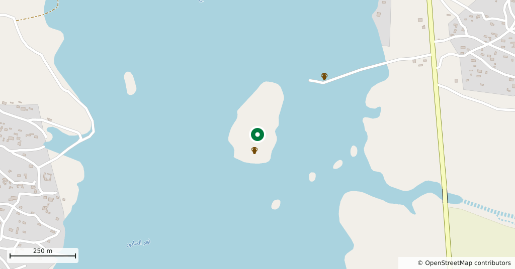
15 kilometres south-east of Hasakah, on the east bank of the Khabur. The Al-Basil Dam was completed in 1997, and part of the site now lies within the reservoir, in a zone that can go under water depending on the level. The mound itself is visible; we could not confirm how much of the lower town and excavation areas is submerged, nor current access.
How long it takes
An hour. That is enough to climb the mound and look over the part of the lower town that runs down to the shore.
Thannuris: the edge of two empires
In the 1st century BC the Khabur became the frontier between Rome and the Parthian Empire, and a small farming settlement grew into an important town. The ala prima nova Diocletiana, a unit of local mounted archers, was stationed between Thannuris and Horaba, today’s Tell Ajaja. According to the 6th-century historian Procopius, the emperor Justinian wanted the fortress strengthened. The first attempt failed when the army under Belisarius was defeated by the Sassanid Persians. A later effort succeeded, and Thannuris became, in Procopius’ words, a truly formidable fortress. Even so, the Persians took it in 587, when it had been left undefended.
Church, monastery and Timur
The town’s church was in continuous use from the 6th century to the 12th. A monastery, first built of limestone in the 5th or 6th century, was repaired several times and stayed in use until the 15th century. In 1401 Timur’s army destroyed the town. In the Ottoman period it was the tax centre for semi-nomads who pitched their tents along the Durin canal; an Ottoman military building and graves were found on the site.
What not to miss
The unbroken sequence of layers. Around 2000 BC many settlements in the region were abandoned and never reoccupied, but Tell Tuneinir was not affected. From Ninevite V pottery, of the early third millennium BC, to Ottoman graves, four thousand years of material lie stacked on the same mound. Together with Tell Ajaja and Tell Taban to the south, it is one link in the chain of sites along the Khabur that runs from Assyria to Rome.
A history of excavation
Austen Henry Layard passed through in 1853 while surveying the Khabur valley. Friedrich Sarre and Ernst Herzfeld examined the site in 1911 and Antoine Poidebard in 1934, when he mapped it. Wolfgang Röllig and Hartmut Kühne worked here in 1977-1978, and Jean-Yves Monchambert in 1983-1984. When the Al-Basil Dam threatened the site, the Syrian Directorate-General of Antiquities and Museums asked St. Louis Community College to step in; a team led by Michael and Neathery Fuller assessed the site in 1986 and began excavating in 1987. After the dam was finished, work continued as rainfall allowed. The last season was in 2004.
Tips
- Pair it with Tell Taban; both are on the same bank of the Khabur, 12 km apart
- Ground near the reservoir softens with the water level; test it before stepping close to the edge
- The mound is earth and mud brick; keep away from the edges of the old trenches
- Before going, ask in Hasakah how much of the site is above water
Transparency
- How this was chosen
- Written by hand; opening hours, entry fee and coordinates are kept as data. A field that is not known for certain is marked as variable rather than guessed.
- Facts checked
- September 2026
- Last updated
- September 15, 2026