Bosra’s Roman bridges: a half-day loop to Gemarrin and Kharaba
Two Roman bridges over the Wadi Zeidi north of Bosra fit into one morning: the stripped arches at Gemarrin and the intact span at Kharaba. A 21-kilometre loop.
- Duration
- 4 hours
- Distance
- 20.5 km
- Difficulty
- Moderate
- Best season
- March–May, October–November
- stops
- 3
- City
- Bosra
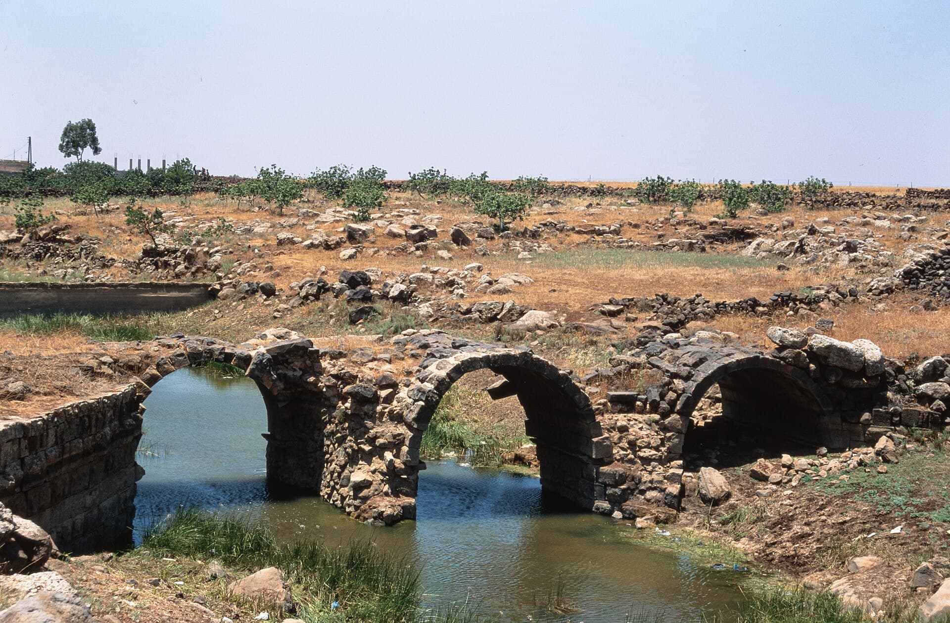
Two Roman bridges cross the Wadi Zeidi north of Bosra, and both fit into a half-day loop that starts and ends at the theatre. At Gemarrin the fill has been stripped away and three arches stand like a skeleton. The three-arch bridge at Kharaba is the most complete Roman bridge in the valley, but it shares its crossing with the modern road bridge, so the arches can only be seen from the valley floor. The loop is about 21 kilometres, with 45 minutes at the wheel in total. The rest of the time goes on the valley edge and the climb down.
The route
From the front of the theatre, head north on the Gemarrin road. The village is 5 kilometres away, ten minutes’ drive; the bridge is at its north end, where the road crosses the valley. From there turn west towards Kharaba: the road follows the upper edge of the valley for 9 kilometres, about twenty minutes. At Kharaba the modern road crosses the valley at the same point as the Roman bridge. Pull over at the roadside and climb down to the valley floor to see the arches. The drive back runs south-east, 7 kilometres to Bosra.
Timing
Leave the theatre at 08:00. There is no shade in the valley or the fields. Both stops are easier in the morning. Be at Gemarrin at 08:15 and give it half an hour: look first at the diagonal retaining walls on both banks, then at the arches. If you also want the 2nd-century villa in the middle of the village, allow an hour here. Reach Kharaba around 09:45. Most of the 40 minutes goes on the valley floor and crossing between the banks, and the square flood channel at the east end cannot be seen from the road. Be back in Bosra by 11:00, with the rest of the day for the town.
Take care
The present condition of both bridges is not confirmed; the sources that describe them as well preserved date from before the conflict. At Gemarrin the backs of the vaults are exposed and the stones are loose, so do not climb onto the arches. At Kharaba the way down to the valley floor has no path and is stony; wear shoes that grip, as the slope is slippery after rain. There is no known ticket office, but ask before crossing fields near the villages. The bridges lie in rural Daraa province. The province saw armed incidents throughout 2025 and unexploded ordnance remains a risk, so stay on known roads and paths. This page does not say the route is safe today; before leaving Bosra, ask locally about the road and the current situation in the area.
The route on a map
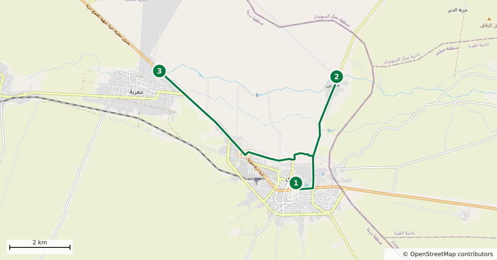
Stops along the route
- 01
- 02
- 03
Transparency
- How this was chosen
- The stops and their order were set by hand. The line on the map is real road geometry, not a straight hop between pins; distance and duration belong to that itinerary.
- Facts checked
- September 2026
- Last updated
- September 15, 2026