Damascus Jewish Quarter walk: from the Mariamite Cathedral to the synagogues and Bab Kisan
About 1500 metres through the Jewish Quarter of Damascus, five stops: the Mariamite Cathedral, the Farhi mansions, the Menarsha and Elfrange synagogues, Bab Kisan.
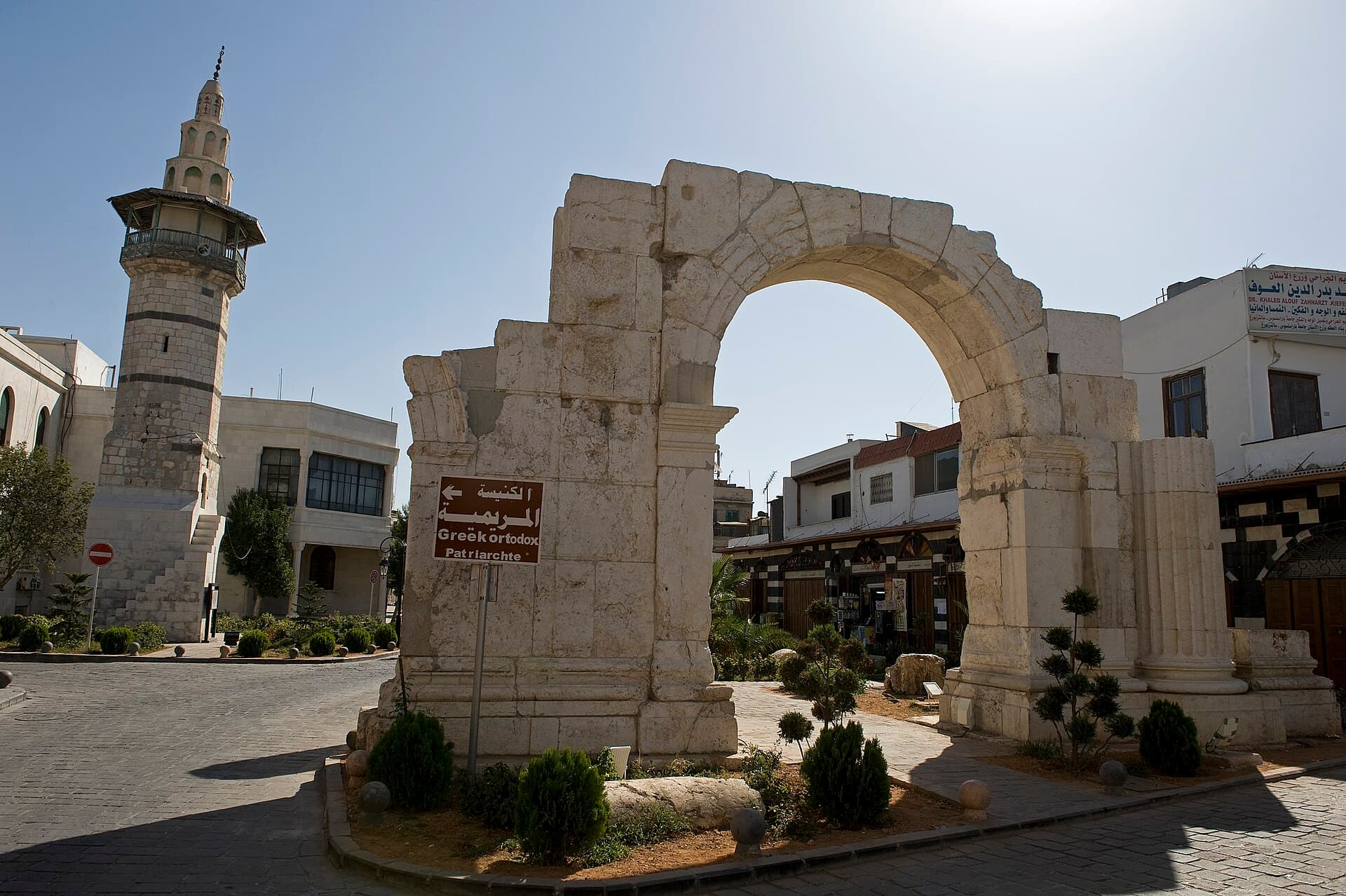
- Duration
- 3 hours
- Distance
- 1.5 km
- Difficulty
- Easy
- Best season
- Year round; mornings
- stops
- 5
- City
- Damascus
This walk of about 1500 metres crosses both sides of Straight Street in the Old City of Damascus: five stops, three hours. It starts at the Mariamite Cathedral, seat of the Greek Orthodox Patriarchate of Antioch, enters Haret al-Yahud, the Jewish Quarter south of the street, and ends at Bab Kisan in the south-east corner of the walls. Until 1948 most people in the quarter were Jewish; the community’s last large emigration came in 1992, and newer maps show the area as al-Amin. In the middle of the walk are two synagogues about 100 metres apart: the Menarsha, unused since 1949, and the Elfrange, the last synagogue in Syria still used for worship. Both are locked. This route offers lanes, doors and facades, not interiors.
The route
You reach the cathedral by a short lane off Straight Street, through the gate of a forecourt with iron railings. Coming out, go back to Straight Street, walk 80 metres east, then turn south into the narrow lanes of the quarter. There is no single monument to find here. What you see is the fabric: houses with plain doors on the lane and courtyards turned inwards, and the mansions of the Farhi family, bankers to Ottoman Damascus, along Tallat al-Hijara Street. After about 200 metres south, on the east side of al-Mansha Street, opposite the north end of the Farhi-Muallim mansion, is the Menarsha Synagogue. The Elfrange Synagogue is about 100 metres further south, on the east side of the al-Fannanin cul-de-sac between the Liniado and Farhi-Muallim mansions; outside there is almost no religious sign. The last leg is the only long one on the route, close to 1100 metres. Head west and walk the length of al-Amin Street south until you are out of the Old City. Then turn east and follow Ibn Asakir Street. Bab Kisan stands at its end, facing out of the walls.
Timing
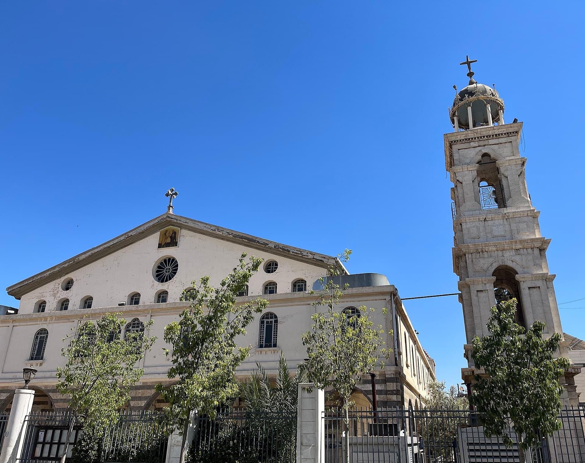
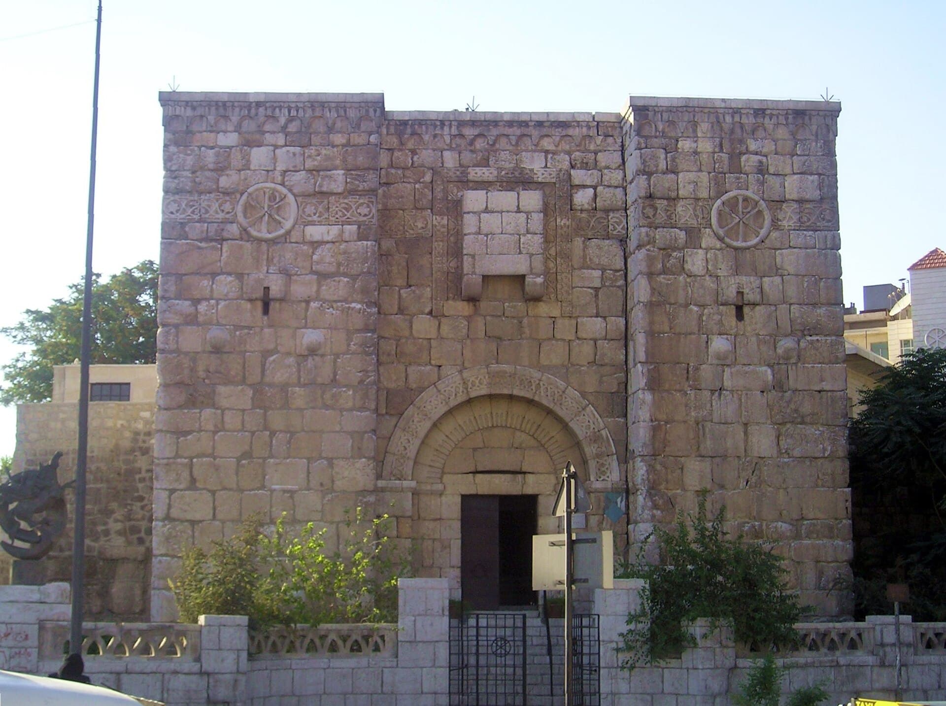
Be at the cathedral at 09:00, at an hour with no service. The courtyard is quiet then, and half an hour is enough for the stone pulpits with spiral stairs on either side of the nave. Enter the quarter at 09:30. The lanes are empty in the morning; because cul-de-sacs cut them up, coming back to the same corner twice is normal, so allow an hour. You reach the door of the Menarsha at 10:30 and the Elfrange at 10:45. If you want to see inside, ask the neighbourhood or the community for permission in advance, and do not try the door. Walk to Bab Kisan at 11:00. The facade faces south-east and takes the morning light head-on; from the opposite pavement, read the blocked window above the arch and the Chi-Rho medallions on the tower faces.
Take care
No source from the last twelve months shows the quarter as it is today. The lanes are part of the Old City, but whether the mansions and synagogues can be visited is not known. Part of the Menarsha has collapsed; the building where 12 people were killed in the attack of 5 August 1949 has not been used since that day. The Elfrange was restored in 2019 and is still used, if rarely; do not take photographs during worship. House doors open straight onto the lanes and people live here: do not step over a threshold to look into a courtyard, and do not photograph residents without asking. Traffic runs past Bab Kisan, so take your time crossing. Keep shoulders and knees covered in the cathedral and in the chapel at Bab Kisan. When asking the way, the quarter’s newer name, al-Amin, helps.
The route on a map
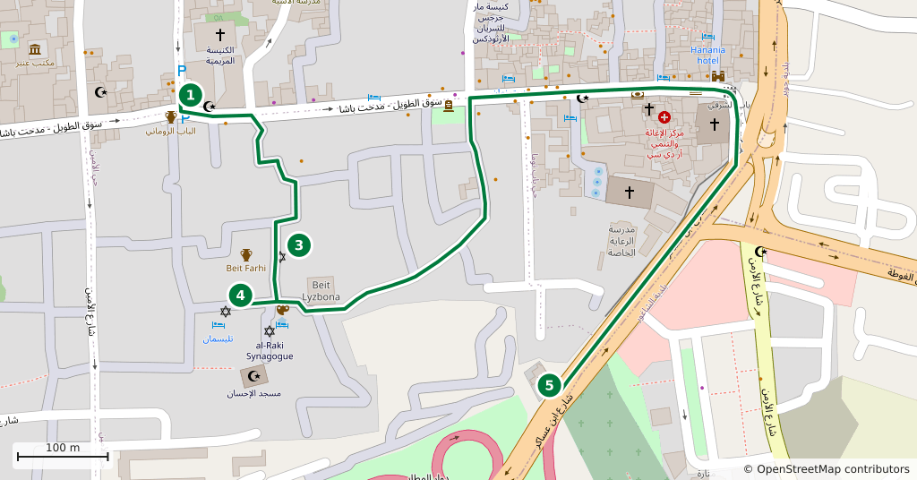
Stops along the route
- 01
- 02
- 03
- 04
- 05
Transparency
- How this was chosen
- The stops and their order were set by hand. The line on the map is real road geometry, not a straight hop between pins; distance and duration belong to that itinerary.
- Facts checked
- September 2026
- Last updated
- September 15, 2026