Hama’s water trail: from the Hama Museum to the Muhammadiyya noria
Follow the Orontes through Hama: the museum’s noria display, the riverside waterwheels, the Great Mosque and the 21-metre Muhammadiyya wheel that once fed it.
- Duration
- 4 hours
- Distance
- 2 km
- Difficulty
- Easy
- Best season
- March–May
- stops
- 5
- City
- Hama
This route follows one question: how did Hama lift the water of the Orontes into the city? It starts with the noria display at the Hama Museum, walks west along the bank from the norias in the centre, passes the Great Mosque and ends at the Muhammadiyya noria, a wheel 21 metres across. The Muhammadiyya once sent its water to that very mosque, so the walk runs from where the water arrived to the wheel that lifted it. Five stops, close to two kilometres on foot, between three and a half and four hours.
The route
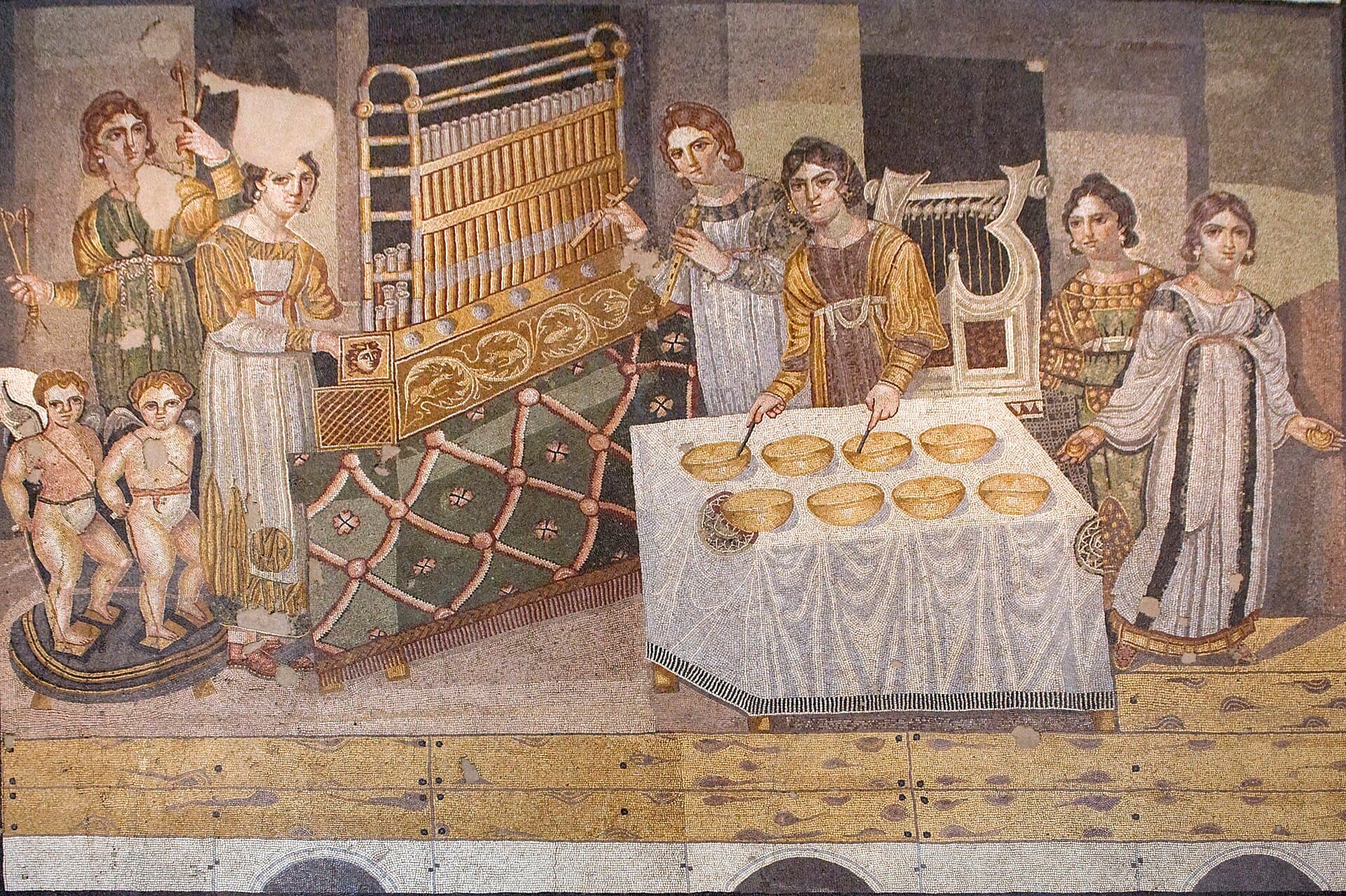
The Hama Museum is in the north of the city, about 200 metres east of the Orontes. The fifth hall covers the Islamic period: it holds a display on how the norias, the great wooden waterwheels, work, and the minbar made for the al-Nuri Mosque in 559 AH, or 1163. In the second hall stands the basalt lion that once guarded an Aramaean palace gate. Some pieces reportedly went missing during the war years, and the hall layout comes from pre-war accounts; if you want to see a particular object, ask at the entrance.
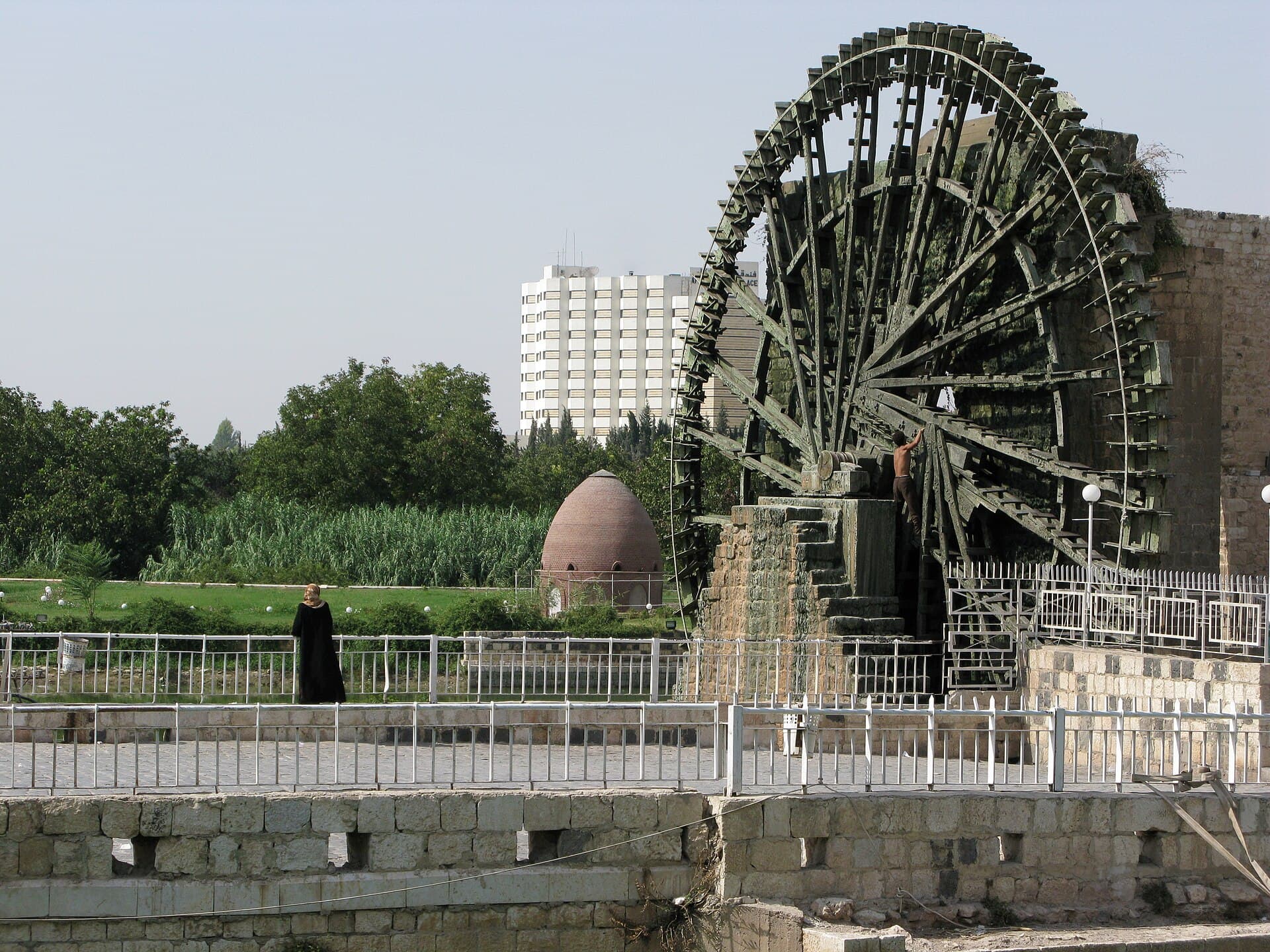
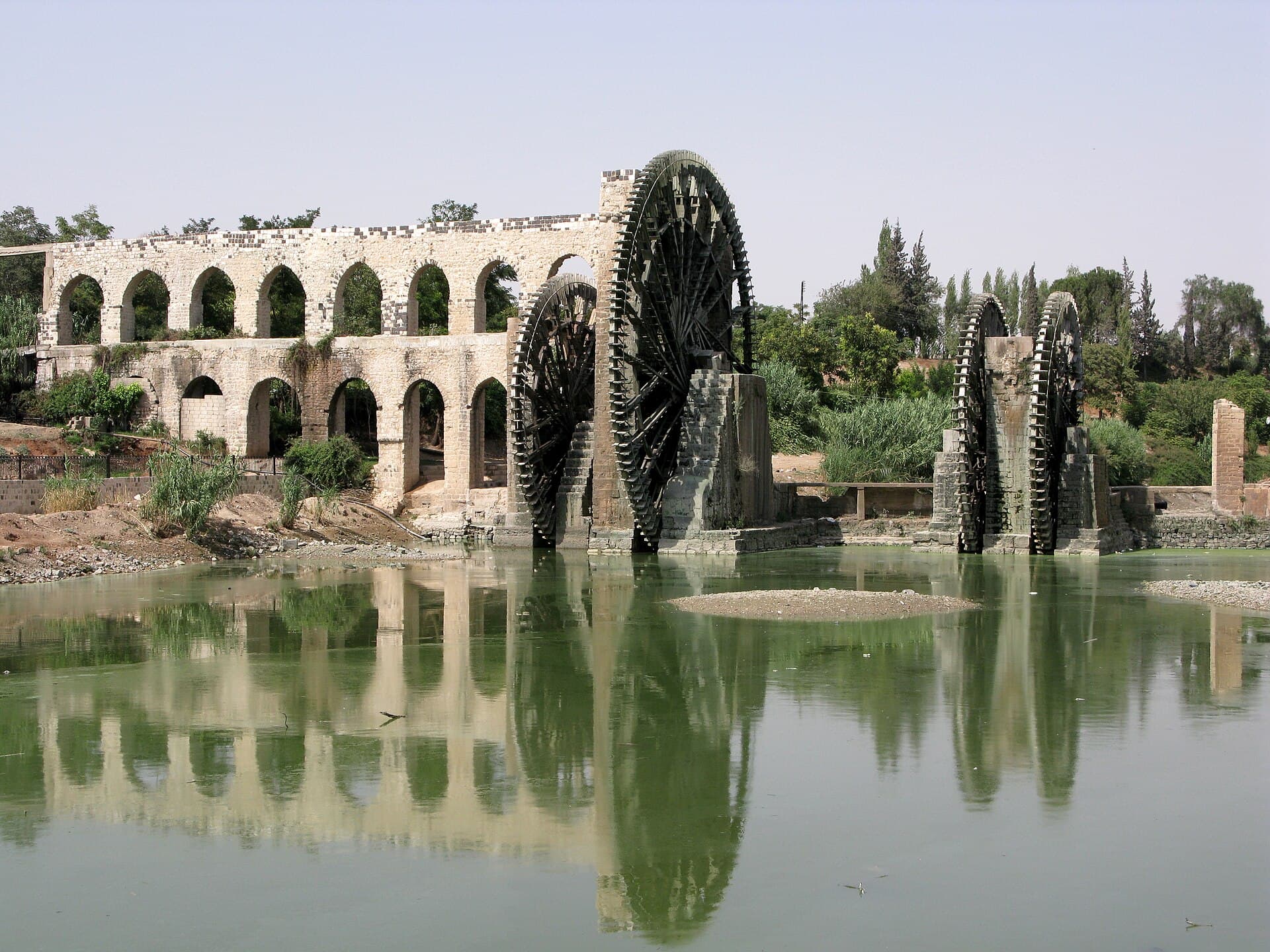
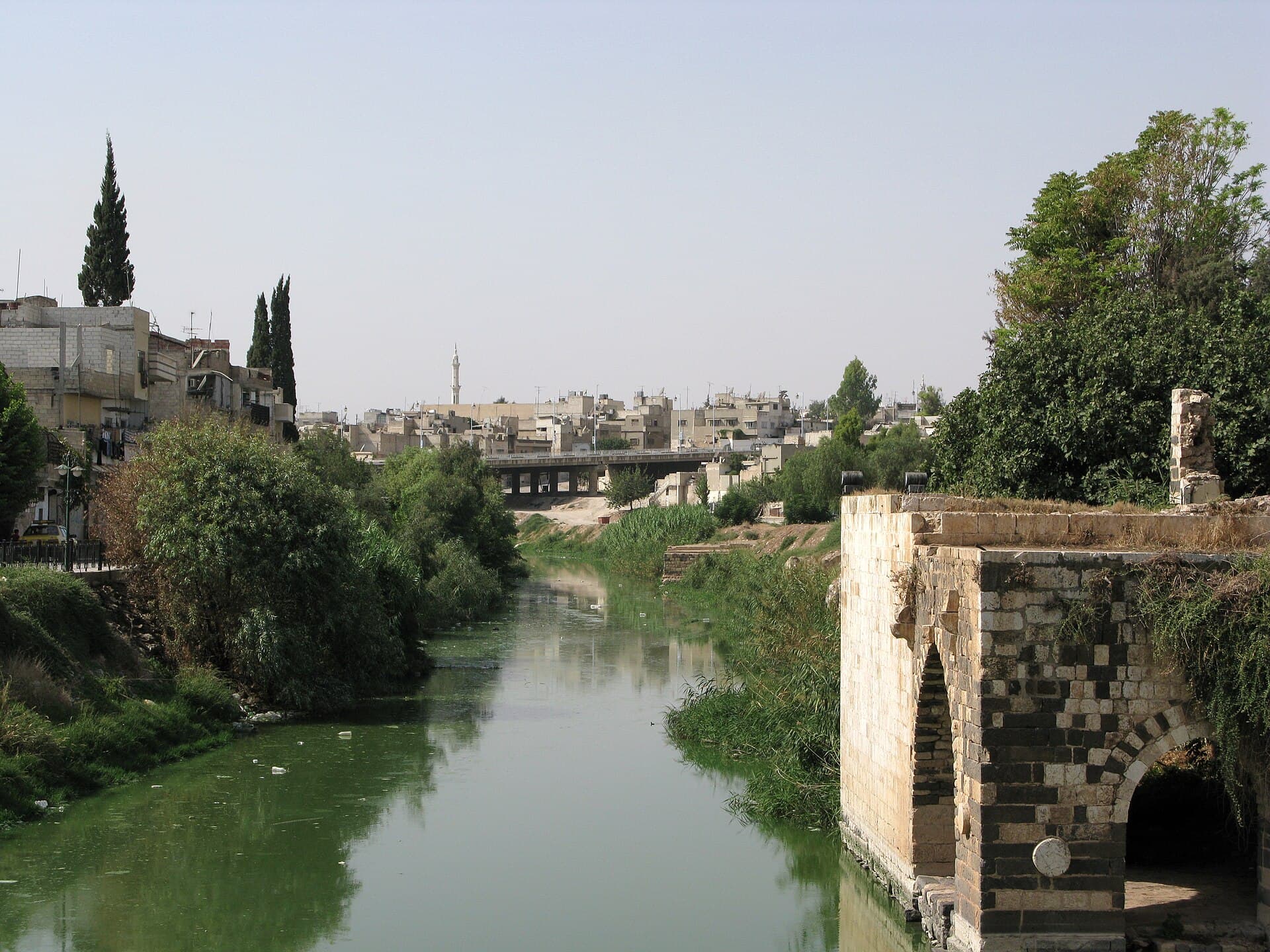
From the museum, walk south down to the river. The norias in the centre turn around the riverside path. There is no motor: the current turns the wheel, and its buckets empty into an aqueduct at the top. Go down to the water’s edge to hear them. Then follow the bank west. Here the Orontes runs right through the middle of the city. The river is 571 kilometres long; the Assyrians called it Arantu and the Egyptians Araunti, a name that became Orontes in Greek. From the norias to the Great Mosque is about 930 metres on foot.
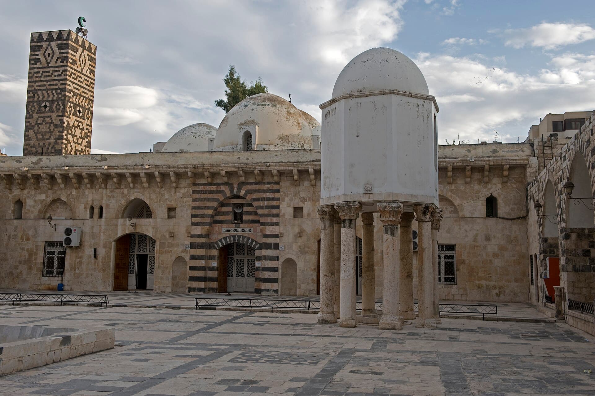
The Great Mosque stands one street back from the bank. Its site was a Roman temple in the 3rd century; the present building was rebuilt after its destruction in 1982, and it does not hide the fact. Look at the domed treasury in the middle of the courtyard and at the two minarets: the square one dates from 1124, the octagonal one from 1427. About 400 metres west of the mosque is the Muhammadiyya noria. It is 21 metres across and carries 120 buckets, and the inscription on its aqueduct gives the date 763 AH, or 1361. Its job was to carry water to the Great Mosque. For roughly 500 years it was the tallest waterwheel in the world, until the Laxey Wheel on the Isle of Man took the record in 1854. In 2006 the American Society of Mechanical Engineers (ASME) listed it as a historic landmark, and in 2020 craftsmen were reported to have repaired it. Look at the water just in front of the wheel: the long, narrow-angled weir that gathers the current at its base starts there.
Timing
Start the day at the museum, because its closing time is uncertain. Be at the door around 09:00 and give the five halls an hour and a half. Go down to the norias at 10:45; an hour is enough. Around 11:45 start walking west along the bank, which takes half an hour at an easy pace. If you reach the Great Mosque at midday prayer, wait in the courtyard and go in once the prayer hall empties. Be at the Muhammadiyya noria around 13:15. Whether the wheel turns depends on the river’s flow: it is most likely in spring, and by late summer it may have stopped.
Take care
Museum opening hours and entry fee vary, so check at the entrance. The norias, the riverbank and the Muhammadiyya noria are in the open and free. The Great Mosque is also free; cover shoulders and knees and do not enter during prayers. From a distance the norias look alike, so ask people on the bank for the Muhammadiyya by name. Watch for wet stone when you go down to the wheels, and keep clear of the turning buckets. The river changes from year to year: in summer 2025 the bed dried out in places, and in winter 2026 the water rose again.
The route on a map
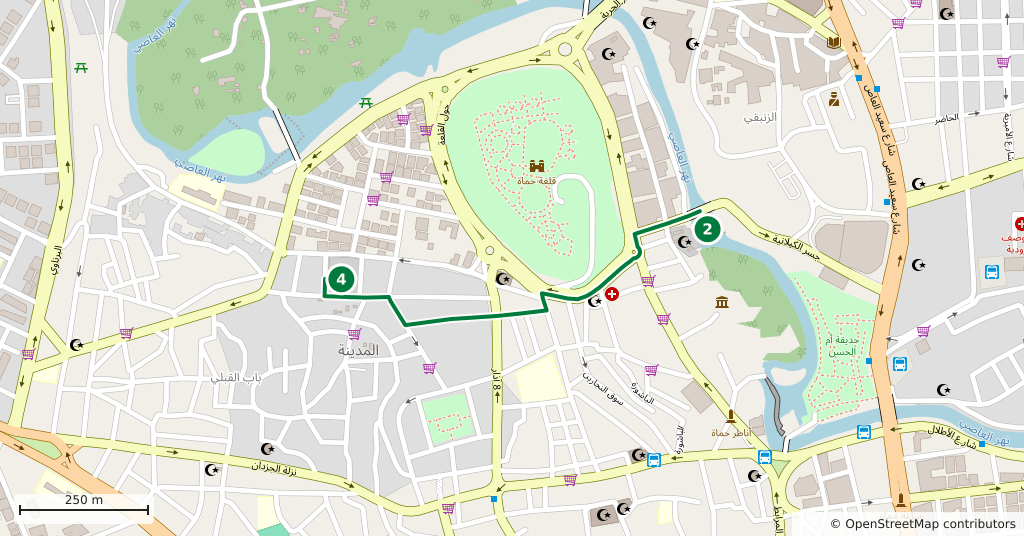
Stops along the route
- 01
- 02
- 03
- 04
- 05
Transparency
- How this was chosen
- The stops and their order were set by hand. The line on the map is real road geometry, not a straight hop between pins; distance and duration belong to that itinerary.
- Facts checked
- September 2026
- Last updated
- September 15, 2026