Arwad Island walking tour: harbour tower, citadel and Phoenician wall
A 20-minute boat ride from Tartus, then Arwad on foot: the harbour tower, the citadel and its museum, and the giant blocks of the Phoenician wall on the west shore.
- Duration
- 3.5 hours
- Distance
- 0.7 km
- Difficulty
- Easy
- Best season
- Spring and autumn
- stops
- 4
- City
- Tartus
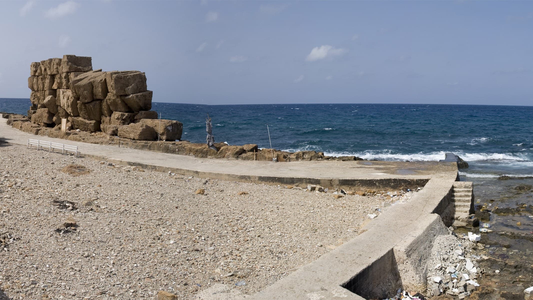
Arwad lies 3 kilometres off Tartus and is Syria’s only inhabited island. There are no cars, the lanes are narrow, and crossing from one shore to the other takes less than half an hour. In that small space you can read how an island city defended itself, from the Phoenicians to the Mamluks. The walk starts at the east harbour where the boats come in and moves to the Ayyubid Tower on the waterfront and the citadel at the centre of the island. It ends on the west shore, facing the open sea, at the giant blocks of the Phoenician wall. Four stops, about 700 metres of walking on the island, three and a half hours with the boat.
The route
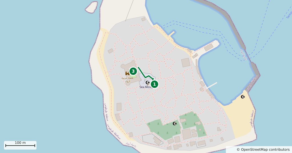
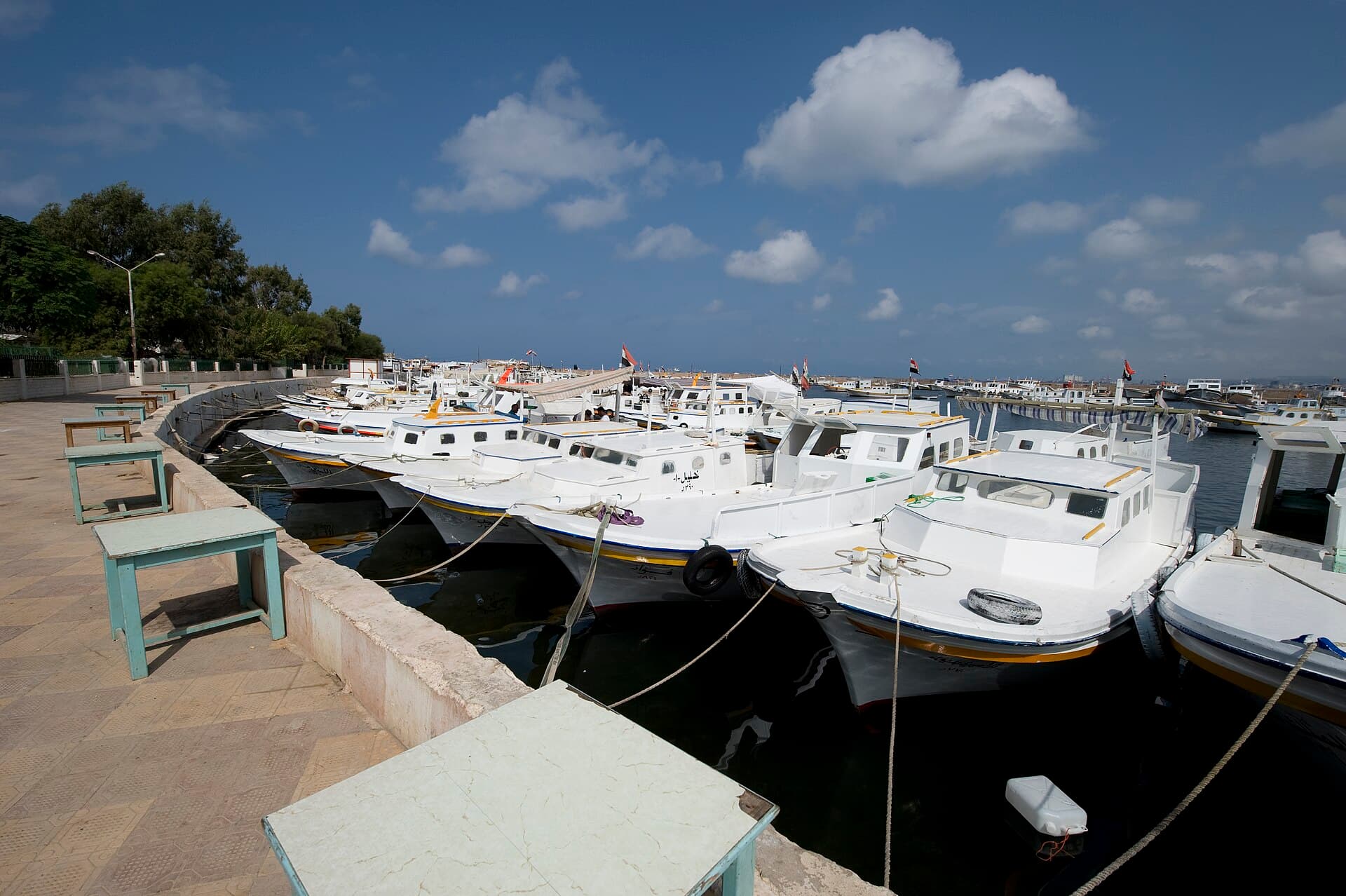
Boats leave from the jetty on the Tartus corniche. There is no timetable; they go when they fill up, and the crossing takes about 20 minutes. You land at the harbour on the island’s east side, where workshops on the shore still build wooden boats. The Ayyubid Tower stands on the waterfront, the first building you reach off the boat: two storeys, square in plan, with round towers at two of its corners. From the tower walk west through the narrow lanes to the centre of the island. The citadel is a few minutes away, and on an island this small it is hard to get lost. After the citadel carry on west to where the lanes end. On the shore facing the open sea, beside the coast road, lie the blocks of the Phoenician wall. The harbour is a few minutes back through the same lanes.
Timing
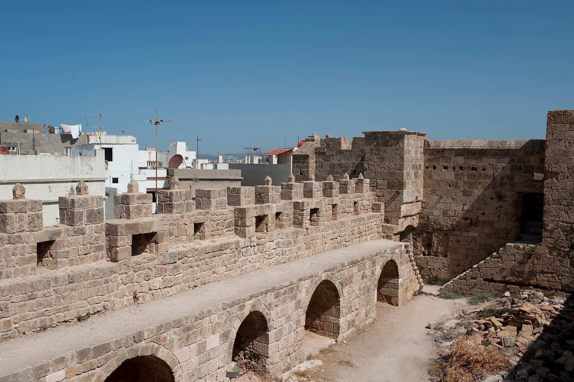
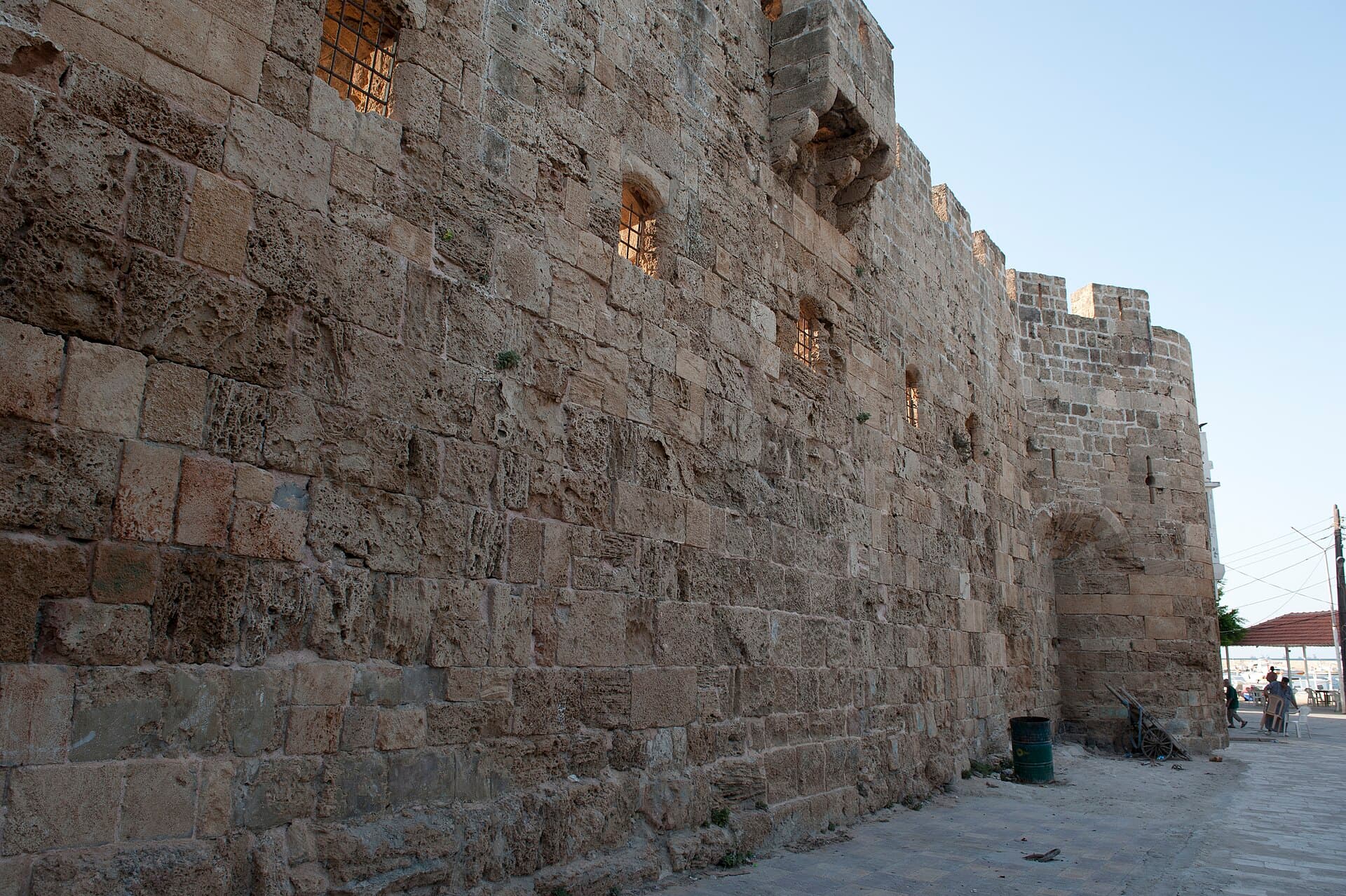
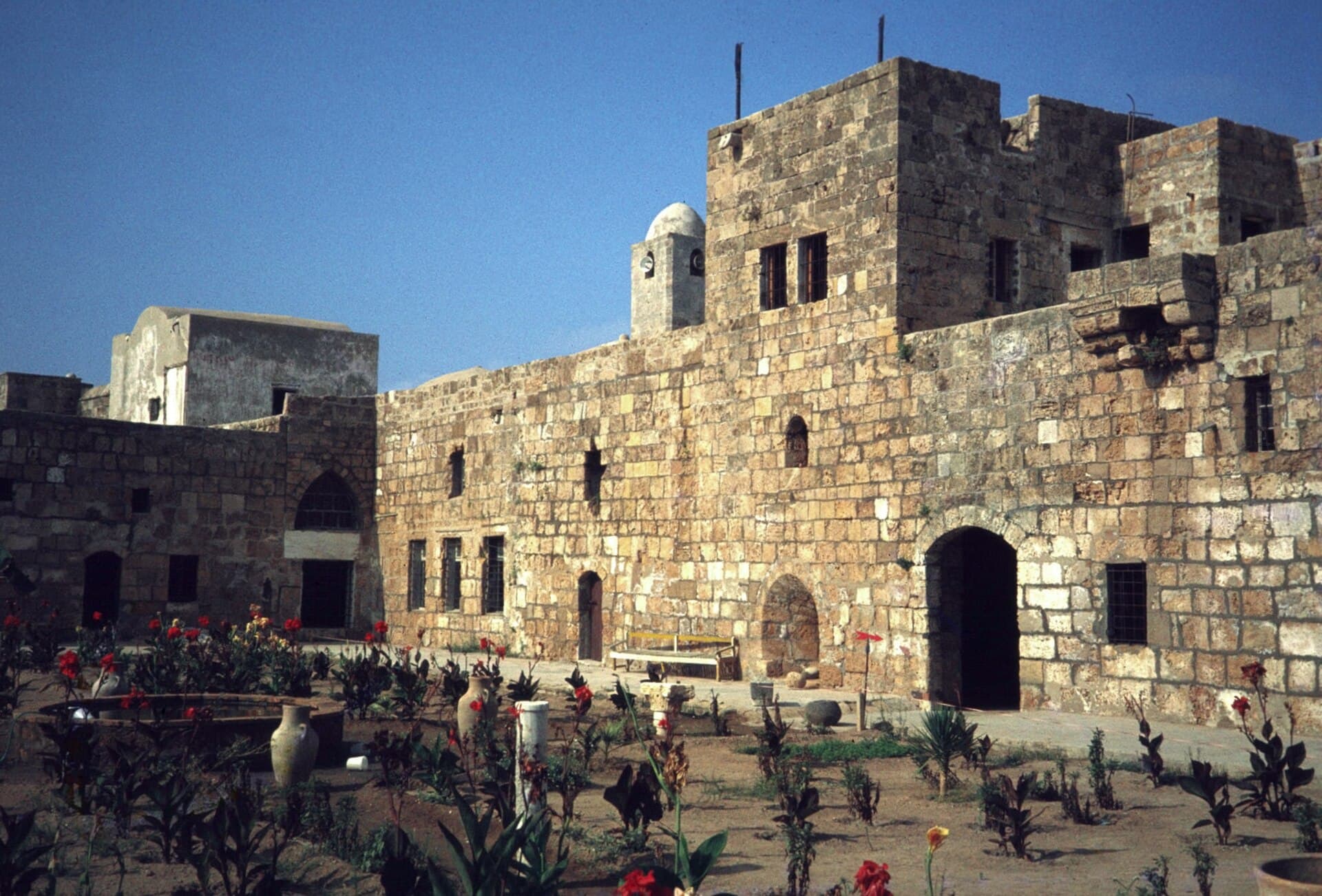
Be at the jetty on the corniche at 09:00, and when you board ask when the last boat back leaves; sailings thin out in the late afternoon. You reach the harbour around 09:30; give the boat workshops twenty minutes. At 09:50, the Ayyubid Tower. Its harbour front faces east and takes the morning sun. It is called Ayyubid, but the Arab Encyclopedia dates it to the 14th century, the Mamluk period, and it was listed by a decision dated 14 January 1959. The main entrance is on the west side. Beside it a relief shows a standing lion tied by a rope around its neck to a palm tree. Inside, the building now displays Roman amphorae found off Tartus; ask at the jetty whether the display is open. Twenty minutes. Reach the citadel at 10:15 and give it an hour. It measures about 110 by 58 metres and rises to 17 metres at its highest point. Sources disagree on its date: Arabic Wikipedia links it to the Templars, the Arab Encyclopedia to the 14th century. What is certain is that the island fell to the Mamluks in 1302; Arwad was the Crusaders’ last foothold in the Levant. A prison under the French Mandate, the citadel became a museum after independence in 1946. Compare the lion-and-palm relief at its main gate with the one at the tower, then climb to the terrace: Tartus lies spread out along the opposite shore. At 11:20 you are on the west shore. In 1853 Captain William Allen measured blocks here 15 and 18 feet long, close to five metres. They were laid crosswise, so the length of each block gave the thickness of the wall. On this side the wall was cut into the bedrock. Forty-five minutes. At 12:10 head back to the harbour, and take a boat to Tartus around 12:30.
Take care
The boat fare and the citadel ticket are separate and both vary; ask before you board and at the gate. Opening hours at the tower and the citadel vary too. In rough weather stay off the rocks on the west shore, which faces the open sea. No recent source says which stretches of the wall you can walk to today, so look on the spot. The island is a neighbourhood: do not walk into courtyards, and ask before photographing people. The lanes have little shade, so bring a hat and water. Spring and autumn are the easiest seasons; summer middays are crowded and hot. Tartus opened its 2026 tourist season in June with an official visit to the island, and the boat service is running.
The route on a map
Stops along the route
- 01
- 02
- 03
- 04
Transparency
- How this was chosen
- The stops and their order were set by hand. The line on the map is real road geometry, not a straight hop between pins; distance and duration belong to that itinerary.
- Facts checked
- September 2026
- Last updated
- September 15, 2026